Powick / Poincguuic / Poiwic / Poiwicha / Powyke / Poywyk
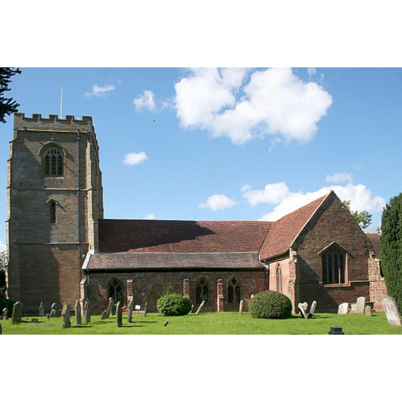
Image copyright © Bob Embleton, 2007
CC-BY-SA-2.0
Results: 4 records
view of church exterior - south view
Scene Description: Source caption: "St. Peter's has developed over the centuries. The south transept (right) dates from the 12th century, the nave 14th century and the tower 15th century."
Copyright Statement: Image copyright © Bob Embleton, 2007
Image Source: digital photograph taken 7 July 2007 by Bob Embleton [www.geograph.org.uk/photo/491811] [accessed 17 October 2014]
Copyright Instructions: CC-BY-SA-2.0
view of church interior - nave - looking east
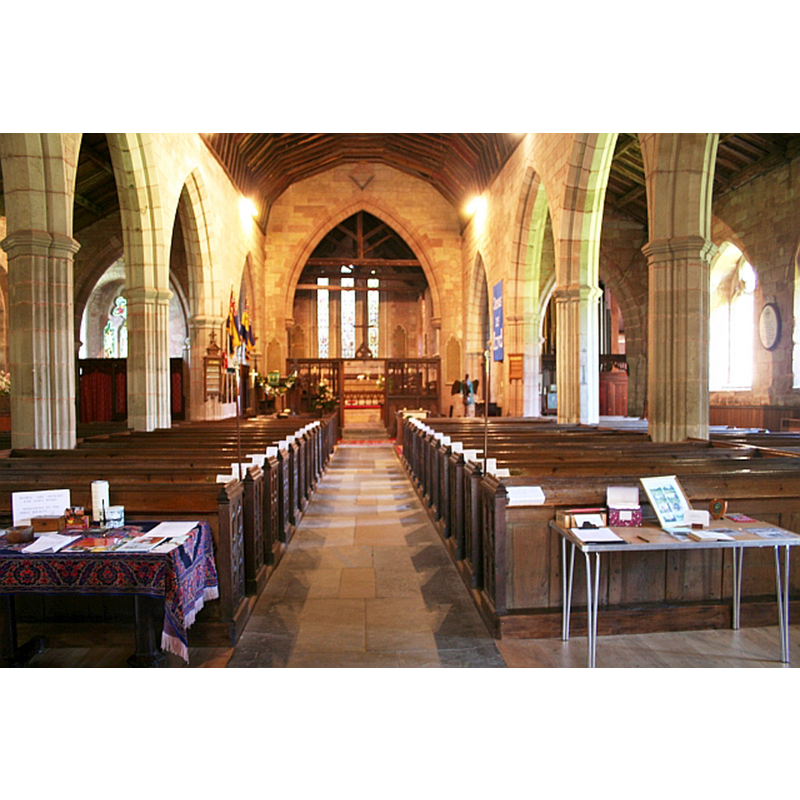
Copyright Statement: Image copyright © Bob Embleton, 2007
Image Source: digital photograph taken 7 July 2007 by Bob Embleton [www.geograph.org.uk/photo/491847] [accessed 17 October 2014]
Copyright Instructions: CC-BY-SA-2.0
design element - motifs - quatrefoil


design element - motifs - trefoil
INFORMATION
Font ID: 16554POW
Object Type: Baptismal Font1
Font Century and Period/Style: 14th century, Decorated? / Perpendicular?
Church / Chapel Name: Parish Church of St. Peter and St. Laurence [or Lawrence]
Font Location in Church: Inside the church, in the N transept
Church Patron Saint(s): St. Peter & St. Lawrence
Church Address: Upton Road, Powick, Worcestershire WR2 4QS
Site Location: Worcestershire, West Midlands, England, United Kingdom
Directions to Site: Located 5 km from Worcester
Ecclesiastic Region: Diocese of Worcester
Historical Region: Hundred of Pershore -- Hundred of Oswaldslow
Font Notes:
Click to view
There are four entries for Powick [variant spelling] in the Domesday survey [http://domesdaymap.co.uk/place/SO8351/powick/] [accessed 17 October 2014], one of which reports a priest and a church in it. Miller (1890) gives the dedication of this church as "St. Peter and St. Laurence" and reports an octagonal font in it. A font here is noted in Noakes (1852): "In the north transept is a handsome octagonal stone font, each face or division of the cup having quatrefoil carvings, and trefoils in the corresponding divisions of the shaft." The Victoria County History (Worcester, vol. 4, 1924) notes: "There was a priest at Powick in 1086. [...] The oldest parts of the building are the walls of the transepts, which, though refaced in places and with later windows inserted, are substantially of 12thcentury date. [...] If the 12th-century church had a central tower it was entirely removed in later times, either in the 14th century or when the nave arcade was reconstructed. [...] The font is of 14th-century date and consists of an octagonal stone basin with panelled sides containing quatrefoils within circles and stands on a panelled and moulded stem and base." In Brooks & Pevsner (2007).
COORDINATES
UTM: 30U 551756 5779293
Latitude & Longitude (Decimal): 52.1617, -2.243358
Latitude & Longitude (DMS): 52° 9′ 42.12″ N, 2° 14′ 36.09″ W
MEDIUM AND MEASUREMENTS
Material: stone
Font Shape: octagonal, mounted
Basin Interior Shape: round
Basin Exterior Shape: octagonal
REFERENCES
- Victoria County History [online], University of London, 1993-. URL: https://www.british-history.ac.uk.
- Brooks, Alan, Worcestershire, New Haven; London: Yale University Press, 2007, p. 542
- Miller, George [Revd.], The Parishes of the Diocese of Worcester, Birmingham: Hall & English, 1890, vol. 2: 269
- Noake, John, The rambler in Worcestershire, or, Stray notes on churches and congregations, Worcester: Published and sold by all booksellers, 1848, p. 130