Worcester No. 3 / Bedwardine / St. John-in-Bedwardine / Uueogorna / Vveogorna / Weogorna / Wigornia / Wirccester / Wirecestre
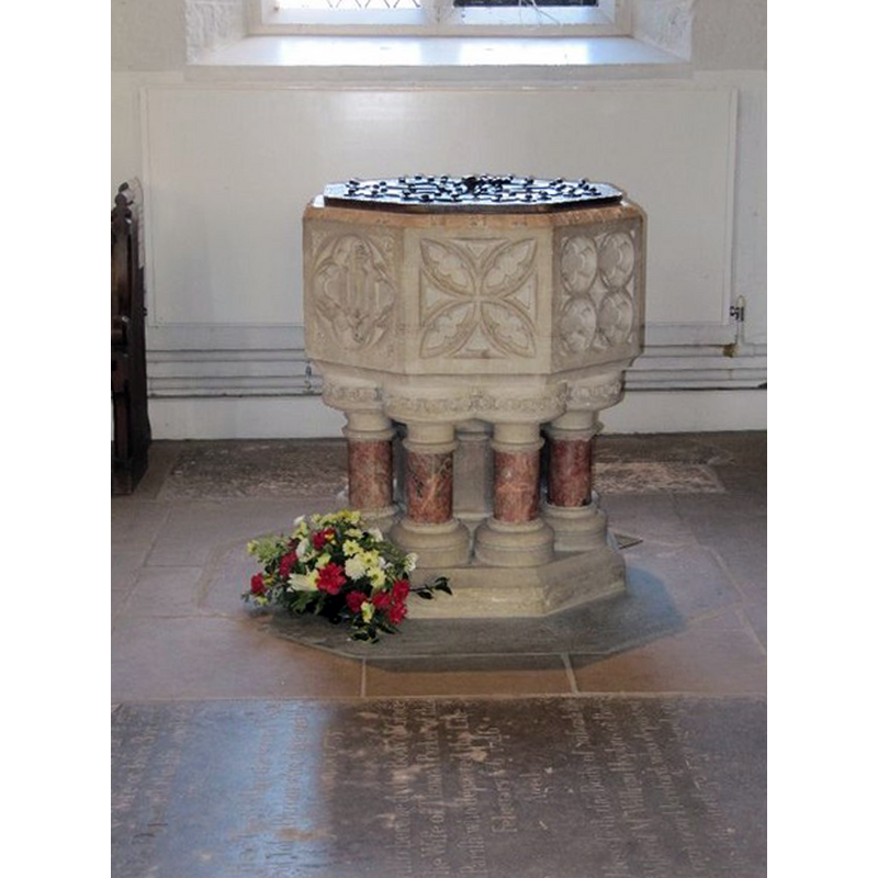
Image copyright © Bill Nicholls, 2011
CC-BY-SA-2.0
Results: 4 records
view of font and cover
Scene Description: the modern font
Copyright Statement: Image copyright © Bill Nicholls, 2011
Image Source: digital photograph taken 17 January 2011 by Bill Nicholls [www.geograph.org.uk/photo/2262596] [accessed 30 September 2014]
Copyright Instructions: CC-BY-SA-2.0
view of church exterior - southeast view
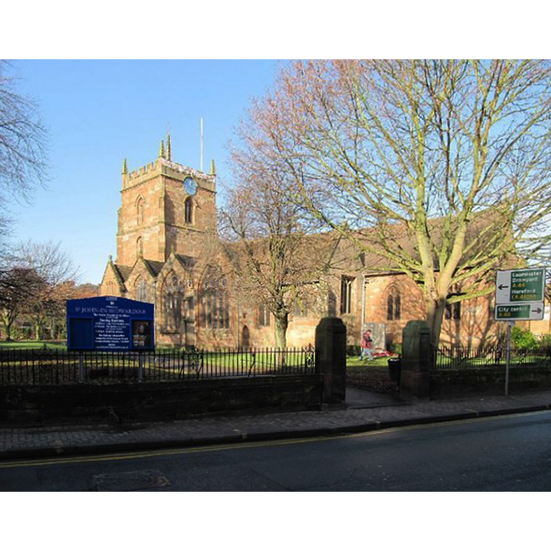
Scene Description: Source caption: "View of St John in Bedwardine from the A4103 Bransford Road"
Copyright Statement: Image copyright © Bill Nicholls, 2011
Image Source: digital photograph taken 17 January 2011 by Bill Nicholls [www.geograph.org.uk/photo/2263902] [accessed 30 September 2014]
Copyright Instructions: CC-BY-SA-2.0
view of church interior - nave - looking west
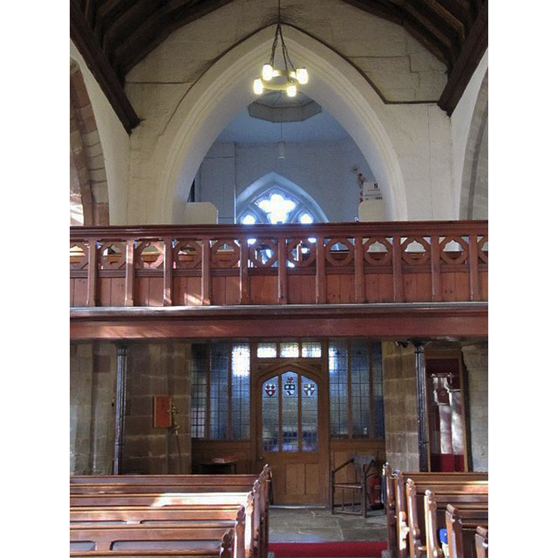
Copyright Statement: Image copyright © Bill Nicholls, 2011
Image Source: digital photograph taken 17 January 2011 by Bill Nicholls [www.geograph.org.uk/photo/2262688] [accessed 30 September 2014]
Copyright Instructions: CC-BY-SA-2.0
view of church interior - nave - looking east
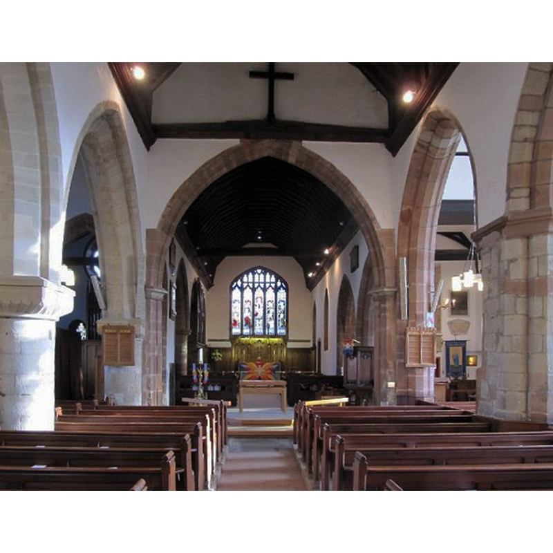
Copyright Statement: Image copyright © Bill Nicholls, 2011
Image Source: digital photograph taken 17 January 2011 by Bill Nicholls [www.geograph.org.uk/photo/2262714] [accessed 30 September 2014]
Copyright Instructions: CC-BY-SA-2.0
INFORMATION
Font ID: 16553WOR
Object Type: Baptismal Font1?
Font Century and Period/Style: 12th - 13th century, Medieval
Church / Chapel Name: Parish Church of St. John
Church Patron Saint(s): St. John the Baptist
Church Address: Bromyard Road, Worcester, Worcestershire, WR2 5BS
Site Location: Worcestershire, West Midlands, England, United Kingdom
Directions to Site: Located on St. John's St., where Bromyard Road meets Malvern Road, Worcester, Worcestershire, WR2 5BS
Ecclesiastic Region: Diocese of Worcester
Historical Region: Hundred of Oswaldslow
Additional Comments: disappeared font?
Font Notes:
Click to view
There are three entries for Worcester [variant spelling] in the Domesday survey [http://domesdaymap.co.uk/place/SO8454/worcester/] [accessed 30 October 2014], neither of which mention cleric or church in it. We found no entry for Bedwardine in the Domesday survey. Noake (1848) notes that "the chapel of St. John, in Bedwardine, was [...] made parochial" ca. 1371, to replace the older unconsecrated chapel of St. John of Wyke [aka Wick] which had been taken down. There is no mention of a font in Noake. Miller (1890) remarks on some Norman pillars in this church, but "The font is modern, and was erected together with the stained glass windows in chancel, in memory of John Whitmore Isaac." The Victoria County History (Worcester, vol. 3, 1913) notes: "The church of St. John the Baptist in Bedwardine was originally a chapel of ease to the church of St. Cuthbert, Wick Episcopi. St. Cuthbert had in its turn been a chapelry attached to the church of St. Helen, Worcester [...] It is not clear when the chapel in St. John's began to be more important than the mother church [...] William Lynn, bishop in 1370 [...] determined, at the request of the parishioners, to abandon the church of Wick, which was already 'half deserted and attended by very few,' and make St. John's Chapel the parish church. [...] The new church was consecrated in 1371. [...] The north arcade of three bays is of the 12th century, but the arches were destroyed some years ago [...] The font is modern." Brooks & Pevsner (2007) note that the "church of the medieval suburb w[est] of the Severn" [river] was Norman in origin, "though nothing of this is visible outside" now, and report a carved stone and marble font dating from the 1884 renovation. [NB; according to the Parish web site [www.stjohninbedwardine.co.uk/churchhist.html] [accessed 5 October 201], "St John’s church dates from about 1165. Originally it was one of two chapels on the west bank of the Severn, the other being at Lower Wick"; we have no information on the medieval font].
COORDINATES
UTM: 30U 552286 5782221
Latitude & Longitude (Decimal): 52.187969, -2.235164
Latitude & Longitude (DMS): 52° 11′ 16.69″ N, 2° 14′ 6.59″ W
REFERENCES
- Victoria County History [online], University of London, 1993-. URL: https://www.british-history.ac.uk.
- Brooks, Alan, Worcestershire, New Haven; London: Yale University Press, 2007, p. 712-713
- Miller, George [Revd.], The Parishes of the Diocese of Worcester, Birmingham: Hall & English, 1890, vol. 2: 283
- Noake, John, The rambler in Worcestershire, or, Stray notes on churches and congregations, Worcester: Published and sold by all booksellers, 1848, p. 74