Bredicot / Bradecot / Bradecote / Bradicot / Bradigcotan / Bradingecotan / Bredicote / Bredicoto / Brodecot
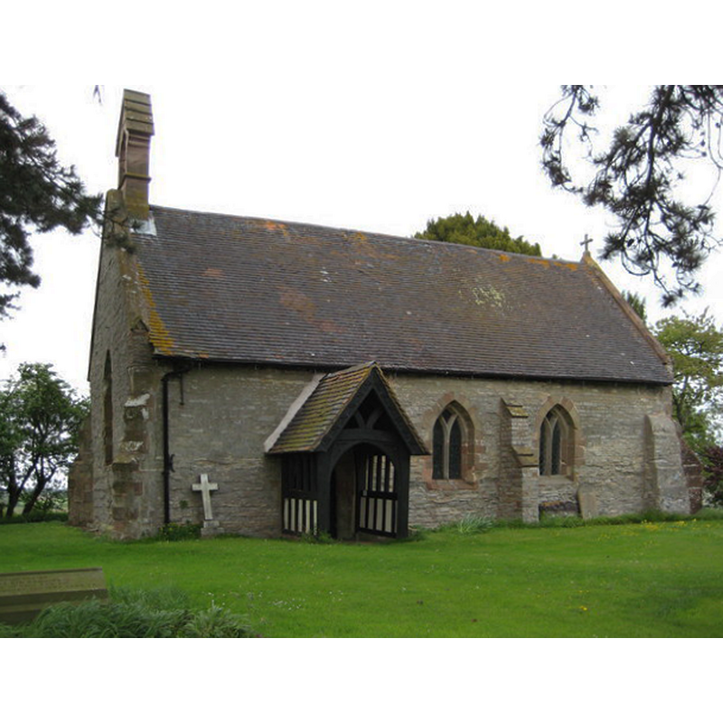
Image copyright © Philip Halling, 2009
CC-BY-SA-2.0
Results: 3 records
view of church exterior - southwest view
Copyright Statement: Image copyright © Philip Halling, 2009
Image Source: digital pohotograph taken 7 May 2009 by Philip Halling [www.geograph.org.uk/photo/1291898] [accessed 23 September 2014]
Copyright Instructions: CC-BY-SA-2.0
design element - patterns - diaper


design element - architectural - arch or window - trefoiled
INFORMATION
Font ID: 16548BRE
Object Type: Baptismal Font1
Font Century and Period/Style: 13th - 14th century [basin only] [re-cut?], Medieval [composite]
Church / Chapel Name: Parish Church of St. James the Less
Font Location in Church: Inside the church
Church Patron Saint(s): St. James the Less [aka James the Lesser, James the Little, James the Minor, James the Younger]
Church Address: Bredicot, Worcestershire, WR7 4QA
Site Location: Worcestershire, West Midlands, England, United Kingdom
Directions to Site: Located off the A4538, 7 km E of Worcester, 10 km S of Droitwich
Ecclesiastic Region: Diocese of Worcester
Historical Region: Hundred of Oswaldslow
Additional Comments: altered font: modern base / re-cut basin?
Font Notes:
Click to view
There is an entry for Bredicot [variant spelling] in the Domesday survey [http://domesdaymap.co.uk/place/SO9054/bredicot/] [accessed 23 September 2014], but it mentions neither priest nor church in it; curiously, though, the lord of the manor in 1066 had been "Brictwold", a priest; by 1086 the lordship had changed to the hands of Walter Ponther [aka Pontherius or Puher, according to Keats-Rohan (1999)], who in 1086 appears associated with a total of 28 places. Miller (1890) writes; "The church, from its shape, being oblong with the upper end raised for the chancel, is probably of very early date [...] The font is octagonal and curiously carved probably of the 14th century." The Victoria County History (Worcester, vol. 3, 1913) notes: "The church [...] has been very much restored in modern times, but its walls probably contain 13th-century material [...] The font is octagonal with shallow trefoiled panels on the side of the bowl and a small square diaper above. The bowl may be as early as the 13th century, but the stem and base are modern." In Brooks & Pevsner (2007): "Octagonal C14 font, with tall cusped panels, perhaps re-cut."
COORDINATES
UTM: 30U 558717 5782890
Latitude & Longitude (Decimal): 52.193334, -2.14098
Latitude & Longitude (DMS): 52° 11′ 36″ N, 2° 8′ 27.53″ W
MEDIUM AND MEASUREMENTS
Material: stone
Font Shape: octagonal, mounted
Basin Interior Shape: round
Basin Exterior Shape: octagonal
REFERENCES
- Victoria County History [online], University of London, 1993-. URL: https://www.british-history.ac.uk.
- Brooks, Alan, Worcestershire, New Haven; London: Yale University Press, 2007, p. 162
- Keats-Rohan, K.S.B., Domesday people: a prosopography of persons occurring in English documents, 1066-1166 [NB: vol. 2 has title: Domesday descendants], Woodbridge, Suffolk: Boydell Press, 1999-2002, p. 456
- Miller, George [Revd.], The Parishes of the Diocese of Worcester, Birmingham: Hall & English, 1890, vol. 2: 91