Bockleton / Bockintun / Bocleton / Boclintun / Bocklynton / Boculton / Bokelton / Bokilton / Boklynton / Bukleton
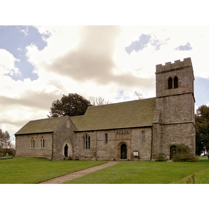
Image copyright © Philip Pankhurst, 2013
CC-BY-SA-2.0
Results: 5 records
view of church exterior - north view
Scene Description: Source caption: "The North side of this important Norman church. The Barneby chapel to the left dates from 1560, but was hideously 'restored' by Henry Curzon in 1867."
Copyright Statement: Image copyright © Philip Pankhurst, 2013
Image Source: digital photograph taken 29 April 2013 by Philip Pankhurst [www.geograph.org.uk/photo/3435890] [accessed 22 October 2014]
Copyright Instructions: CC-BY-SA-2.0
view of church exterior - south view
![Source caption: "Externally an important Norman nave with a 13th century chancel and a later tower."]](/static-50478a99ec6f36a15d6234548c59f63da52304e5/compressed/1141024011_compressed.png)
Scene Description: Source caption: "Externally an important Norman nave with a 13th century chancel and a later tower."]
Copyright Statement: Image copyright © Philip Pankhurst, 2013
Image Source: digital photograph taken 29 April 2013 by Philip Pankhurst [www.geograph.org.uk/photo/3435835] [accessed 22 October 2014]
Copyright Instructions: CC-BY-SA-2.0
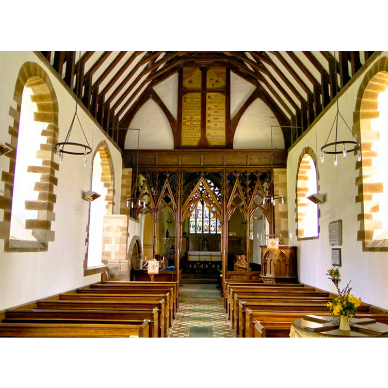
view of church interior - nave - looking west
![Source caption: "The interior is a surprise after the Norman and 13th century exterior. A complete set of Henry Woodyer fittings survive, including screen, pews, font and pulpit, all installed as part of a 'restoration' of 1861-2." -- the modern font is partly visible at the back [west], on the left [south] side](/static-50478a99ec6f36a15d6234548c59f63da52304e5/compressed/1141024014_compressed.png)
Scene Description: Source caption: "The interior is a surprise after the Norman and 13th century exterior. A complete set of Henry Woodyer fittings survive, including screen, pews, font and pulpit, all installed as part of a 'restoration' of 1861-2." -- the modern font is partly visible at the back [west], on the left [south] side
Copyright Statement: Image copyright © Philip Pankhurst, 2013
Image Source: digital photograph taken 29 April 2013 by Philip Pankhurst [www.geograph.org.uk/photo/3436152] [accessed 22 October 2014]
Copyright Instructions: CC-BY-SA-2.0
view of church interior - nave - looking east
Scene Description: the top of the modern font and its cover can be seen in the foreground, right corner
Copyright Statement: Image copyright © Philip Pankhurst, 2013
Image Source: digital photograph taken 29 April 2013 by Philip Pankhurst [www.geograph.org.uk/photo/3436150] [accessed 22 October 2014]
Copyright Instructions: CC-BY-SA-2.0
view of font and cover

Scene Description: the modern font
Copyright Statement: Image copyright © Tudor Barlow, 2013
Image Source: digital photograph taken 31 August 2013 by Tudor Barlow [www.flickr.com/photos/tudorbarlow/9800830666/] [accessed 22 October 2014]
Copyright Instructions: PERMISSION NOT AVAILABLE -- IMAGE NOT FOR PUBLIC USE
INFORMATION
Font ID: 16544BOC
Object Type: Baptismal Font1?
Font Date: ca. 1160?
Font Century and Period/Style: 12th century (mid?), Late Norman
Church / Chapel Name: Parish Church of St. Michael
Church Patron Saint(s): St. Michael
Church Address: Bockleton Road, Bockleton, Worcestershire WR15 8PP
Site Location: Worcestershire, West Midlands, England, United Kingdom
Directions to Site: Located 8 km S of Tenbury Wells
Ecclesiastic Region: Diocese of Hereford
Historical Region: Hundred of Doddingtree
Additional Comments: disappeared font? (the one from the ca.1160 church here)
Font Notes:
Click to view
There is an entry for Bockleton [variant spelling] in the Domesday survey [http://domesdaymap.co.uk/place/SO5961/bockleton/] [accessed 22 October 2014], but it mentions neither cleric nor church in it. Miller (1890) reports "two doorways together with arcading of the 12th century" and some early English work" in this church, but mentions no font in it. The Victoria County History (Worcester, vol. 4, 1924) notes: "The nave dates from about 1160, and probably had at that time a small chancel, which was replaced by the present one about the middle of the 13th century. [...] The fabric has been very thoroughly restored and has lost much of its mediaeval character internally [...] Both the font and pulpit are modern." This modern font is noted also in Brooks & Pevsner (2007): "round font with trefoiled arcade and carved heads." [NB: we have no information on the medieval font(s) of this church]
COORDINATES
UTM: 30U 527512 5788909
Latitude & Longitude (Decimal): 52.249895, -2.597002
Latitude & Longitude (DMS): 52° 14′ 59.62″ N, 2° 35′ 49.21″ W
REFERENCES
- Victoria County History [online], University of London, 1993-. URL: https://www.british-history.ac.uk.
- Brooks, Alan, Worcestershire, New Haven; London: Yale University Press, 2007, p. 157
- Miller, George [Revd.], The Parishes of the Diocese of Worcester, Birmingham: Hall & English, 1890, vol. 2: 300-301