Poulton nr. Blackpool / Poulton-le-Fylde
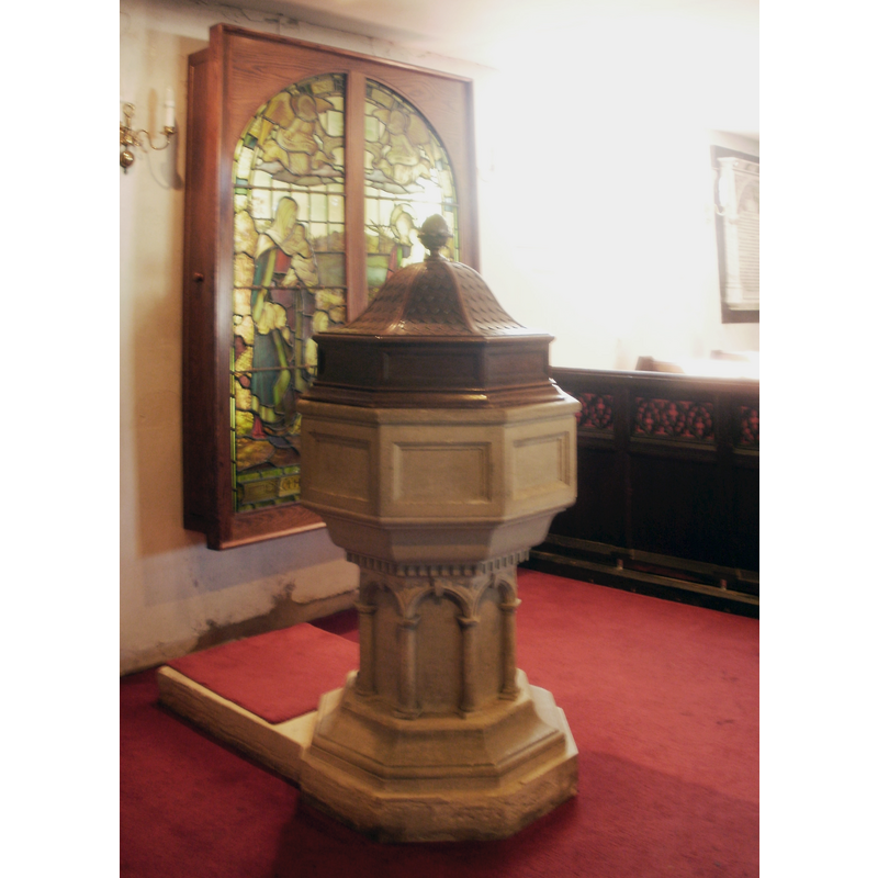
Image copyright © Belovedfreak, 2011
CC-BY-SA-3.0
Results: 4 records
view of font and cover
Scene Description: the modern replacement font and cover [cf. FontNotes]
Copyright Statement: Image copyright © Belovedfreak, 2011
Image Source: digital photograph taken 11 May 2011 by Belovedfreak [http://commons.wikimedia.org/wiki/File:Font_in_St_Chad's_church,_Poulton-le-Fylde.jpg] [accessed 15 July 2014]
Copyright Instructions: CC-BY-SA-3.0
view of church exterior - south view
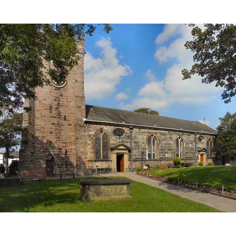
Copyright Statement: Image copyright © David Dixon, 2011
Image Source: digital photograph taken 1 September 2011 by David Dixon [www.geograph.org.uk/photo/2581995] [accessed 15 May 2014]
Copyright Instructions: CC-BY-SA-3.0
view of church interior - nave - looking west
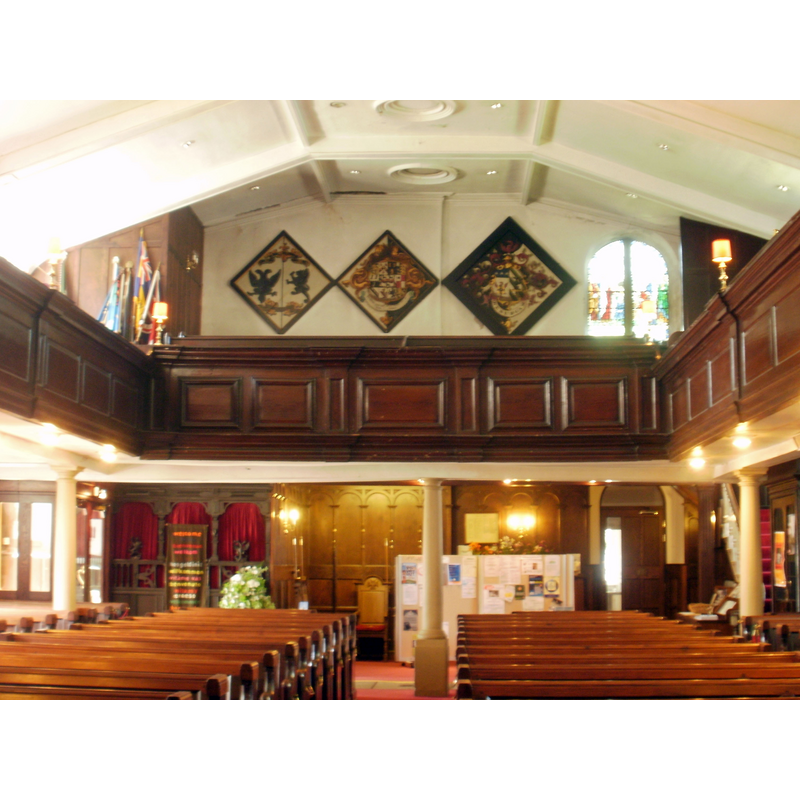
Copyright Statement: Image copyright © Belovedfreak, 2011
Image Source: digital photograph taken 11 May 2011 by Belovedfreak [http://commons.wikimedia.org/wiki/File:West_gallery,_St_Chad's_church,_Poulton-le-Fylde.jpg] [accessed 15 July 2014]
Copyright Instructions: CC-BY-SA-3.0
view of church interior - nave - looking east
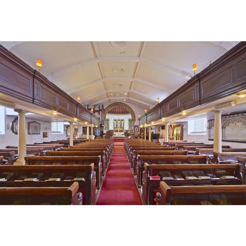
Copyright Statement: Image copyright © Mdbeckwith, 2014
Image Source: digital photograph taken 2 May 2014 by Mdbeckwith [http://commons.wikimedia.org/wiki/File:St_Chad's_Church.jpg] [accessed 15 July 2014]
Copyright Instructions: CC-BY-SA-3.0
INFORMATION
Font ID: 16526POU
Object Type: Baptismal Font1
Font Date: 1649
Font Century and Period/Style: 17th century(mid)
Church / Chapel Name: Parish Church of St. Chad
Font Location in Church: [cf. FontNotes]
Church Patron Saint(s): St. Chad [aka, Ceaadda, Cedd, Ceoddi]
Church Notes: church here first documented 1094
Church Address: Ball St, Poulton-le-Fylde, Lancashire FY6 7BG, United Kingdom
Site Location: Lancashire, North West, England, United Kingdom
Directions to Site: Located 5 km NE of Blackpool
Ecclesiastic Region: Diocese of Blackburn
Historical Region: Hundred of Amounderness
Additional Comments: disused font / re-carved font? / moved font? -- disappeared font? (the one from the pre-Conquest (?) church here)
Font Notes:
Click to view
Poulton [le-Fylde] appears mentioned in the Domesday survey entry for Preston [http://domesdaymap.co.uk/place/XX0000/poulton-le-fylde-and-little-poulton/] [accessed 15 July 2014]; the entry reports three churches in it, one of which is believed to have been Poulton's, as Whitaker (1823) confirms, and he suggests that Poulton was severed from the Saxon parish of Kirkham in the early Norman period, "immediately after Domesday"; Whitaker adds that no evidence remains of that building as it was demolished and re-built in 1751. The entry for this Poulton in Whitaker (1823) mentions a font in passim. Fishwick (1885) writes: "In the vicarage is an old stone font, which tradition says came from the church, which on its eight sides has inscribed, +. M.H. 1649, ['here is something like a crown, but it is nearly defaced']. The present font, which replaced an older one, was presented by the daughter of the Rev. Canon Hull, and has inscribed on it, 'Frances Mary Hull, baptized April 21st, 1846. Fell asleep in Jesus, May 6th, 1866'." The Poulton-le-Fylde Historical and CivicSociety website [www.poulton-le-fylde-hcs.co.uk/] [accessed 11 May 2010] notes: "The earliest documentary reference to a church at Poulton-le-Fylde occurs in 1094, when Roger de Poitou gave it […] to the new priory to St Mary at Lancaster. The medieval and later dedication of the church to St Chad […] There is […] no ancient font". [NB: the 1649 date indicates the beginning of the Commonwealth, therefore not a very auspicious moment for crowns to appear on fonts -- could it be an earlier font re-carved anyway? -- we have no information on its present whereabouts]. The entry for this parish in the Victoria County History (Lancaster, vol. 7, 1912) notes: "The church of Poulton, with one plough-land and all appurtenances, was given by Roger of Poitou to the Abbey of Sees in 1094. [...] The site is an ancient one, but all trace of the original church has vanished, the oldest part of the present building being the tower, which is said to have been erected in the reign of Charles I [i.e., 1625-1649]. [demolished 1751] The nave dates from 1752–3 and the apse from 1868"; no font mentioned.
COORDINATES
UTM: 30U 500520 5966521
Latitude & Longitude (Decimal): 53.8472, -2.9921
Latitude & Longitude (DMS): 53° 50′ 49.92″ N, 2° 59′ 31.56″ W
MEDIUM AND MEASUREMENTS
Material: stone
Font Shape: octagonal, mounted
Basin Interior Shape: round
Basin Exterior Shape: octagonal
INSCRIPTION
Inscription Language: letters and numbers
Inscription Location: on the side of the basin
Inscription Text: "+. M.H. 1649, [...]" ['here is something like a crown, but it is nearly defaced']
Inscription Notes: [cf. FontNotes]
Inscription Source: [cf. FontNotes]
REFERENCES
- Victoria County History [online], University of London, 1993-. URL: https://www.british-history.ac.uk.
- Fishwick, Henry, The History of the Parish of Poulton-le-Fylde, in the County of Lancaster, Manchester: Printed for the Chetham Society, 1885, p. 45
- Whitaker, Thomas Dunham, An history of Richmondshire, in the North Riding of the County of York [...], with illustrations by J.M.W. Turner, London: [s.n.], 1823, vol. 2: 441