Overton nr. Morecambe / Ouerton / Ouretun
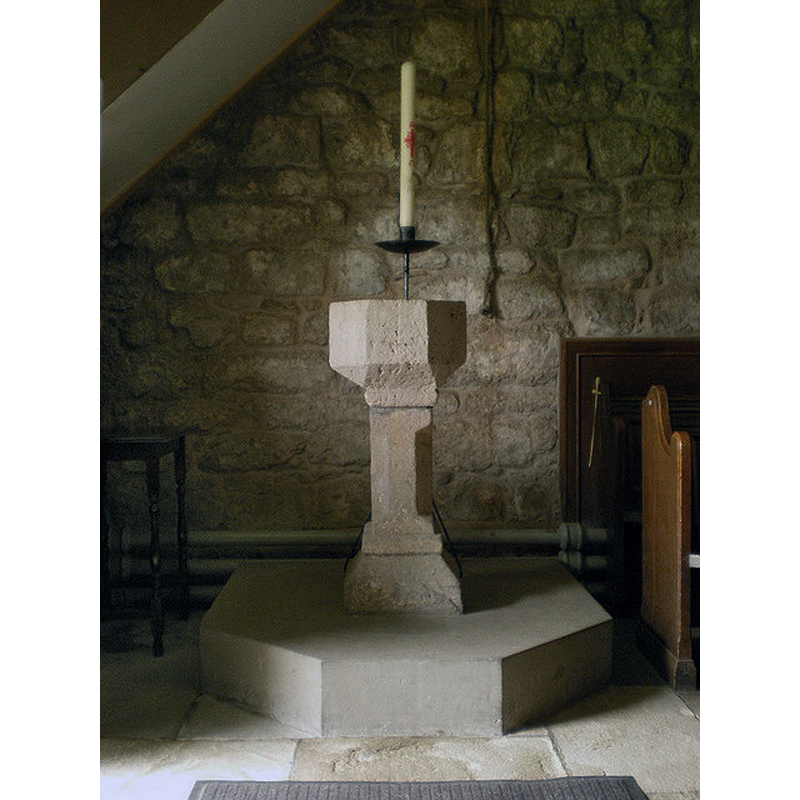
Image copyright © Alexander P Kapp, 2009
CC-BY-SA-2.0
Results: 4 records
view of font
Copyright Statement: Image copyright © Alexander P Kapp, 2009
Image Source: digital photograph taken 6 April 2009 by Alexander P Kapp [www.geograph.org.uk/photo/1239194] [accessed 1 April 2019]
Copyright Instructions: CC-BY-SA-2.0
view of church exterior - south portal
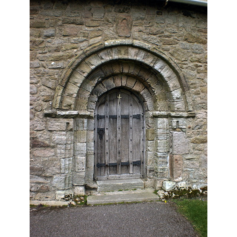
Copyright Statement: Image copyright © Alexander P Kapp, 2009
Image Source: digital photograph taken 6 April 2009 by Alexander P Kapp [www.geograph.org.uk/photo/1239213] [accessed 1 April 2019]
Copyright Instructions: CC-BY-SA-2.0
view of church exterior - southwest view
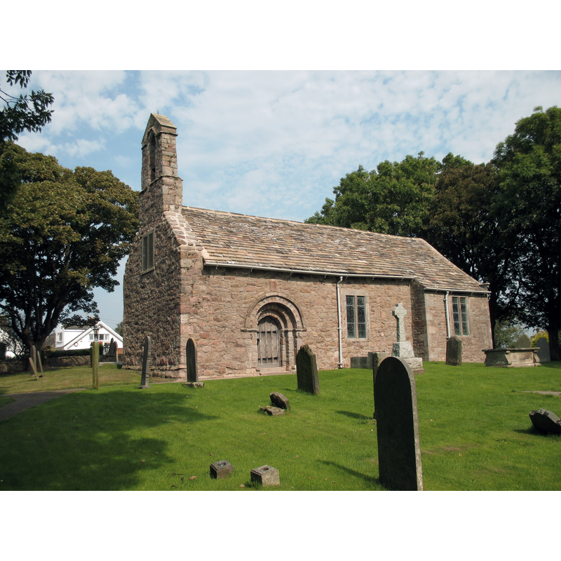
Copyright Statement: Image copyright © Antiquary, 2016
Image Source: digital photograph taken 13 September 2016 by Antiquary [https://commons.wikimedia.org/wiki/File:St._Helen,_Overton,_Lancashire.jp] [accessed 1 April 2019]
Copyright Instructions: CC-BY-SA-3.0
view of church interior - nave - looking east
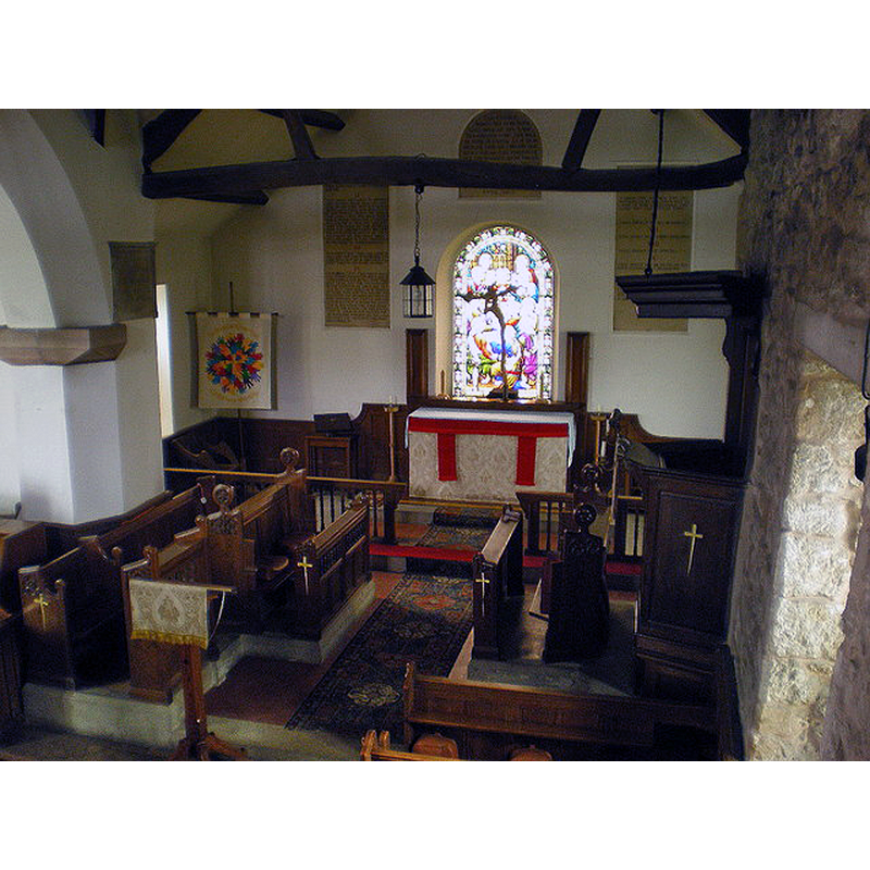
Copyright Statement: Image copyright © Alexander P Kapp, 2009
Image Source: digital photograph taken 6 April 2009 by Alexander P Kapp [www.geograph.org.uk/photo/1239209] [accessed 1 April 2019]
Copyright Instructions: CC-BY-SA-2.0
INFORMATION
Font ID: 16524OVE
Object Type: Baptismal Font1?
Font Century and Period/Style: 12th century, Late Norman
Church / Chapel Name: Parish Church of St. Helen
Church Patron Saint(s): St. Helena [VCH has it as dedication unknown]
Church Notes: 12thC church; re-built late-18thC; restored 1902
Church Address: 8 Church Grove, Overton, Lancaster LA3 3HZ, UK -- Tel.: 01524 858234
Site Location: Lancashire, North West, England, United Kingdom
Directions to Site: Located off (S) the A683, N of the Lune river, S of Morecambe, 7-8 km SW of Lancaster
Ecclesiastic Region: Diocese of Blackburn
Historical Region: Hundred of Lonsdale -- Hundred of Amounderness [in Domesday]
Additional Comments: disappeared font? (the one from the 12thC church here)
Font Notes:
Click to view
There is an entry for this Overton [variant spelling] in the Domesday survey [https://opendomesday.org/place/SD4357/overton/] [accessed 1 April 2019] but it mentions neither cleric nor church in it. The entry for this township in the Victoria County History (Lancaster, vol. 8, 1914) notes: "The south doorway is a good example of Norman work, with semicircular arch, and, being very much exposed, has weathered badly", and illustrates the position of the font at the west end of the nave, beneath the gallery; the font is modern. The entry for this church in Historic England [Listing NGR: SD4404657576] notes: "Church, C12th, altered 1771 and 1830, restored 1902. [...] The octagonal sandstone font is set on a square base chamfered to an octagon." [NB: we have no information on the medieval font [NB: the present font, described as modern above, looks rather strange for a 'modern' font, at least on the outside; it looks like it has been re-carved from a larger vessel; does the inside of the basin hold any clues?]
COORDINATES
UTM: 30U 509535 5984789
Latitude & Longitude (Decimal): 54.0113, -2.8545
Latitude & Longitude (DMS): 54° 0′ 40.68″ N, 2° 51′ 16.2″ W
REFERENCES
- Victoria County History [online], University of London, 1993-. URL: https://www.british-history.ac.uk.