Over Kellet / Chellet / Kelet / Kellet / Kelleth / Lesser Kellet
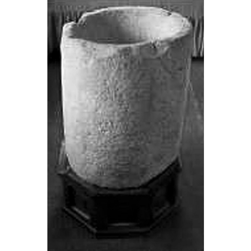
Image copyright © Over Kellet Parish, 1996
No known copyright restriction / Fair Dealing
Results: 3 records
view of font
Scene Description: the old font
Copyright Statement: Image copyright © Over Kellet Parish, 1996
Image Source: B&W digital image of a photograph in the Parish Appraisal of 1996 [http://www.overkellet.org/?Parish_Appraisal_1996:Page_4] [accessed 11 May 2010]
Copyright Instructions: No known copyright restriction / Fair Dealing
view of church exterior - southwest view
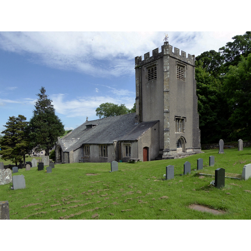
Scene Description: Source caption: "St. Cuthbert's, Over Kellet. Joint Church of England and Methodist church."
Copyright Statement: Image copyright © Philip Platt, 2015
Image Source: digital photograph taken 29 June 2015 by Philip Platt [www.geograph.org.uk/photo/4546958] [accessed 3 April 2019]
Copyright Instructions: CC-BY-SA-2.0
view of church exterior - southwest view
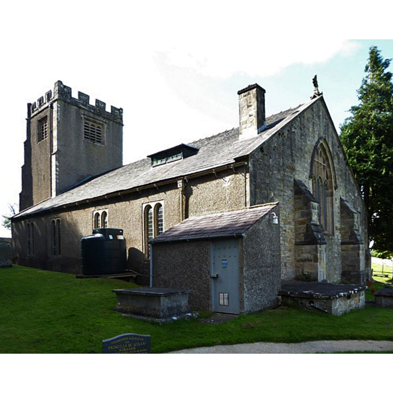
Copyright Statement: Image copyright © Basher Eyre, 2017
Image Source: digital photograph taken 12 August 2017 by Basher Eyre [www.geograph.org.uk/photo/5517770] [accessed 3 April 2019]
Copyright Instructions: CC-BY-SA-2.0
INFORMATION
Font ID: 16523KEL
Object Type: Baptismal Font1
Font Century and Period/Style: 10th - 13th century, Medieval
Church / Chapel Name: Parish Church of St. Cuthbert
Font Location in Church: [cf. FontNotes]
Church Patron Saint(s): St. Cuthbert [aka Cubertus]
Church Address: 3 Kirklands Rd, Over Kellet, Carnforth LA6 1DP, UK
Site Location: Lancashire, North West, England, United Kingdom
Directions to Site: Located off the B6254, just E of Carnford, 10 km NNE of Lancaster
Ecclesiastic Region: Diocese of Blackburn
Historical Region: Hundred of Lonsdale -- Hundred of Amounderness [in Domesday]
Additional Comments: disused font / re-cyled font used in a garden (is the claim to pre-Conquest date reasonable?)
Font Notes:
Click to view
[Nether and Over] Kellet [variant spelling] have en entry, together with over a dozen other places, in the Domesday survey [https://opendomesday.org/place/XX0000/nether-and-over-kellet/] [accessed 3 April 2019]; the entry mentions neither cleric nor church in it. The entry for this township in the Victoria County History (Lancaster, vol. 8, 1914) notes: "The oldest part of the building is the west arch and pier of the south aisle, which, together with the respond, are of early 13th-century date and transitional in character, [...] but the written evidences do not begin so early, the earliest intimation being in April 1281 [...] The font is a modern stone one and stands at the west end of the south aisle. The old font, which is a circular bowl of gritstone, is now in the garden at Hall Garth." This old font may have been in its own place when, as the VCH notes, "Robert Cock in 1633 desired to be buried 'at the porch door near unto the font.'" The Parish Appraisal of 1996 [http://www.overkellet.org/?Parish_Appraisal_1996:Page_4] [accessed 11 May 2010] notes: "There may have been a Church here by the C10th. The Saxon/Early Norman font retrieved from Hall Garth's garden in 1973, is of that period."
COORDINATES
UTM: 30U 517523 5996851
Latitude & Longitude (Decimal): 54.1195, -2.7319
Latitude & Longitude (DMS): 54° 7′ 10.2″ N, 2° 43′ 54.84″ W
MEDIUM AND MEASUREMENTS
Material: stone, gritstone
Font Shape: tub-shaped
Basin Interior Shape: round
Basin Exterior Shape: round
REFERENCES
- Victoria County History [online], University of London, 1993-. URL: https://www.british-history.ac.uk.