Melling / Melinge / Melling in Lonsdale / Melling with Wrayton
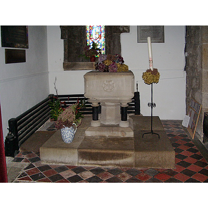
Image copyright © Alexander P Kapp, 2007
CC-BY-SA-2.0
Results: 4 records
view of font in context
Scene Description: the modern font at the west end of the south aisle
Copyright Statement: Image copyright © Alexander P Kapp, 2007
Image Source: digital photograph taken 12 November 2007 by Alexander P Kapp [www.geograph.org.uk/photo/612823] [accessed 28 February 2019]
Copyright Instructions: CC-BY-SA-2.0
view of church exterior - southeast view
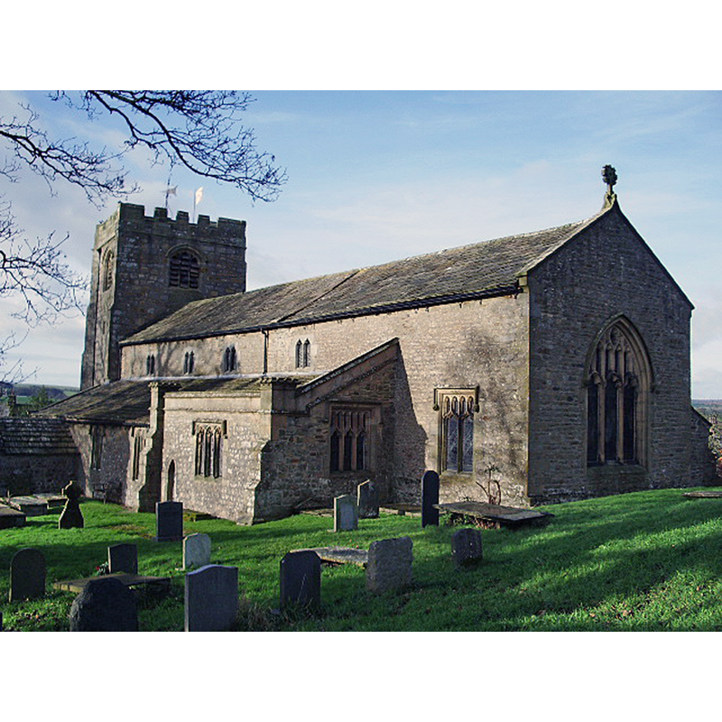
Copyright Statement: Image copyright © Alexander P Kapp, 2007
Image Source: digital photograph taken 12 November 2007 by Alexander P Kapp [www.geograph.org.uk/photo/612077] [accessed 28 February 2019]
Copyright Instructions: CC-BY-SA-2.0
view of church interior - looking west
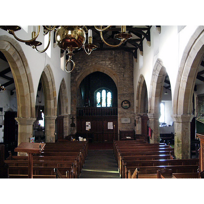
Scene Description: the modern font is discernible at the west end of the south aisle
Copyright Statement: Image copyright © Alexander P Kapp, 2007
Image Source: digital photograph taken 12 November 2007 by Alexander P Kapp [www.geograph.org.uk/photo/612835] [accessed 28 February 2019]
Copyright Instructions: CC-BY-SA-2.0
view of church interior - looking east
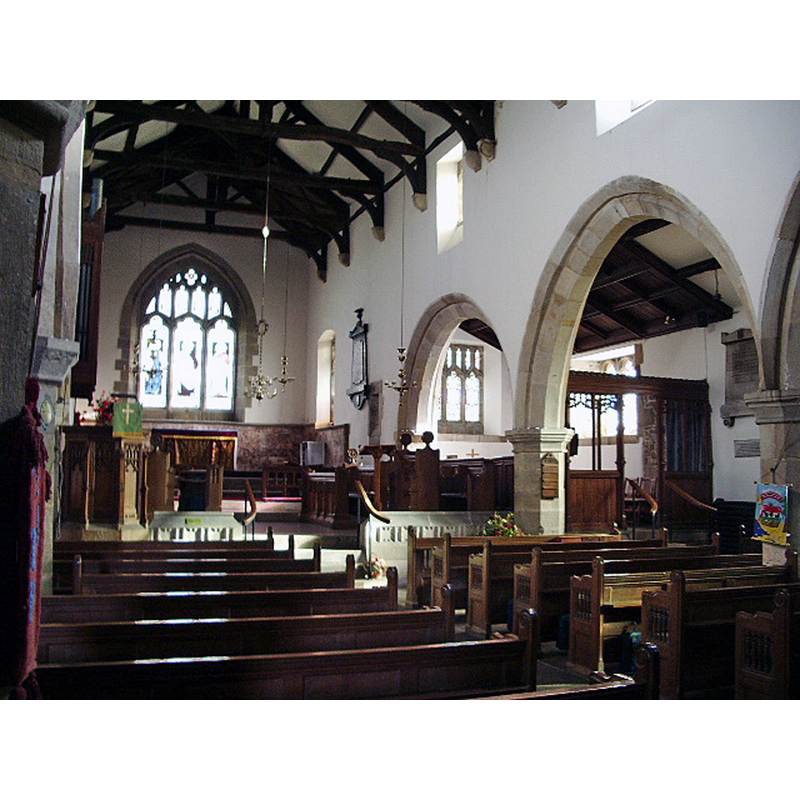
Copyright Statement: Image copyright © Alexander P Kapp, 2007
Image Source: digital photograph taken 12 November 2007 by Alexander P Kapp [www.geograph.org.uk/photo/612838] [accessed 28 February 2019]
Copyright Instructions: CC-BY-SA-2.0
INFORMATION
Font ID: 16518MEL
Object Type: Baptismal Font1?
Font Century and Period/Style: 11th - 15th century, Medieval
Church / Chapel Name: Parish Church of St. Wilfrid [formerly St. Peter's?]
Church Patron Saint(s): St. Wilfrid [aka Wilfred, Wilfrith] [earlier dedicated to St. Peter?]
Church Address: Main Street, Melling, Lancaster LA6 2RA, UK
Site Location: Lancashire, North West, England, United Kingdom
Directions to Site: Located 3-4 km NNE of Hornby, towards the West Yorkshire border [NB: not to be mistaken with Melling in Halsall, also in Lancs.]
Ecclesiastic Region: Diocese of Blackburn
Historical Region: Hundred of West Derby
Additional Comments: disappeared font?
Font Notes:
Click to view
There is an entry for this Melling [variant spelling] in the Domesday survey [https://opendomesday.org/place/SD3900/melling/] [accessed 28 February 2019] but it mentions neither cleric nor church in it. The entry for this parish in the Victoria County History (Lancaster, vol. 8, 1914) notes: "The building is largely of 15th-century date, but some fragments of an older structure are built into the walls, and others have been found in more recent times, indicating a church on the same site at a very early period. A portion of a pre-Conquest sepulchral slab found 6 ft. below the tower floor is preserved in the vestry […] The font and pulpit and the fittings generally, with the exception of the seats in the aisles, which are the 18th-century ones cut down, are all modern." [NB: we have no information on the medieval font]
COORDINATES
UTM: 30U 525057 5998577
Latitude & Longitude (Decimal): 54.1347, -2.6165
Latitude & Longitude (DMS): 54° 8′ 4.92″ N, 2° 36′ 59.4″ W
REFERENCES
- Victoria County History [online], University of London, 1993-. URL: https://www.british-history.ac.uk.