Lytham / Lidun
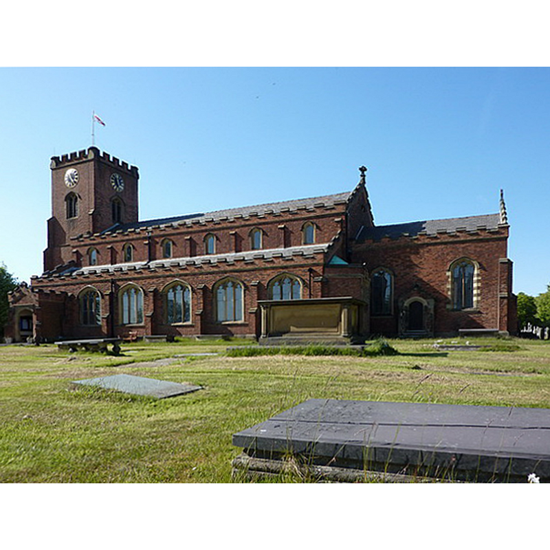
Image copyright © Alexander P Kapp, 2010
CC-BY-SA-3.0
Results: 2 records
view of church exterior - southeast view
Copyright Statement: Image copyright © Alexander P Kapp, 2010
Image Source: digital photograph taken 17 May 2010 by Alexander P Kapp [ww.geograph.org.uk/photo/1884747] [accessed 21 February 2019]
Copyright Instructions: CC-BY-SA-3.0
view of font and cover

Scene Description: the modern font
Copyright Statement: Image copyright © Tony Boughen, 2010
Image Source: digital photograph by Tony Boughen in Lancashire Churches [http://www.lancashirechurches.co.uk/lythamstj.htm] [accessed 10 May 2010]
Copyright Instructions: PERMISSION NOT AVAILABLE -- IMAGE NOT FOR PUBLIC USE
INFORMATION
Font ID: 16517LYT
Object Type: Baptismal Font1?
Font Date: ca. 1190?
Font Century and Period/Style: 12th century (late?), Late Norman? / Transitional?
Church / Chapel Name: Parish Church of St. Cuthbert
Church Patron Saint(s): St. Cuthbert [aka Cubertus]
Church Notes: present church is modern, 19thC, a replacement of two earlier churches; the previous one was late-18thC;
Church Address: [the modern church] Church Rd, Lytham, Lytham Saint Annes FY8 5JN, UK
Site Location: Lancashire, North West, England, United Kingdom
Directions to Site: Located 13 SSE of Blackpool, 19 km W of Preston
Ecclesiastic Region: Diocese of Blackburn
Historical Region: Hundred of Amounderness
Additional Comments: disappeared font?
Font Notes:
Click to view
An entry for Lytham [variant spelling] in the Domesday survey [https://opendomesday.org/place/SD3727/lytham/] [accessed 21 February 2019] reports three churches in it. Whitaker (1823) states that there was no church here prior to the foundation of the priory, and that the present church is entirely modern; he mentions no font in it. The entry for the Priory of Lytham in the Victoria County History (Lancaster, vol. 2, 1908) reports the Benedictine "priory of Lytham was founded between 1189 and 1194 [...] The priory was dedicated to St. Cuthbert." Dissolved 1530s. Hartwell & Pevsner (2009) note: "A church is recorded in 1190", but the present church is a 19th-century one replacing a 18th-century building. The present font appears to be Victorian, a square basin of somewhat Early English inspiration, raised on five moulded supports and a polygonal plinth. The wooden cover is square and flat, also modern. [NB: we have no information on the medieval font]
COORDINATES
UTM: 30U 501570 5954306
Latitude & Longitude (Decimal): 53.7374, -2.9762
Latitude & Longitude (DMS): 53° 44′ 14.64″ N, 2° 58′ 34.32″ W
REFERENCES
- Victoria County History [online], University of London, 1993-. URL: https://www.british-history.ac.uk.
- Hartwell, Clare, Lancashire North, New Haven; London: Yale University Press, 2009, p. 434
- Whitaker, Thomas Dunham, An history of Richmondshire, in the North Riding of the County of York [...], with illustrations by J.M.W. Turner, London: [s.n.], 1823, vol. 2: 440