Leyland / Lailand / Leiland / Leilaund / Leylond
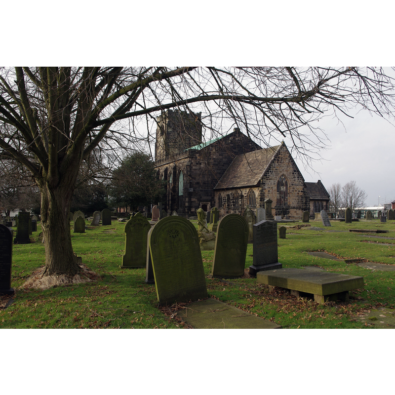
Image copyright © Ian Taylor, 2018
CC-BY-SA-2.0
Results: 1 records
view of church exterior - southeast view
Copyright Statement: Image copyright © Ian Taylor, 2018
Image Source: digital photograph taken 13 January 2018 by Ian Taylor [www.geograph.org.uk/photo/5651208] [accessed 11 March 2019]
Copyright Instructions: CC-BY-SA-2.0
INFORMATION
Font ID: 16515LEY
Object Type: Baptismal Font1?
Font Century and Period/Style: 12th century, Norman
Church / Chapel Name: Parish Church of St. Andrew
Church Patron Saint(s): St. Andrew
Church Address: Church Rd, Leyland PR25 3EL, UK
Site Location: Lancashire, North West, England, United Kingdom
Directions to Site: Located off (S) the B5248, 8-9 km S of Preston
Ecclesiastic Region: Diocese of Blackburn
Historical Region: Hundred of Leyland
Additional Comments: disappeared font? (the one from the Domesday-time church here)
Font Notes:
Click to view
There are four entries for Leyland [variant spelling] in the Domesday survey [https://opendomesday.org/place/SD5422/leyland/] [accessed 11 March 2019] one of which reports a priest but not a church in it, though there must have been one there. The entry for this parish in the Victoria County History (Lancaster, vol. 6, 1911) notes: "The church of Leyland was given to Evesham Abbey by Warine Bussel, baron of Penwortham, and the gift was enlarged by Richard Bussel, his son, in the first half of the 12th century", and reports "portions of 12th-century masonry" found in the 19th-century excavation work on the foundations; the font, howver, is reported as modern. [NB: modern too is the font at St. Ambrose, as well as the other fonts of Leyland churches]. The entry for this church in Historic England [Listing NGR: SD5411121591] notes: "Church, consisting of C14 chancel, C15 west tower, and nave of 1817"; no font mentioned.
COORDINATES
UTM: 30U 520056 5948930
Latitude & Longitude (Decimal): 53.6887, -2.6963
Latitude & Longitude (DMS): 53° 41′ 19.32″ N, 2° 41′ 46.68″ W
REFERENCES
- Victoria County History [online], University of London, 1993-. URL: https://www.british-history.ac.uk.