Cockersand Abbey / Cocressand / Kokersand
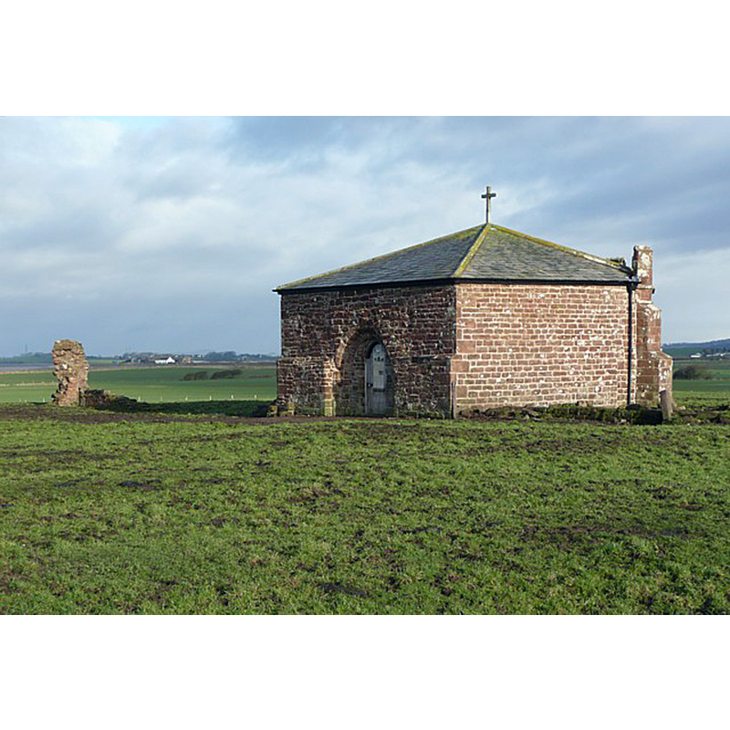
Image copyright © Hunphrey Bolton, 2009
CC-BY-SA-2.0
Results: 1 records
view of church exterior in context
Scene Description: Source caption: "The remains of Cockersand Abbey, Thurnham. The Premonstratensian Abbey was founded in 1190. All that remains is this restored Chapter House and some nondescript columns of ruined masonry. (Nikolaus Pevsner, Buildings of England)."
Copyright Statement: Image copyright © Hunphrey Bolton, 2009
Image Source: digital photograph taken 26 December 2009 by Humphrey Bolton [www.geograph.org.uk/photo/1653546] [accessed 7 October 2018]
Copyright Instructions: CC-BY-SA-2.0
INFORMATION
Font ID: 16504COC
Object Type: Baptismal Font1?
Font Century and Period/Style: 12th century (late?), Late Norman
Church / Chapel Name: Abbey Church [disappeared]
Font Location in Church: [cf. FontNotes]
Church Notes: abbey founded before 1184 as Hospital of St Mary; refounded as a Premonstratensian priory soon thereafter; promoted to abbey in 1192 but continued to function as a hospital as well; dissolved 1539; only a few ruins of the church remain
Church Address: Cockerham, Lancaster LA2 0AZ, UK
Site Location: Lancashire, North West, England, United Kingdom
Directions to Site: Located in Thurnham, NW of Cockerham, S of Lancaster, NW of Preston
Ecclesiastic Region: Diocese of Blackburn
Historical Region: Hundred of Amounderness
Additional Comments: disappeared font?
Font Notes:
Click to view
Brooke's 1898 transcription of the 'Chartulary' of this Abbey notes "a holy Font with a lock" in it [NB: we have no information on the present whereabouts of the font at Cockersand Abbey church; the abbey was originally founded in the late-12th century; the Abbey itself was already in disrepair in the 16th century, as Hartwell & Pevsner (2009) note in their reference to John Leland's comment: "Standing veri blekely and object to all wynddes"]. The entry for this abbey in the Victoria County History (Lancaster, vol. 8, 1914) has no details of either church or font: "A careful and complete excavation of the site has yet to be made, and until this is done little can be said with any degree of certainty about the plan of the original buildings. They appear, however, to have been built in the usual way round a cloister garth about 80 ft. square, with the church on the north side and the chapter-house on the east."
COORDINATES
UTM: 30U 508198 5980970
Latitude & Longitude (Decimal): 53.977, -2.875
Latitude & Longitude (DMS): 53° 58′ 37.2″ N, 2° 52′ 30″ W
LID INFORMATION
Date: Medieval?
Notes: [cf. FontNotes]
REFERENCES
- Victoria County History [online], University of London, 1993-. URL: https://www.british-history.ac.uk.
- Brooke, Thomas, The Chartulary of Cockersand Abbey of the Premonstratensian Order, 1890, vol. 1, pt. 1, p. 54