Bolton-le-Sands / Bodeltone
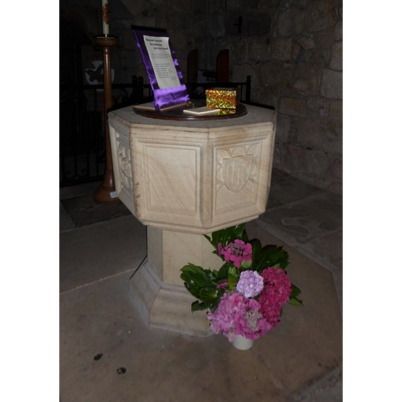
Image copyright © Basher Eyre, 2017
CC-BY-SA-3.0
Results: 3 records
view of font and cover
Scene Description: the modern font and cover
Copyright Statement: Image copyright © Basher Eyre, 2017
Image Source: edited detail of a digital photograph taken 12 August 2017 by Basher Eyre [www.geograph.org.uk/photo/5517861] [accessed 3 April 2019]
Copyright Instructions: CC-BY-SA-3.0
view of church exterior - southwest end
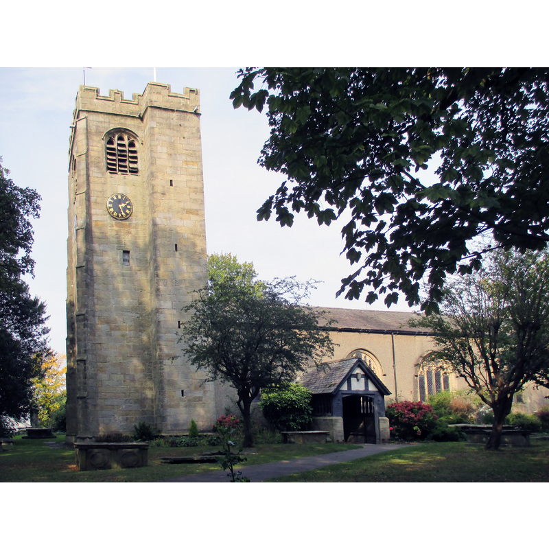
Scene Description: Source caption: "Nave and west tower of Holy Trinity parish church, Bolton-le-Sands, Lancashire, seen from the south".
Copyright Statement: Image copyright © Antiquary, 2014
Image Source: edited detail of a digital photograph taken 18 September 2014 by Antiquary [https://commons.wikimedia.org/wiki/File:C_of_E_parish_church,_Bolton-le-Sands.JPG] [accessed 3 April 2019]
Copyright Instructions: CC-BY-SA-4.0
view of church exterior - southeast view
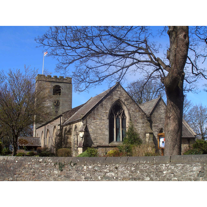
Copyright Statement: Image copyright © John Slater, 2013
Image Source: digital photograph taken 23 April 2013 by John Slater [www.geograph.org.uk/photo/3438349] [accessed 3 April 2019]
Copyright Instructions: CC-BY-SA-2.0
INFORMATION
Font ID: 16498BOL
Object Type: Baptismal Font1?
Font Date: ca. 1094?
Font Century and Period/Style: 11th century (late?), Norman
Church / Chapel Name: Parish Church of the Holy Trinity [formerly and aka St. Michael]
Church Patron Saint(s): The Holy Trinity [formerly dedicated to St. Michael]
Church Address: 70 Main Rd, Bolton-le-Sands, Carnforth LA5 8DU, UK
Site Location: Lancashire, North West, England, United Kingdom
Directions to Site: Located 6 km NNE of Lancaster
Ecclesiastic Region: Diocese of Blackburn
Historical Region: Hundred of Lonsdale -- Hundred of Amoundersess [in Domesday]
Additional Comments: disappeared font? (the font from the ca. 1094 church here)
Font Notes:
Click to view
Bolton [le Sands] [variant spelling] has an entry in the Domesday survey together with over a dozen other places [https://opendomesday.org/place/SD4867/bolton-le-sands/] [accessed 3 April 2019]the entry mentions neither cleric nor church in it. The entry for this parish in the Victoria County History (Lancaster, vol., 8, 1914) notes: "The church existed in 1094 [...] The nave arcade and the west tower are practically all of the old church now left, and are of late 15thcentury date [...] The registers begin in 1653. [...] The floor of the baptistery is 15 in. below that of the nave, and the font is modern." [NB: we have no information on any medieval font here].
COORDINATES
UTM: 30U 513620 5994979
Latitude & Longitude (Decimal): 54.1028, -2.7917
Latitude & Longitude (DMS): 54° 6′ 10.08″ N, 2° 47′ 30.12″ W
REFERENCES
- Victoria County History [online], University of London, 1993-. URL: https://www.british-history.ac.uk.