Altham No. 1 / Alvetham / Elvetham
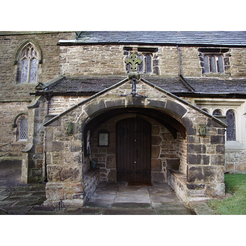
Image copyright © Alexander P Kapp, 2018
CC-BY-SA-3.0
Results: 2 records
view of church exterior - south porch
Copyright Statement: Image copyright © Alexander P Kapp, 2018
Image Source: digital photograph taken 15 January 2018 by Alexander P Kapp [www.geograph.org.uk/photo/660506] [accessed 14 March 2019]
Copyright Instructions: CC-BY-SA-3.0
view of church exterior - south view
![Source caption: "St James Church, Altham. The church was founded in Norman times though the earliest part of this building dates back to the 15th Century. Most of it dates from a Victorian rebuild."
EXT S PORCH digital photograph taken 15 January 2018 by Alexander P Kapp [www.geograph.org.uk/photo/660506] [accessed 14 March 2019]](/static-50478a99ec6f36a15d6234548c59f63da52304e5/compressed/1190316026_compressed.png)
Scene Description: Source caption: "St James Church, Altham. The church was founded in Norman times though the earliest part of this building dates back to the 15th Century. Most of it dates from a Victorian rebuild."
EXT S PORCH digital photograph taken 15 January 2018 by Alexander P Kapp [www.geograph.org.uk/photo/660506] [accessed 14 March 2019]
Copyright Statement: Image copyright © Bill Boaden, 2013
Image Source: digital photograph taken 10 November 2013 by Bill Boaden [www.geograph.org.uk/photo/3737871] [accessed 14 March 2019]
Copyright Instructions: CC-BY-SA-2.0
INFORMATION
Font ID: 16491ALT
Object Type: Baptismal Font1
Font Century and Period/Style: 12th century [re-cut], Norman [altered]
Church / Chapel Name: Parish Church of St. James [formerly St. Mary]
Font Location in Church: In the S porch [cf. FontNotes]
Church Patron Saint(s): St. James [formerly St. Mary]
Church Address: Burnley Rd, Altham, Accrington BB5 5UN, UK -- Tel.: 01254 883023
Site Location: Lancashire, North West, England, United Kingdom
Directions to Site: Located off the A678, N of Huncoat, 8 km W of Burnley
Ecclesiastic Region: Diocese of Blackburn
Historical Region: Hundred of Blackburn
Additional Comments: disused font / re-cycled font / now a seat in the south porch
Font Notes:
Click to view
No individual entry found for Altham in the Domesday survey. The entry for this township in the Victoria County History (Lancaster, vol. 6, 1911) notes: "The south porch has been rebuilt and is very plain in character with a wide four-centred arch with flatpitched gable over. In the north-east corner is what appears to be an early font now mutilated, rent away on one side so as to form a seat." Noted in Hartwell & Pevsner (2009): "an ancient broken tub font" in the re-built south porch. [cf. Index entry for Altham No. 2 for a late medieval font in use in this church]
COORDINATES
UTM: 30U 542949 5960755
Latitude & Longitude (Decimal): 53.7936, -2.348
Latitude & Longitude (DMS): 53° 47′ 36.96″ N, 2° 20′ 52.8″ W
MEDIUM AND MEASUREMENTS
Material: stone
Font Shape: tub-shaped
Basin Interior Shape: round
Basin Exterior Shape: round
REFERENCES
- Victoria County History [online], University of London, 1993-. URL: https://www.british-history.ac.uk.
- Hartwell, Clare, Lancashire North, New Haven; London: Yale University Press, 2009, p. 85