Accrington / Acrington / Ackrygnton / Acrinton / Akarinton / Akeringtone / Akerinton / Akerunton / Akerynton / Akryngton
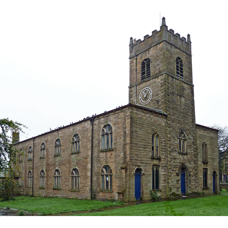
Image copyright © Tim Green, 2011
CC-BY-2.0
Results: 1 records
view of church exterior - northwest view
Copyright Statement: Image copyright © Tim Green, 2011
Image Source: edited detail of a digital photograph taken 8 October 2011 by Tim Green [www.flickr.com/photos/93416311@N00/6224146136] [accessed 15 March 2019]
Copyright Instructions: CC-BY-2.0
INFORMATION
Font ID: 16490ACC
Object Type: Baptismal Font1
Font Century and Period/Style: 15th - 16th century, Late Medieval
Workshop/Group/Artisan: heraldic font
Church / Chapel Name: Parish Church of St. James
Font Location in Church: Inside the church
Church Patron Saint(s): St. James
Church Notes: church founded ca. 1556; present church is 1763 re-building with later modifications
Church Address: Cannon St at Church St, 10 St James Mews, Accrington BB5 4JR, UK -- Tel.: +44 1254 433590
Site Location: Lancashire, North West, England, United Kingdom
Directions to Site: Located 6 km E of Blackburn
Ecclesiastic Region: Diocese of Blackburn
Historical Region: Hundred of Blackburn
Font Notes:
Click to view
No individual entry found for Accrington in the Domesday survey. The entry for the townships of Old and New Accrington in the Victoria County History (Lancaster, vol. 6, 1911) notes: "It is possible that the monks of Kirkstall during their brief tenure built a small chapel adjacent to their grange [...], but nothing is known from the records. At the Reformation the chapel at Accrington [...] was confiscated by the Crown as a chantry [...] but was restored to the inhabitants in 1553 [...] The registers date from 1754. St. James's Church was built in 1763, replacing the old chapel." The British Listed Buildings database [www.britishlistedbuildings.co.uk/en-183854-church-of-st-james-accrington] [accessed 4 October 2011] notes: "late-medieval octagonal font with blank shields in faces". [NB: the other churches and chapels in Accrington are modern].
COORDINATES
UTM: 30U 541838 5956115
Latitude & Longitude (Decimal): 53.75199, -2.3655
Latitude & Longitude (DMS): 53° 45′ 7.16″ N, 2° 21′ 55.8″ W
MEDIUM AND MEASUREMENTS
Material: stone
Font Shape: octagonal, mounted
Basin Interior Shape: round
Basin Exterior Shape: octagonal
REFERENCES
- Victoria County History [online], University of London, 1993-. URL: https://www.british-history.ac.uk.