Wollaston nr. Shrewsbury / Willauestune / Willavestune / Woolaston
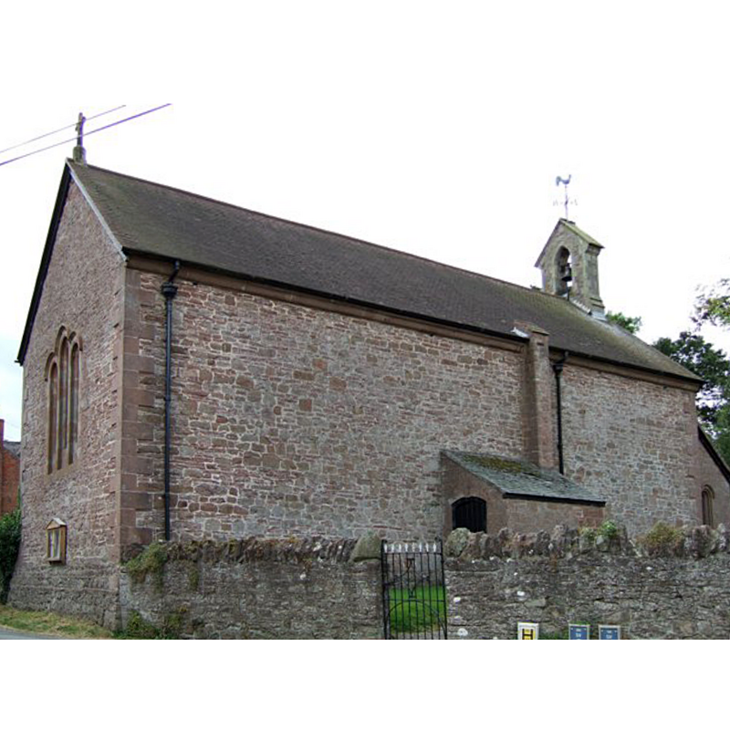
Image copyright © Anne, 2007
CC-BY-SA-2.5
Results: 1 records
view of church exterior
Copyright Statement: Image copyright © Anne, 2007
Image Source: digital photograph taken 27 August 2007 by Anne [www.geograph.org.uk/photo/537639] [accessed 17 November 2020]
Copyright Instructions: CC-BY-SA-2.5
INFORMATION
Font ID: 16486WOL
Object Type: Baptismal Font1?
Font Century and Period/Style: 13th century, Medieval
Church / Chapel Name: Parish Church of St. John the Baptist
Font Location in Church: [cf. FontNotes]
Church Patron Saint(s): St. John the Baptist
Church Notes: 18thC church replaced a medieval one documented 1289
Church Address: National Cycle Rte 81, Shrewsbury SY5 9DN, UK
Site Location: Shropshire, West Midlands, England, United Kingdom
Directions to Site: Located on the A458, 15 km W of Shrewsbury, at the Welsh border [Coordinates: 52°42′14″N 2°59′38″W / 52.704°N 2.994°W]
Ecclesiastic Region: Diocese of Hereford
Historical Region: Hundred of Reweset
Additional Comments: disappeared font? (the one from the medieval church documented late-13thC here)
Font Notes:
Click to view
There is an entry for this Wollaston [alternate spelling] in the Domesday survey [https://opendomesday.org/place/SJ3212/wollaston/] but it mentions neither priest nor church in it. Anderson (1864) notes an early chapel dependent of Alberbury. Newman & Pevsner (2006) note that a simple church was "built on the site of a medieval chapel in 1787-8", which was "restored in 1885-6". The entry for this church in Historic England [Listing NGR: SJ3292812298] notes: "Parish church. 1787-8 on the site of a medieval chapel first recorded in 1289 and probably reusing some materials; remodelled and porch and vestry added in 1885; restored and bellcote replaced in 1911. [...] octagonal stone font with moulded base, and bowl with inscription: "IHS / SUFFER THE / LITTLE CHILDREN / TO COME UNTO / ME, AND FORBID / THEM NOT: FOR / OF SUCH IS / THE KINGDOM / OF GOD", and wooden cover". [NB: we have no information on the medieval font]
COORDINATES
UTM: 30U 500385 5839360
Latitude & Longitude (Decimal): 52.70415, -2.9943
Latitude & Longitude (DMS): 52° 42′ 15″ N, 2° 59′ 39″ W
REFERENCES
- Anderson, John Corbet, Shropshire, its early history and antiquities, comprising […], London: Willis and Sotheran, 1864, p. 362
- Newman, John, Shropshire, New Haven: Yale University Press, 2006, p. 707