Weston-under-Redcastle / Weston under Redcastle / Weston-under-Red Castle / Westune
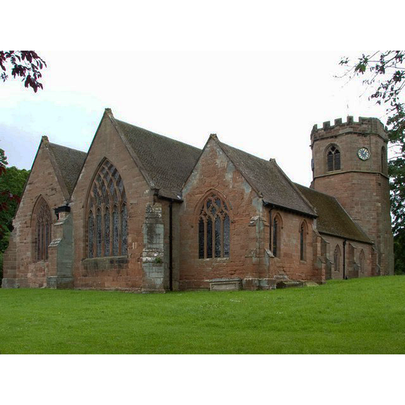
Image copyright © Mike White, 2009
CC-BY-SA-2.0
Results: 2 records
view of church exterior - northeast view
Copyright Statement: Image copyright © Mike White, 2009
Image Source: digital photograph taken 27 May 2009 by Mike White [www.geograph.org.uk/photo/1323622] [accessed 11 February 2015]
Copyright Instructions: CC-BY-SA-2.0
view of church exterior - north view
![Source caption: "Saint Luke’s Parish Church, in Hodnet [...] The oldest part of the building (the south isle) dates from the 12th century. In the 14th century the church was remodelled, with the south isle chapel, nave, chancel and rare three-stage octagonal tower added. The church was restored in the latter half of the nineteenth century."](/static-50478a99ec6f36a15d6234548c59f63da52304e5/compressed/1150214012_compressed.png)
Scene Description: Source caption: "Saint Luke’s Parish Church, in Hodnet [...] The oldest part of the building (the south isle) dates from the 12th century. In the 14th century the church was remodelled, with the south isle chapel, nave, chancel and rare three-stage octagonal tower added. The church was restored in the latter half of the nineteenth century."
Copyright Statement: Image copyright © David Dixon, 2011
Image Source: digital photograph taken 9 August 2011 by David Nixon [www.geograph.org.uk/photo/2552173] [accessed 11 February 2015]
Copyright Instructions: CC-BY-SA-2.0
INFORMATION
Font ID: 16481WES
Object Type: Baptismal Font1?
Font Century and Period/Style: Medieval
Church / Chapel Name: Parish Church of St. Luke
Font Location in Church: [cf. FontNotes]
Church Patron Saint(s): St. Luke
Church Notes: church originally 12thC
Church Address: Guinea Lane, Weston-under-Redcastle, Shropshire, SY4 5XG
Site Location: Shropshire, West Midlands, England, United Kingdom
Directions to Site: Located off (E) the A49, SW of Market Drayton, NNE of Shrewsbury
Ecclesiastic Region: Diocese of Lichfield
Historical Region: Hundred of Hodnet [in Domesday]
Additional Comments: disappeared font?
Font Notes:
Click to view
There is an entry for Weston[-under-Redcastle] [variant spelling] in the Domesday survey [http://domesdaymap.co.uk/place/SJ5628/weston-under-redcastle/] [accessed 11 February 2015], but it mentions neither cleric nor church in it. Anderson (1864) notes an ancient chapel here. Newman & Pevsner (2006) reports a Georgian church modified in 1879. English Heritage [Listing NGR: SJ5650228801] (1987) reports an "octagonal late Perpendicular-style font [...] late C19" in this church. [NB: we have no information on the font of the medieval church]
COORDINATES
UTM: 30U 523769 5856199
Latitude & Longitude (Decimal): 52.8535, 2.5770
REFERENCES
- Anderson, John Corbet, Shropshire, its early history and antiquities, comprising […], London: Willis and Sotheran, 1864, p. 396
- Newman, John, Shropshire, New Haven: Yale University Press, 2006, p. 686