Bedford No. 4
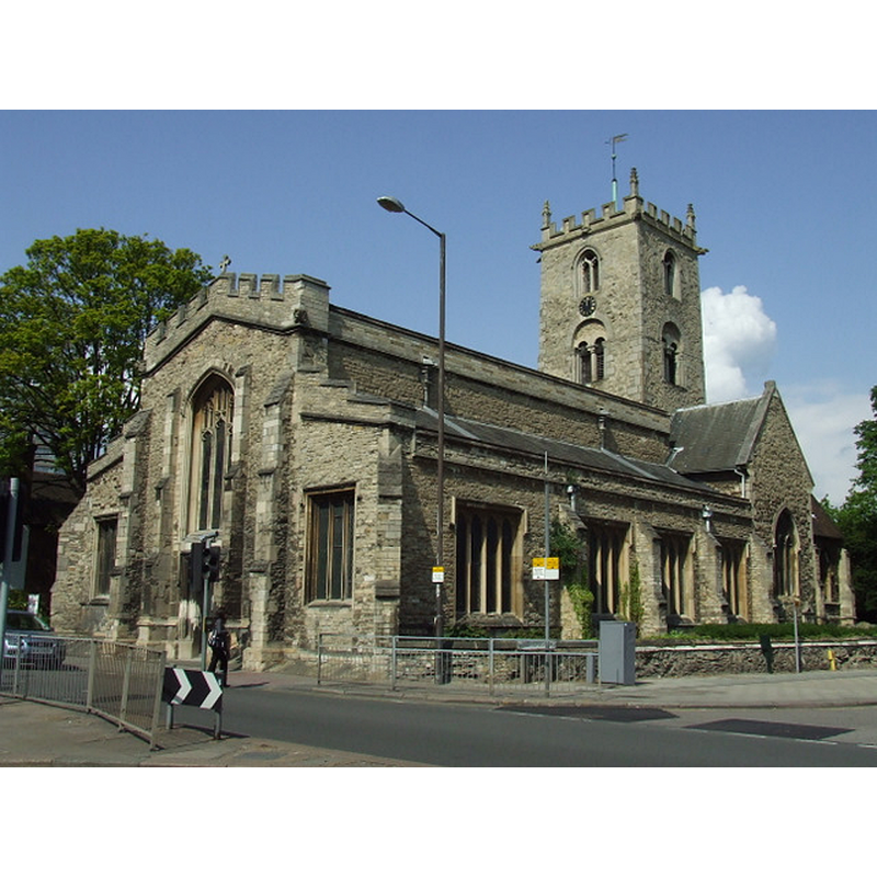
Image copyright © Thomas Nugent, 2010
CC-BY-SA-2.0
Results: 1 records
view of church exterior - northeast view
Scene Description: Source caption: "Former St Mary's Church. On St Mary's Street at the junction with Cardington Road and St John's Street. Has not been used for worship since 1975."
Copyright Statement: Image copyright © Thomas Nugent, 2010
Image Source: digital photograph taken 17 May 2010 by Thomas Nugent [www.geograph.org.uk/photo/1866445] [accessed 10 September 2015]
Copyright Instructions: CC-BY-SA-2.0
INFORMATION
Font ID: 16473BED
Object Type: Baptismal Font1
Font Century and Period/Style: 12th century, Norman
Church / Chapel Name: Parish Church of St. Mary the Virgin [redundant]
Church Patron Saint(s): St. Mary the Virgin
Church Notes: redundant; in the care of the Churches Conservation Trust
Church Address: 26 Church Lane, Bedford, Bedford Borough MK41 9HN
Site Location: Bedfordshire, East, England, United Kingdom
Ecclesiastic Region: Diocese of St. Albans
Historical Region: Hundred of Buckelowe
Additional Comments: disapeared font? (the one from the 12thC church here)
Font Notes:
Click to view
Illustrated in a May 1839 image by Henry E. L. Dryden, now in the Sir Henry Dryden Collection, Northamptonshire. The Victoria County History (Bedford, vol. 3, 1912) notes: "The earliest details [of this church] belong to a fine cruciform church of 12th-century date [...] At the west end of the nave is a modern painted octagonal font with traceried panels." [NB: we have no information on the 12th-century font]
COORDINATES
UTM: 30U 673476 5778851
Latitude & Longitude (Decimal): 52.13291, -0.465338
Latitude & Longitude (DMS): 52° 7′ 58.48″ N, 0° 27′ 55.22″ W
REFERENCES
- Victoria County History [online], University of London, 1993-. URL: https://www.british-history.ac.uk.