Tugford / Dodefort / Tugaford
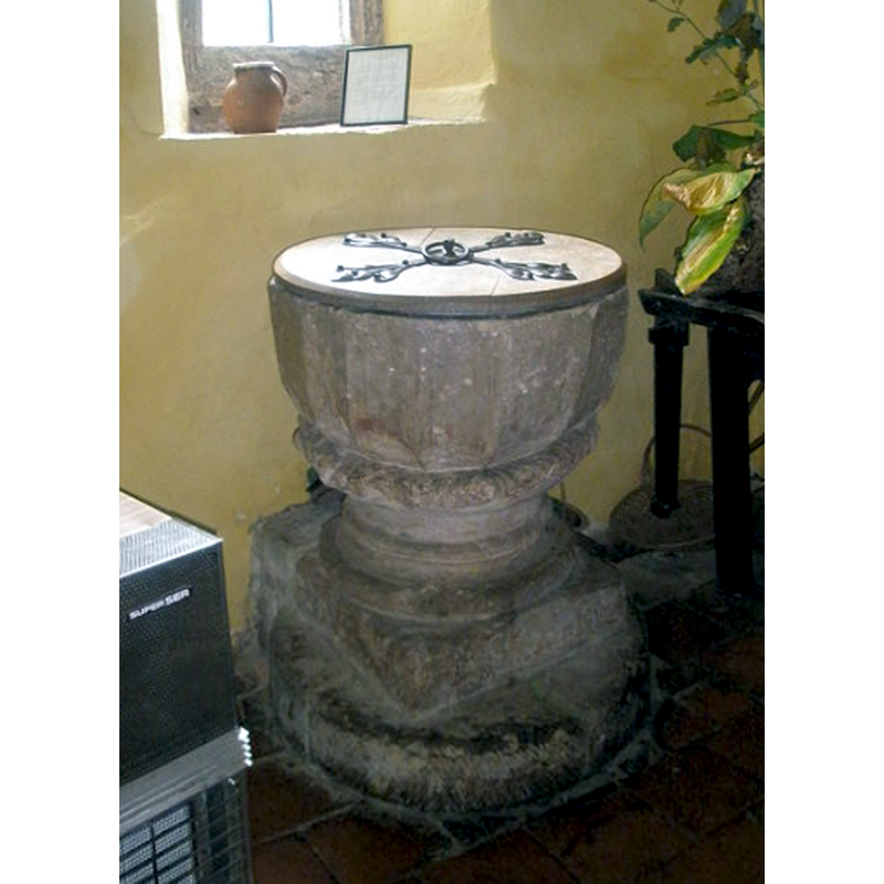
Image copyright © Basher Eyre, 2009
CC-BY-SA-2.0
Results: 8 records
view of font and cover
Copyright Statement: Image copyright © Basher Eyre, 2009
Image Source: digital photograph taken 9 August 2009 by Basher Eyre [www.geograph.org.uk/photo/1446995] [accessed 30 June 2015]
Copyright Instructions: CC-BY-SA-2.0
view of church exterior - south portal
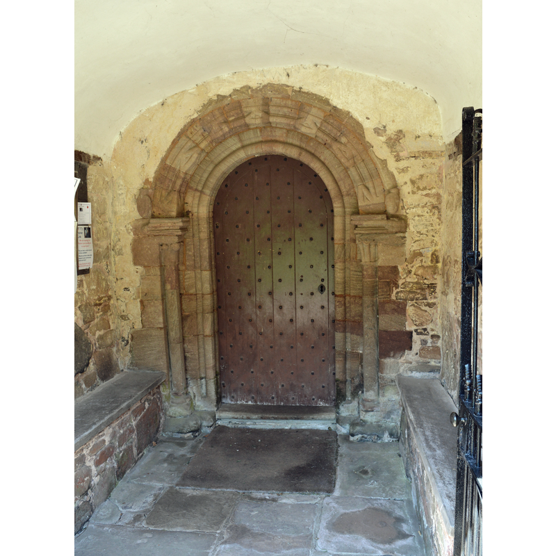
Scene Description: Source caption: "St Catherine, Tugford. The South door, 'latest 12th century' says the Shropshire Pevsner."
Copyright Statement: Image copyright © Philip Pankhurst, 2014
Image Source: digital photograph taken 17 May 2014 by Philip Pankhurst [www.geograph.org.uk/photo/3990497] [accessed 30 June 2015]
Copyright Instructions: CC-BY-SA-2.0
view of church exterior - northwest end
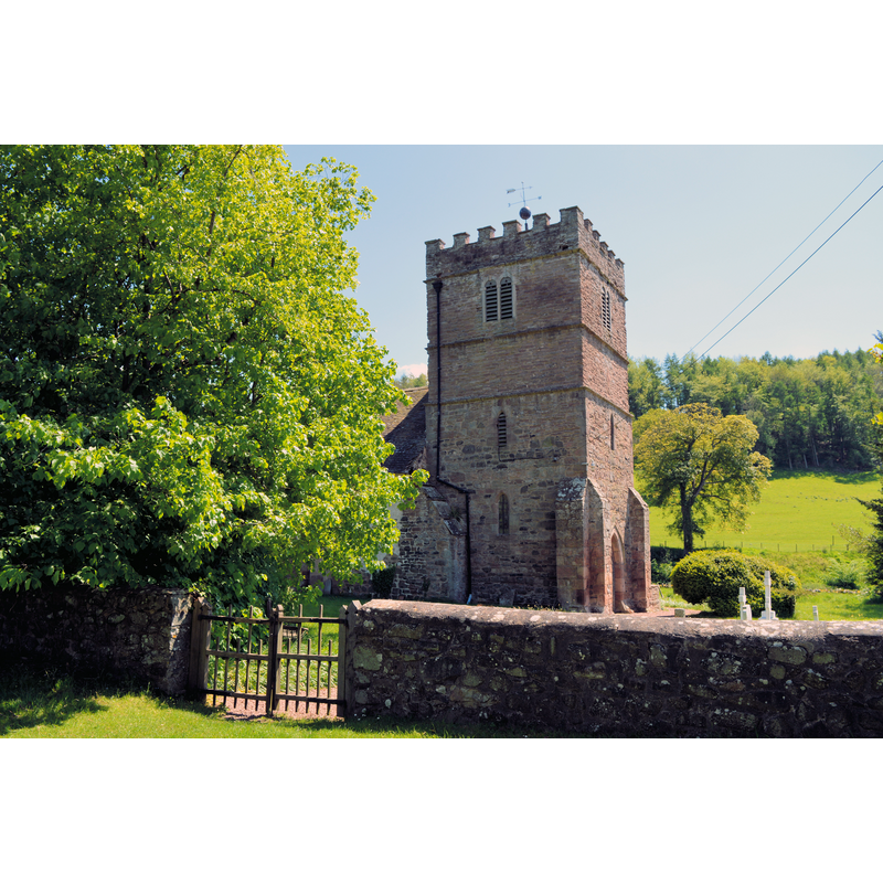
Copyright Statement: Image copyright © Philip Pankhurst, 2014
Image Source: digital photograph taken 17 May 2014 by Philip Pankhurst [www.geograph.org.uk/photo/3991275] [accessed 30 June 2015]
Copyright Instructions: CC-BY-SA-2.0
view of church exterior - southwest view
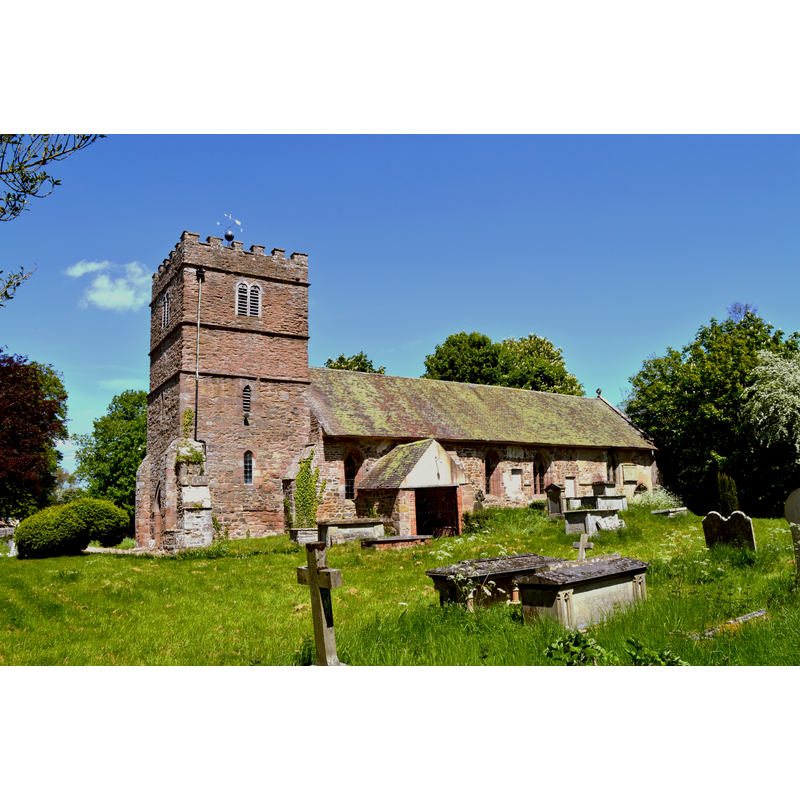
Copyright Statement: Image copyright © Philip Pankhurst, 2014
Image Source: digital photograph taken 17 May 2014 by Philip Pankhurst [www.geograph.org.uk/photo/3990176] [accessed 30 June 2015]
Copyright Instructions: CC-BY-SA-2.0
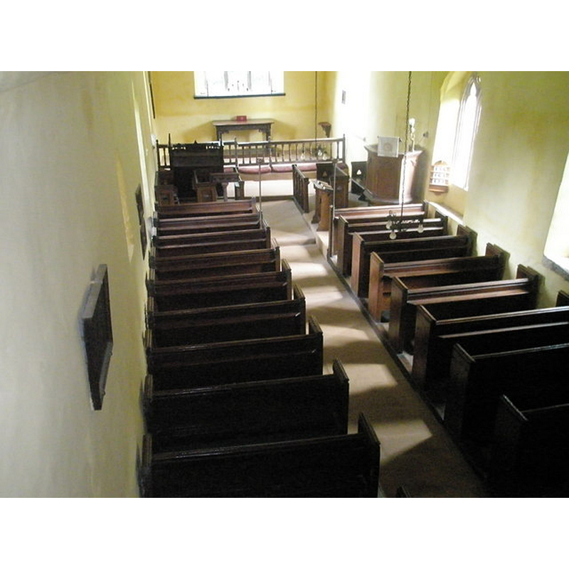
view of church interior - nave - looking west
Copyright Statement: Image copyright © Philip Pankhurst, 2014
Image Source: digital photograph taken 17 May 2014 by Philip Pankhurst [www.geograph.org.uk/photo/3990741] [accessed 30 June 2015]
Copyright Instructions: CC-BY-SA-2.0
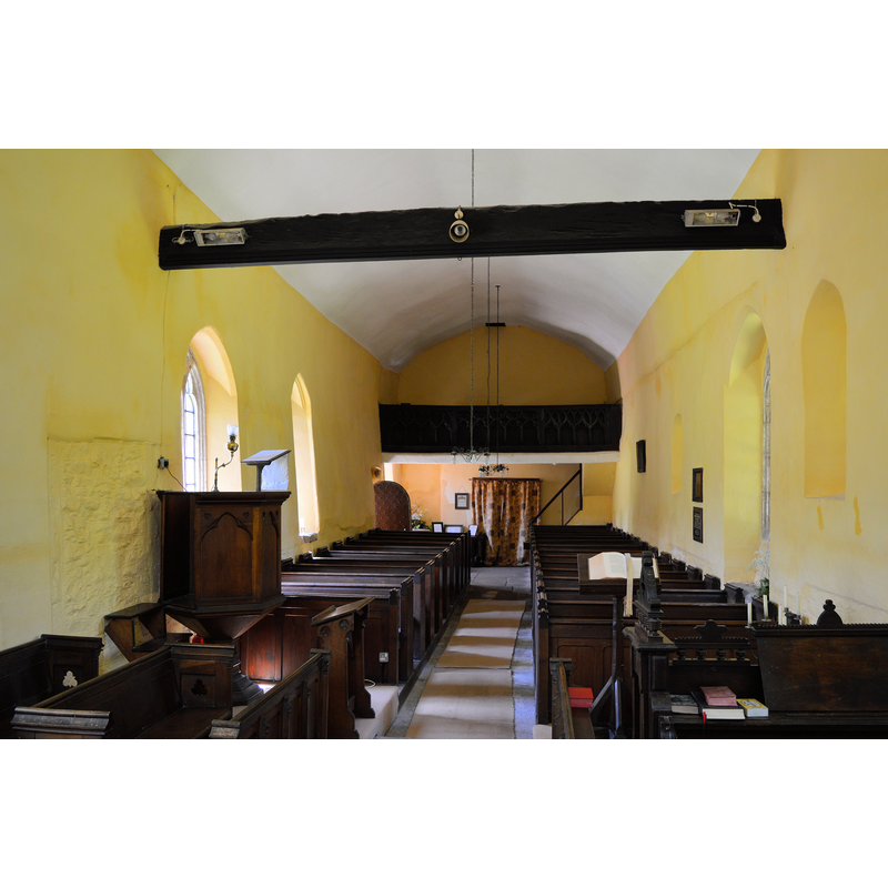
view of church interior - nave - looking east
Scene Description: Source caption: "Looking down from the balcony into St Catherine, Tugford"
Copyright Statement: Image copyright © Basher Eyre, 2009
Image Source: digital photograph taken 9 August 2009 by Basher Eyre [www.geograph.org.uk/photo/1447013] [accessed 30 June 2015]
Copyright Instructions: CC-BY-SA-2.0
design element - motifs - moulding
Copyright Statement: Image copyright © Basher Eyre, 2009
Image Source: digital photograph taken 9 August 2009 by Basher Eyre [www.geograph.org.uk/photo/1446995] [accessed 30 June 2015]
Copyright Instructions: CC-BY-SA-2.0
design element - motifs - roll moulding
Copyright Statement: Image copyright © Basher Eyre, 2009
Image Source: digital photograph taken 9 August 2009 by Basher Eyre [www.geograph.org.uk/photo/1446995] [accessed 30 June 2015]
Copyright Instructions: CC-BY-SA-2.0
INFORMATION
Font ID: 16470TUG
Object Type: Baptismal Font1
Font Date: ca. 1200?
Font Century and Period/Style: 12th - 13th century, Transitional / Early English
Church / Chapel Name: Parish Church of St. Catherine
Font Location in Church: Inside the church
Church Patron Saint(s): St. Catherine of Alexandria [aka Katherine, Katharine]
Church Address: Tugford nr. Abdon, Shropshire SY7 9HS
Site Location: Shropshire, West Midlands, England, United Kingdom
Directions to Site: Located 13 km NE of Ludlow
Ecclesiastic Region: Diocese of Hereford
Historical Region: Hundred of Patton [in Domesday] -- Hundred of Munslow
Additional Comments: disappeared font? (was here a church here in the 11thC?)
Font Notes:
Click to view
There is an entry for Tugford [variant spelling] in the Domesday survey [http://opendomesday.org/place/SO5587/tugford/] [accessed 30 June 2015], but it mentions neither cleric nor church in it. Anderson (1864) reports the "chapel of Tugaford [sic] is mentioned in 1138". The entry in English Heritage [Listing NGR: SO5571087060] (1954) notes: "Late C12 or C13 chalice font with 16-sided fluted panelled bowl set on a cable mould and a
cylindrical stem." The Victoria County History (Shropshire, vol. 10, 1998) notes: "About 1138 the bishop of Hereford ordered Tugford and Baucott chapels to be counted as one ('pro una capella computari')", and adds that part of the church may go back as far as the 11th century; the "chancel seems to have been wholly rebuilt, perhaps about 1200", and, perhaps, the font is "roughly contemporary with the chancel". Newman & Pevsner (2006) note: "Font. C13. Fourteen-sided, fluted circular bowl on a moulded stem."
cylindrical stem." The Victoria County History (Shropshire, vol. 10, 1998) notes: "About 1138 the bishop of Hereford ordered Tugford and Baucott chapels to be counted as one ('pro una capella computari')", and adds that part of the church may go back as far as the 11th century; the "chancel seems to have been wholly rebuilt, perhaps about 1200", and, perhaps, the font is "roughly contemporary with the chancel". Newman & Pevsner (2006) note: "Font. C13. Fourteen-sided, fluted circular bowl on a moulded stem."
COORDINATES
UTM: 30U 523489 5814435
Latitude & Longitude (Decimal): 52.479564, -2.654145
Latitude & Longitude (DMS): 52° 28′ 46.43″ N, 2° 39′ 14.92″ W
MEDIUM AND MEASUREMENTS
Material: stone
Font Shape: polygonal (14? / 16?) (mounted) -- chalice-shaped
Basin Interior Shape: round
Basin Exterior Shape: polygonal (14? / 16?)
LID INFORMATION
Date: modern
Material: wood
Apparatus: no
Notes: round and flat, with metal decoration and ring handle; modern
REFERENCES
- Victoria County History [online], University of London, 1993-. URL: https://www.british-history.ac.uk.
- Anderson, John Corbet, Shropshire, its early history and antiquities, comprising […], London: Willis and Sotheran, 1864, p. 259
- Newman, John, Shropshire, New Haven: Yale University Press, 2006, p. 666