Wellington nr. Shrewsbury / Walitone / Welinton
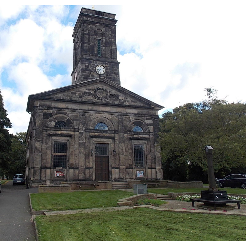
Image copyright © Jaggery, 2013
CC-BY-SA-2.0
Results: 1 records
view of church exterior - west view
Scene Description: Source caption: "West side of All Saints Church, Wellington. Viewed from the Church Street end. The Anglican church is in the diocese of Lichfield. The building was erected in 1789/1790 to replace the medieval church which had been damaged by both the Roundheads and Cavaliers in the Civil War, and had been in poor condition since at least 1747."
Copyright Statement: Image copyright © Jaggery, 2013
Image Source: digital photograph taken 10 October 2013 by Jaggery [www.geograph.org.uk/photo/3694859] [accessed 9 July 2015]
Copyright Instructions: CC-BY-SA-2.0
INFORMATION
Font ID: 16465WEL
Object Type: Baptismal Font1?
Font Century and Period/Style: 11th century, Norman
Church / Chapel Name: Parish Church of All Saints [the old church was demolished in 1787]
Church Patron Saint(s): All Saints
Church Address: Church Street, Wellington, Shropshire, TF1 3DW
Site Location: Shropshire, West Midlands, England, United Kingdom
Directions to Site: Located off (S) the A5223, 17 km E of Shrewsbury
Ecclesiastic Region: Diocese of Lichfiel
Historical Region: Hundred of Wrockwardine [in Domesday] -- Hundred of Bradford
Additional Comments: disappeared font? (the one from the likely Domesday-time church here)
Font Notes:
Click to view
There is an entry for this Wellington [variant spelling] in the Domesday survey [http://opendomesday.org/place/SJ6511/wellington/] [accessed 9 July 2015]; it mentions a priest but not a church in it, though there probably was one there. Anderson (1864) writes: "As we glean from the Domesday report of the manor, this church was existent in 1086". The Victoria County History (Shropshire, vol. 11, 1985) notes: "There was a priest at Wellington by 1086 [...] and Roger of Montgomery, earl of Shrewsbury (d. 1094), gave the church there to Shrewsbury abbey [...] The ancient parish church of ALL SAINTS [...] was demolished in 1787 [...] At least one window dated from the 12th century." The major rebuilding of the late-18th century and "unfortunate alterations of 1898 by C.R. Dalgleish" are reported in Newman & Pevsner (2006), who note that the present immersion font dates actually from 1980. [NB: we have no information on the early font of this church]
COORDINATES
UTM: 30U 532565 5839212
Latitude & Longitude (Decimal): 52.701839, -2.51806
Latitude & Longitude (DMS): 52° 42′ 6.62″ N, 2° 31′ 5.02″ W
REFERENCES
- Victoria County History [online], University of London, 1993-. URL: https://www.british-history.ac.uk.
- Anderson, John Corbet, Shropshire, its early history and antiquities, comprising […], London: Willis and Sotheran, 1864, p. 119
- Newman, John, Shropshire, New Haven: Yale University Press, 2006, p. 653