Rushbury / Riseberie / Rusburye / Ryssebury
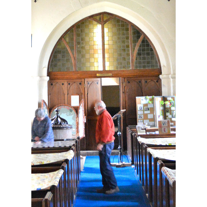
Image copyright © Philip Pankhurst, 2015
CC-BY-SA-2.0
Results: 6 records
view of font and cover
Copyright Statement: Image copyright © Philip Pankhurst, 2015
Image Source: detail of a digital photograph taken 17 April 2015 by Philip Pankhurst [www.geograph.org.uk/photo/4448208] [accessed 24 June 2015]
Copyright Instructions: CC-BY-SA-2.0
view of church exterior - northeast view
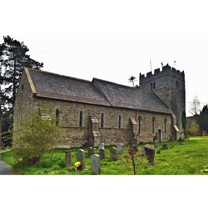
Copyright Statement: Image copyright © Philip Pankhurst, 2015
Image Source: digital photograph taken 17 April 2015 by Philip Pankhurst [www.geograph.org.uk/photo/4447935] [accessed 24 June 2015]
Copyright Instructions: CC-BY-SA-2.0
view of church exterior - southeast view
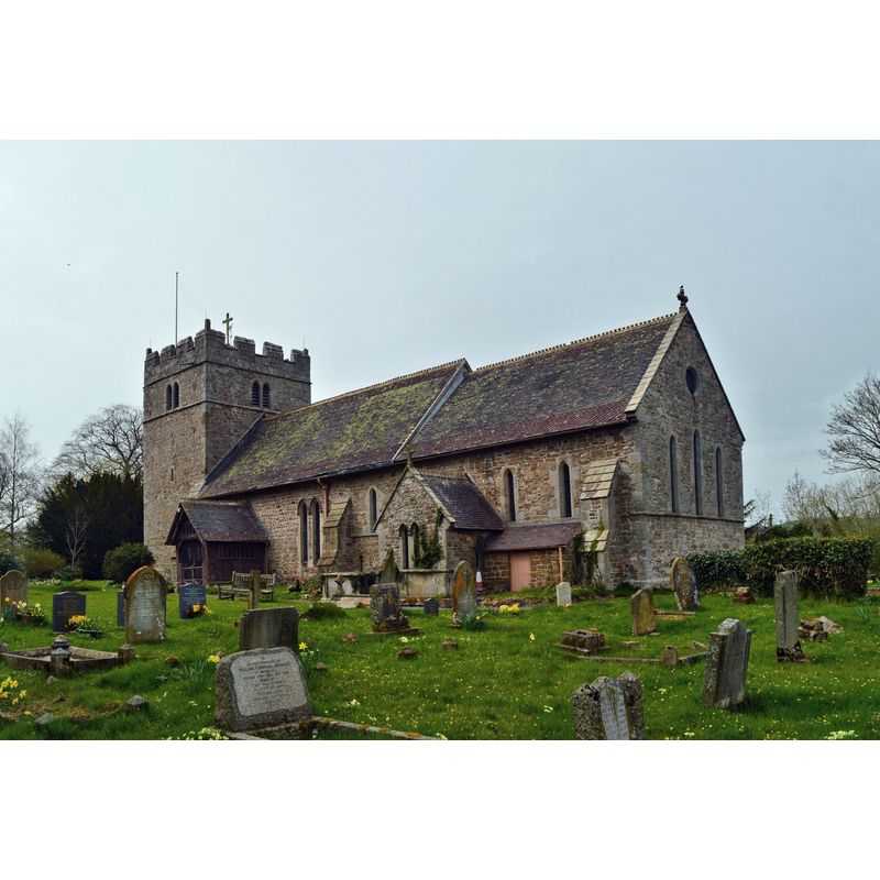
Copyright Statement: Image copyright © Philip Pankhurst, 2015
Image Source: digital photograph taken 17 April 2015 by Philip Pankhurst [www.geograph.org.uk/photo/4446907] [accessed 24 June 2015]
Copyright Instructions: CC-BY-SA-2.0
view of font and cover in context
Scene Description: partially visible here, at the west end of the nave, south side
Copyright Statement: Image copyright © Philip Pankhurst, 2015
Image Source: detail of a digital photograph taken 17 April 2015 by Philip Pankhurst [www.geograph.org.uk/photo/4448208] [accessed 24 June 2015]
Copyright Instructions: CC-BY-SA-2.0
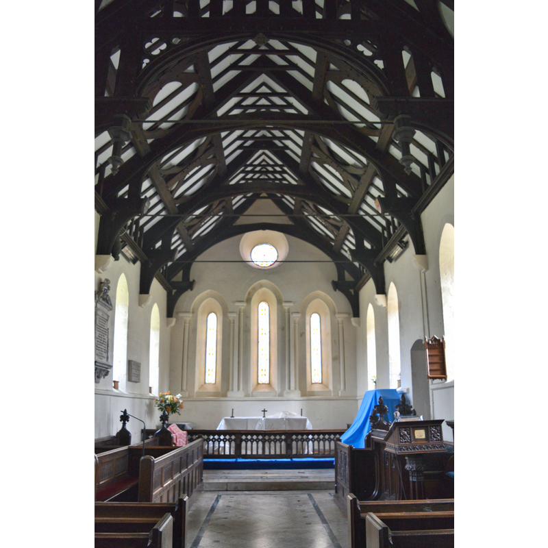
view of church interior - nave - looking west
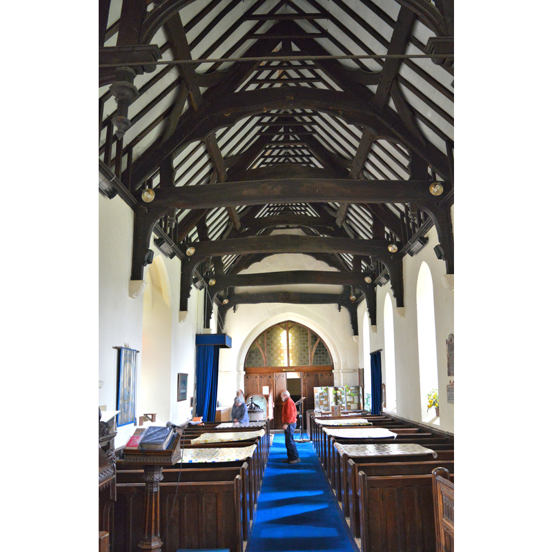
Copyright Statement: Image copyright © Philip Pankhurst, 2015
Image Source: digital photograph taken 17 April 2015 by Philip Pankhurst [www.geograph.org.uk/photo/4448208] [accessed 24 June 2015]
Copyright Instructions: CC-BY-SA-2.0
view of church interior - chancel
Copyright Statement: Image copyright © Philip Pankhurst, 2015
Image Source: digital photograph taken 17 April 2015 by Philip Pankhurst [www.geograph.org.uk/photo/4448284] [accessed 24 June 2015]
Copyright Instructions: CC-BY-SA-2.0
INFORMATION
Font ID: 16417RUS
Object Type: Baptismal Font1
Font Century and Period/Style: 11th - 12th century [basin only], Medieval / composite
Church / Chapel Name: Parish Church of St. Peter
Font Location in Church: Inside the church, at the W end of the nave, S side
Church Patron Saint(s): St. Peter
Church Address: 10 Rushbury Road, Rushbury, Shropshire SY6 7EB
Site Location: Shropshire, West Midlands, England, United Kingdom
Directions to Site: Located 7 km E of Church Stretton, 13 km SW of Much Wenlock
Ecclesiastic Region: Diocese of Hereford
Historical Region: Hundred of Patton [in Domesday] - Hundred of Munslow
Additional Comments: altered font? (the present font has a modern lower base and plinth) -- disappeared font? (was there a pre-Conquest church here, as suggested by the VCH entry? [cf. FontNotes])
Font Notes:
Click to view
There is an entry for Rushbury [variant spelling] in the Domesday survey [http://opendomesday.org/place/SO5191/rushbury/] [accessed 24 June 2015], but it mentions neither cleric nor church in it. The Victoria County History (Shropshire, vol. 10, 1998) however, notes: "The church contains apparently Saxon fabric (fn. 469) and before the Conquest it may have served an area larger than the later, medieval, parish. [...] The oldest fabric, herring-bone work, possibly Saxon, occurs in the lowest courses of the western ends of the north and south nave walls. Inserted through that fabric in the north wall is a tall narrow doorway, probably 12thcentury, with a plain tympanum. About 1200 a new chancel, as long as the nave, was added and a tower of almost the same width; a south doorway was inserted. [...] The tub font is Norman, its elaborate cover 19th-century." Newman & Pevsner (2006) note: "A plain Norman tub on a C20 base."
COORDINATES
UTM: 30U 519133 5819135
Latitude & Longitude (Decimal): 52.521986, -2.718003
Latitude & Longitude (DMS): 52° 31′ 19.15″ N, 2° 43′ 4.81″ W
MEDIUM AND MEASUREMENTS
Material: stone
Font Shape: tub-shaped
Basin Interior Shape: round
Basin Exterior Shape: round
LID INFORMATION
Date: 19th-century?
Material: wood, oak?
Apparatus: no
Notes: [cf. FontNotes]
REFERENCES
- Victoria County History [online], University of London, 1993-. URL: https://www.british-history.ac.uk.