Thornton nr. Thornton Curtis / Thornton Abbey / Torentone / Torentune
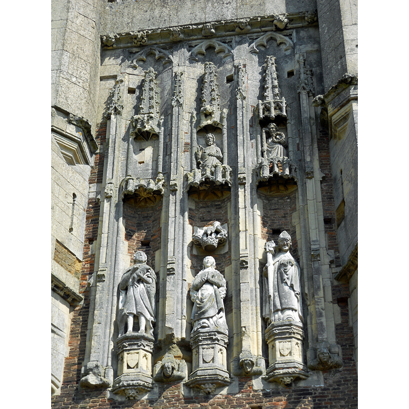
Image copyright © David Wright, 2010
CC-BY-SA-2.0
Results: 6 records
view of context - detail
Scene Description: part of the impressive façade of the gatehouse of Thornton Abbey
Copyright Statement: Image copyright © David Wright, 2010
Image Source: digital photograph taken 4 June 2010 by David Wright [www.geograph.org.uk/photo/1896669] [accessed 30 April 2019]
Copyright Instructions: CC-BY-SA-2.0
view of context - detail
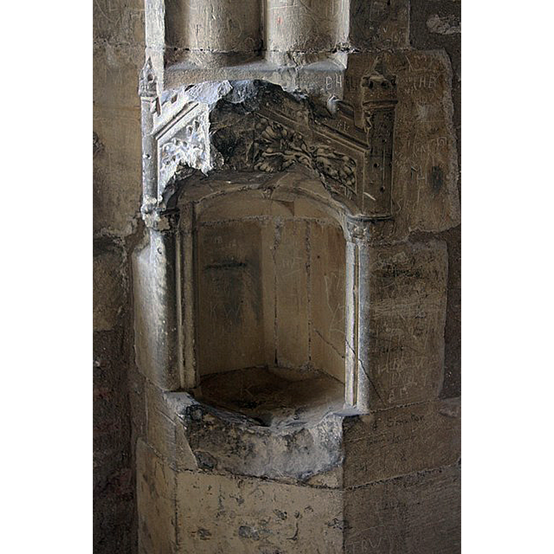
Scene Description: Source caption: "Decorated piscina in the oriel window of the great hall of Thornton Abbey gatehouse".
Copyright Statement: Image copyright © Richard Croft, 2009
Image Source: digital photograph taken 10 April 2009 by Richard Croft [www.geograph.org.uk/photo/1246420] [accessed 30 April 2019]
Copyright Instructions: CC-BY-SA-2.0
view of context - detail
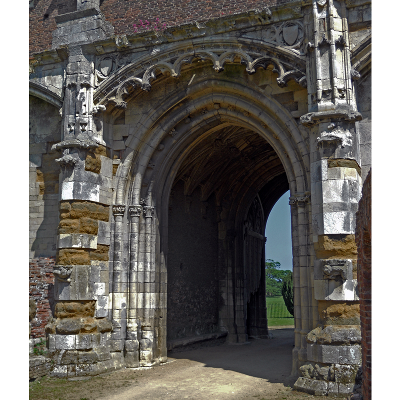
Scene Description: Source caption: "Gateway at Thornton Abbey".
Copyright Statement: Image copyright © David Wright, 2010
Image Source: digital photograph taken 4 June 2010 by David Wright [www.geograph.org.uk/photo/1896690] [accessed 30 April 2019]
Copyright Instructions: CC-BY-SA-2.0
view of context - detail
!["Thornton Abbey's enormous and ornate fortified gatehouse is the largest and amongst the finest in England" [www.english-heritage.org.uk/visit/places/thornton-abbey-and-gatehouse/] [accessed 30 April 2019]](/static-50478a99ec6f36a15d6234548c59f63da52304e5/compressed/1190430005_compressed.png)
Scene Description: "Thornton Abbey's enormous and ornate fortified gatehouse is the largest and amongst the finest in England" [www.english-heritage.org.uk/visit/places/thornton-abbey-and-gatehouse/] [accessed 30 April 2019]
Copyright Statement: Image copyright © David Wright, 2005
Image Source: digital photograph taken 27 June 2005 by David Wright [www.geograph.org.uk/photo/39782] [accessed 30 April 2019]
Copyright Instructions: CC-BY-SA-2.0
view of context - detail
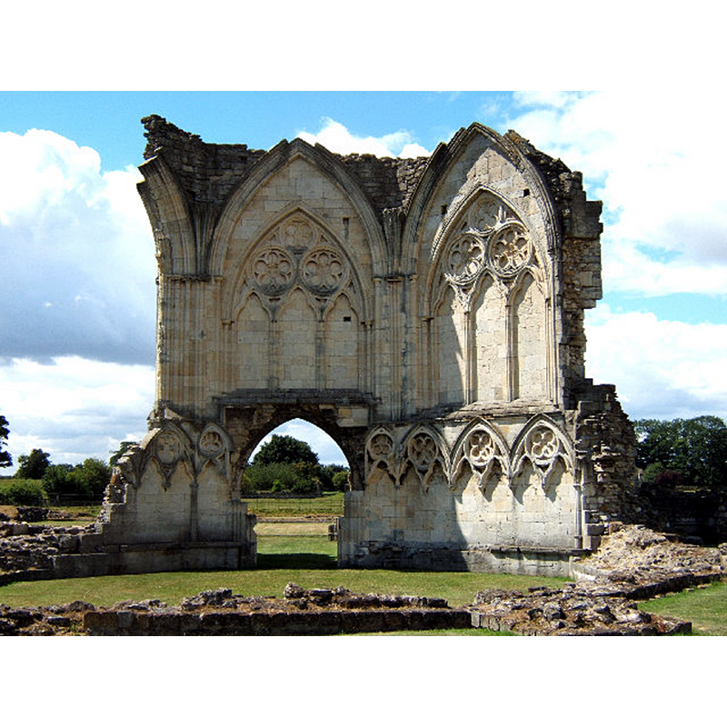
Scene Description: ruins of the semi-demolished abbey
Copyright Statement: Image copyright © David Wright, 2006
Image Source: digital photograph taken 27 June 2005 by David Wright [www.geograph.org.uk/photo/43670] [accessed 30 April 2019]
Copyright Instructions: CC-BY-SA-2.0
view of church exterior
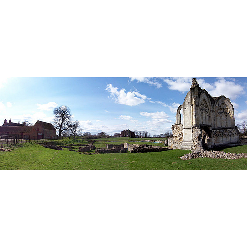
Scene Description: Source caption: "Thornton Abbey. Abbot's Lodge farmhouse on the left, gatehouse in centre and Abbey ruins to the right."
Copyright Statement: Image copyright © David Wright, 2006
Image Source: digital photograph taken 5 April 2006 by David Wright [www.geograph.org.uk/photo/147201] [accessed 30 April 2019]
Copyright Instructions: CC-BY-SA-2.0
INFORMATION
Font ID: 16416THO
Object Type: Baptismal Font1?
Church / Chapel Name: Thornton Abbey Church
Church Address: Thornton Abbey, Ulceby DN39 6TU, UK
Site Location: Lincolnshire, East Midlands, England, United Kingdom
Directions to Site: The abbey grounds are located within the U shape of College Rd at the Halton East Beck, about half-way between Thornton Curtis (WSW) and East Halton (ENE)
Ecclesiastic Region: [Diocese of Lincoln]
Font Notes:
Click to view
There are two entries for Thornton [Curtis] [variant spellings] in the Domesday survey [https://opendomesday.org/place/TA0817/thornton-curtis/] [accessed 30 April 2019] neither of which mentions cleric or church in it. [NB: we have no information on the font of the abbey founded in 1148 by the Augustinians].
COORDINATES
UTM: 30U 677777 5948501
Latitude & Longitude (Decimal): 53.655, -0.3098
Latitude & Longitude (DMS): 53° 39′ 18″ N, 0° 18′ 35.28″ W
REFERENCES
- Victoria County History [online], University of London, 1993-. URL: https://www.british-history.ac.uk.
- Hasted, Edward, The History and topographical survey of the County of Kent [...], Canterbury: Printed for the author, by Simmons and Kirkby, 1778-, p. 2-22
- Hussey, Arthur, Notes on the churches in the counties of Kent, Sussex, and Surrey mentioned in Domesday Book and those of more recent date [...], London: John Russell Smith, 1852, [no. 72]