LeeBotwood / Botewde [Domesday] / Bottewede / Bottewode / Lee Botwood
![Main image for LeeBotwood / Botewde [Domesday] / Bottewede / Bottewode / Lee Botwood](/static-50478a99ec6f36a15d6234548c59f63da52304e5/compressed/1171121005_compressed.png)
Image copyright © Alan Murray-Rust, 2016
CC-BY-SA-2.0
Results: 6 records
view of font and cover
Scene Description: the modern font
Copyright Statement: Image copyright © Alan Murray-Rust, 2016
Image Source: digital photograph taken 25 April 2016 by Alan Murray-Rust [www.geograph.org.uk/photo/4927182] [accessed 21 November 2017]
Copyright Instructions: CC-BY-SA-2.0
view of church exterior in context - northeast view
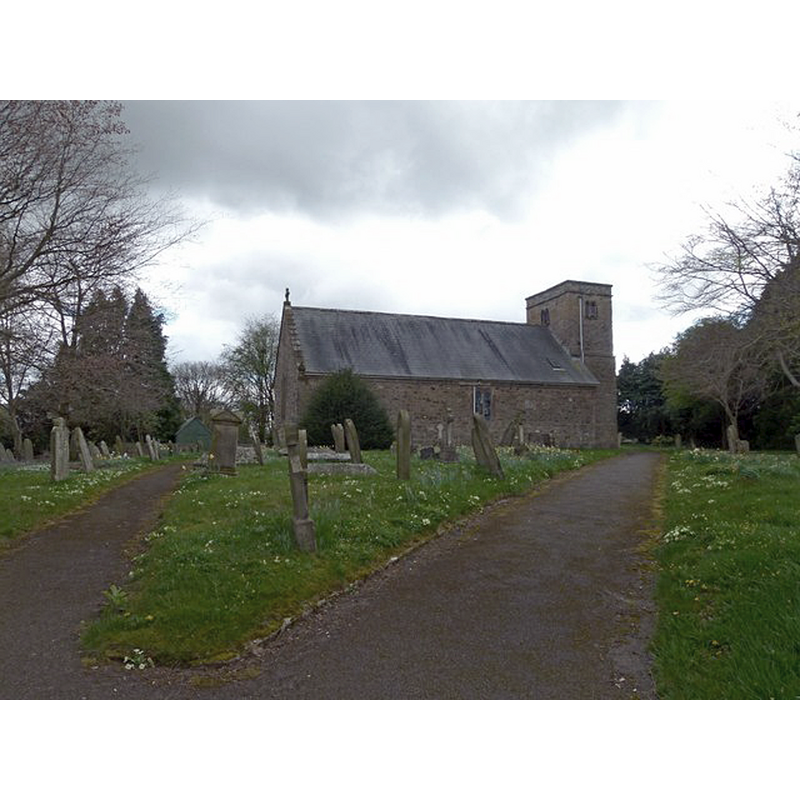
Copyright Statement: Image copyright © Alan Murray-Rust, 2016
Image Source: digital photograph taken 25 April 2016 by Alan Murray-Rust [www.geograph.org.uk/photo/4927149] [accessed 21 November 2017]
Copyright Instructions: CC-BY-SA-2.0
view of church exterior - southwest view
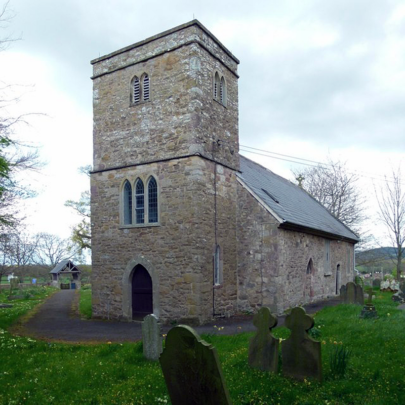
Scene Description: Source caption: "The tower was added in 1829, and is rectangular in plan rather than square."
Copyright Statement: Image copyright © Alan Murray-Rust, 2016
Image Source: digital photograph taken 25 April 2016 by Alan Murray-Rust [www.geograph.org.uk/photo/4927159] [accessed 21 November 2017]
Copyright Instructions: CC-BY-SA-2.0
view of church interior - nave - looking west
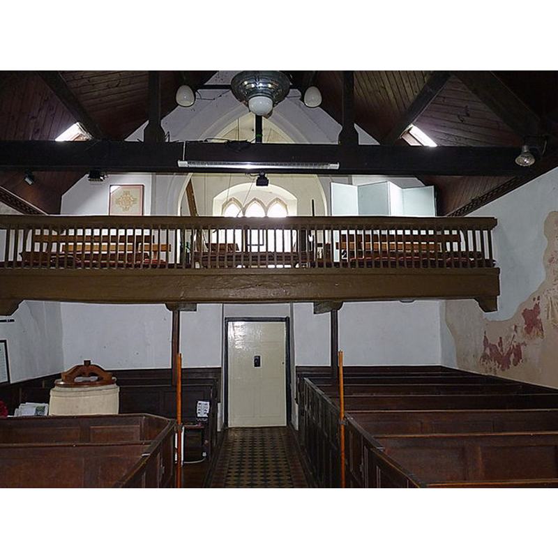
Scene Description: with the modern font partially visible beneath the west gallery
Copyright Statement: Image copyright © Richard Law, 2014
Image Source: digital photograph taken 3 May 2014 by Richard Law [www.geograph.org.uk/photo/3967170] [accessed 21 November 2017]
Copyright Instructions: CC-BY-SA-2.0
view of church interior - nave - looking east
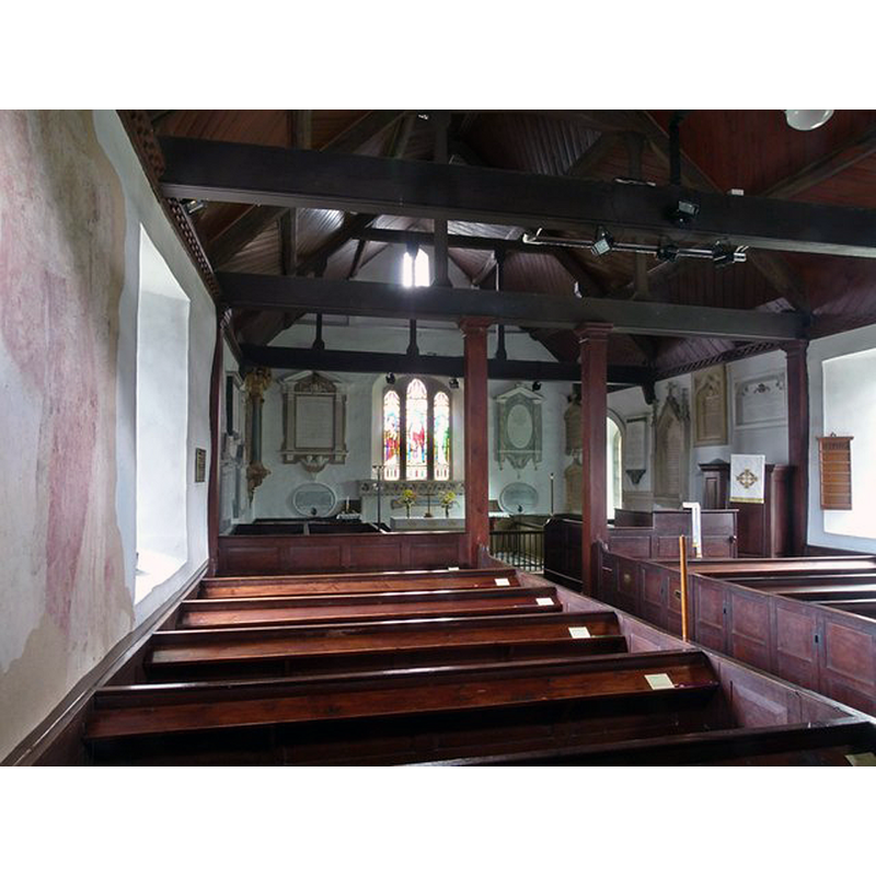
Scene Description: Source caption: "Church of St Mary, Leebotwood. Interior looking east. Medieval wall painting on the left, box pews of 1778 and monuments visible in the chancel. 18th century chancel screen."
Copyright Statement: Image copyright © Alan Murray-Rust, 2016
Image Source: digital photograph taken 25 April 2016 by Alan Murray-Rust [www.geograph.org.uk/photo/4927174] [accessed 21 November 2017]
Copyright Instructions: CC-BY-SA-2.0
view of church interior - north wall - painting
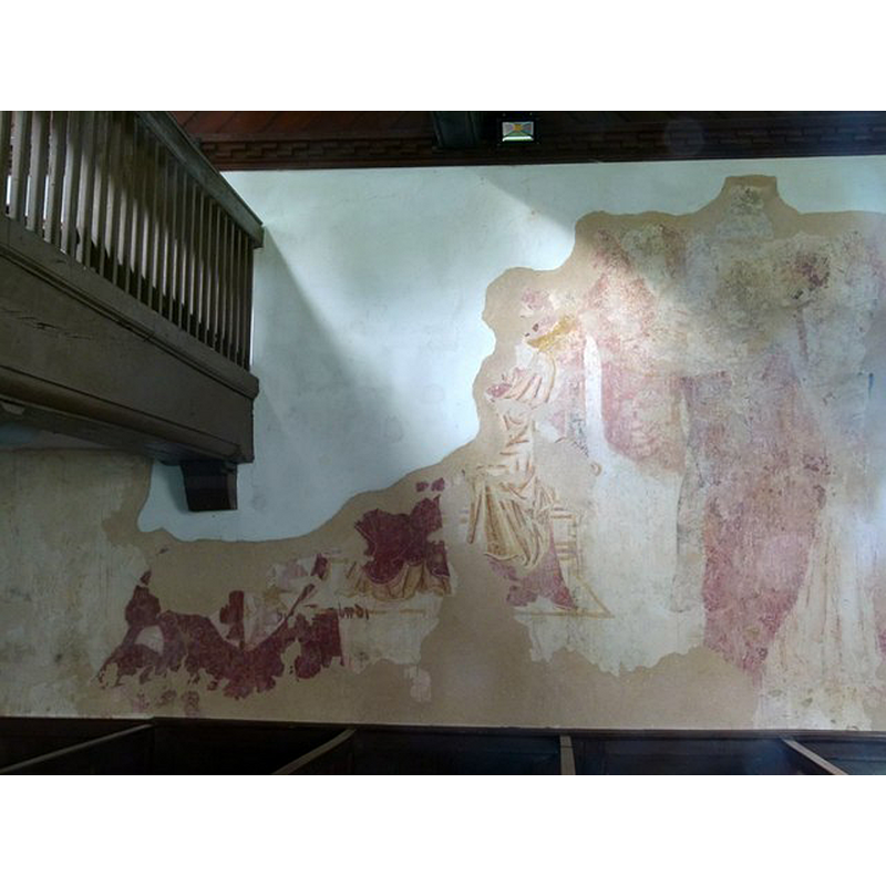
Scene Description: Source caption: "Church of St Mary, Leebotwood. The 13th century wall painting. Although damaged (understandably), the robes of the seated Virgin Mary are very clear in the centre of the image."
Copyright Statement: Image copyright © Alan Murray-Rust, 2016
Image Source: digital photograph taken 25 April 2016 by Alan Murray-Rust [www.geograph.org.uk/photo/4927181] [accessed 21 November 2017]
Copyright Instructions: CC-BY-SA-2.0
INFORMATION
Font ID: 16358LEE
Object Type: Baptismal Font1?
Font Century and Period/Style: 12th century, Late Norman
Church / Chapel Name: Parish Church of St. Mary
Church Patron Saint(s): St. Mary the Virgin
Church Notes: church originally 12thC; present church 13thC with 19thC re-building which included the tower
Church Address: Station Road, Leebotwood, Shropshire, SY6 6NE, UK
Site Location: Shropshire, West Midlands, England, United Kingdom
Directions to Site: Located off (W) the A49, 6 km N of Church Stretton, 15 km SSW of Shrewsbury
Ecclesiastic Region: Diocese of Hereford [earlier in the Diocese of Lichfield and Coventry]
Historical Region: Hundred of Condover
Additional Comments: disappeared font? (the one from the 12thC church here)
Font Notes:
Click to view
There is an entry for Leebotwood [variant spelling] in the Domesday survey [http://opendomesday.org/place/SO4798/leebotwood/] [accessed 21 November 2017], but it mentions neither priest nor church in it. The present font is modern, 19th-century. [NB: we have no information on the font of the original 12th-century church here].
COORDINATES
UTM: 30U 514710 5825874
Latitude & Longitude (Decimal): 52.582707, -2.782901
Latitude & Longitude (DMS): 52° 34′ 57.74″ N, 2° 46′ 58.45″ W