Hughley / Hughlye / Huley / Lega / Lee
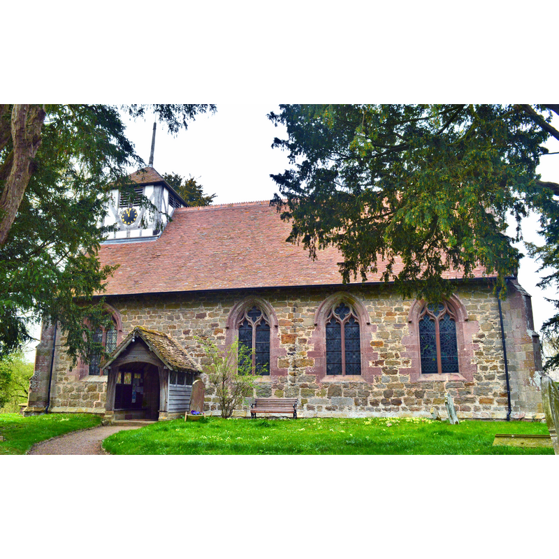
Image copyright © Philip Pankhurst, 2015
CC-BY-SA-2.0
Results: 2 records
view of church exterior - south view
Copyright Statement: Image copyright © Philip Pankhurst, 2015
Image Source: digital photograph taken 17 April 2015 by Philip Pankhurst [www.geograph.org.uk/photo/4448391] [accessed 7 July 2015]
Copyright Instructions: CC-BY-SA-2.0
view of church interior - nave - looking east

Scene Description: Source caption: "St John the Baptist, Hughley. The interior, showing the very fine screen - the best in Shropshire. It dates from around 1500 and is from the same workshop as that at Aymestrey in North Herefordshire."
Copyright Statement: Image copyright © Philip Pankhurst, 2015
Image Source: digital photograph taken 17 April 2015 by Philip Pankhurst [www.geograph.org.uk/photo/4449845] [accessed 7 July 2015]
Copyright Instructions: CC-BY-SA-2.0
INFORMATION
Font ID: 16349HUG
Object Type: Baptismal Font1?
Font Century and Period/Style: 12th century, Late Norman
Church / Chapel Name: Parish Church of St. John the Baptist
Font Location in Church: [cf. FontNotes]
Church Patron Saint(s): St. John the Baptist
Church Address: Hughley, Shropshire SY5 6NT
Site Location: Shropshire, West Midlands, England, United Kingdom
Directions to Site: Located 6 km WSW of Much Wenlock
Ecclesiastic Region: Diocese of Hereford
Historical Region: Hundred of Munslow, Liberty and Borough of Wenlock
Additional Comments: disappeared font? (the one from the 12thC chapel/church here)
Font Notes:
Click to view
No entry for Hughley found in the Domesday survey, but Thomas (2003) notes: "Two holdings, Bourton, and possibly Hughley, were held of Much Wenlock Priory by Edric son of Aliuric in 1086". Anderson (1864) reports a chapel with a chaplain here ca. 1170, "an affiliation of the church of Wenlock". The Victoria County History (Shropshire, vol. 10, 1998) notes: "The octagonal font looks 18th-century but apparently replaced an 'ancient circular' one, the 'clumsy workmanship of the village artist', that was in the church c. 1830". The entry for this church in English Heritage [Listing NGR: SO5648497932] (1958) reports a " late C19 octagonal stone font" in it. [NB: we have no information on the original font of the 12th-century chapel].
COORDINATES
UTM: 30U 524137 5825365
Latitude & Longitude (Decimal): 52.577792, -2.643801
Latitude & Longitude (DMS): 52° 34′ 40.05″ N, 2° 38′ 37.69″ W
MEDIUM AND MEASUREMENTS
Material: stone
Font Shape: round
Basin Interior Shape: round
Basin Exterior Shape: round
REFERENCES
- Victoria County History [online], University of London, 1993-. URL: https://www.british-history.ac.uk.
- Anderson, John Corbet, Shropshire, its early history and antiquities, comprising […], London: Willis and Sotheran, 1864, p. 234
- Thomas, Hugh M., The English and the Normans: ethnic hostility, assimilation, and identity 1066-c.1220, Oxford: Oxford University Press, 2003, p. [396] fn6