Eaton-under-Heywood / Eton-under-Heywood
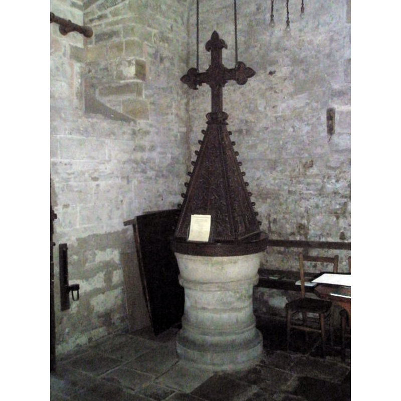
Image copyright © Basher Eyre, 2009
CC-BY-SA-2.0
Results: 7 records
view of font and cover
Copyright Statement: Image copyright © Basher Eyre, 2009
Image Source: digital photograph taken 9 August 2009 by Basher Eyre [www.geograph.org.uk/photo/1446300] [accessed 7 July 2015]
Copyright Instructions: CC-BY-SA-2.0
view of font and cover
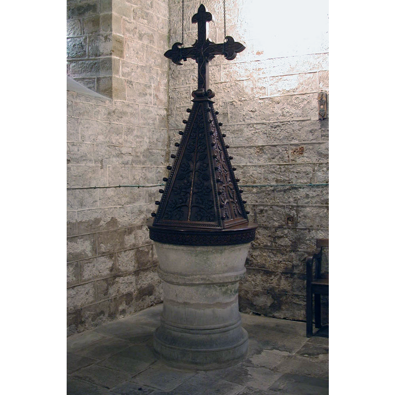
Copyright Statement: Image copyright © John Salmon, 2000
Image Source: digital photograph taken 6 September 2000 by John Salmon [www.geograph.org.uk/photo/2246221] [accessed 7 July 2015]
Copyright Instructions: CC-BY-SA-2.0
design element - motifs - flat moulding
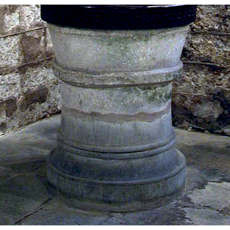
Copyright Statement: Image copyright © John Salmon, 2000
Image Source: detail of a digital photograph taken 6 September 2000 by John Salmon [www.geograph.org.uk/photo/2246221] [accessed 7 July 2015]
Copyright Instructions: CC-BY-SA-2.0
view of church exterior - east view
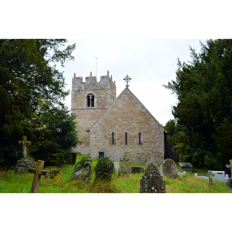
Scene Description: Source caption: "St Edith, Eaton under Heywood. The East end, showing early origins."
Copyright Statement: Image copyright © Philip Pankhurst, 2014
Image Source: digital photograph taken 23 August 2014 by Philip Pankhurst [www.geograph.org.uk/photo/4155578] [accessed 7 July 2015]
Copyright Instructions: CC-BY-SA-2.0
view of church exterior - south view
![EXT S digital photograph taken 29 October 2011 by Richard Law [www.geograph.org.uk/photo/2674462] [accessed 7 July 2015]
EXT E digital photograph taken 23 August 2014 by Philip Pankhurst [www.geograph.org.uk/photo/4155578] [accessed 7 July 2015] Source caption: "St Edith, Eaton under Heywood. The East end, showing early origins."
INT E digital photograph taken 23 August 2014 by Philip Pankhurst [www.geograph.org.uk/photo/4158608] [accessed 7 July 2015]
FONT digital photograph taken 6 September 2000 by John Salmon [www.geograph.org.uk/photo/2246221] [accessed 7 July 2015]
FONT digital photograph taken 9 August 2009 by Basher Eyre [www.geograph.org.uk/photo/1446300] [accessed 7 July 2015]](/static-50478a99ec6f36a15d6234548c59f63da52304e5/compressed/1150830038_compressed.png)
Scene Description: EXT S digital photograph taken 29 October 2011 by Richard Law [www.geograph.org.uk/photo/2674462] [accessed 7 July 2015]
EXT E digital photograph taken 23 August 2014 by Philip Pankhurst [www.geograph.org.uk/photo/4155578] [accessed 7 July 2015] Source caption: "St Edith, Eaton under Heywood. The East end, showing early origins."
INT E digital photograph taken 23 August 2014 by Philip Pankhurst [www.geograph.org.uk/photo/4158608] [accessed 7 July 2015]
FONT digital photograph taken 6 September 2000 by John Salmon [www.geograph.org.uk/photo/2246221] [accessed 7 July 2015]
FONT digital photograph taken 9 August 2009 by Basher Eyre [www.geograph.org.uk/photo/1446300] [accessed 7 July 2015]
Copyright Statement: Image copyright © Richard Law, 2011
Image Source: digital photograph taken 29 October 2011 by Richard Law [www.geograph.org.uk/photo/2674462] [accessed 7 July 2015]
Copyright Instructions: CC-BY-SA-2.0
view of church interior - nave - looking east
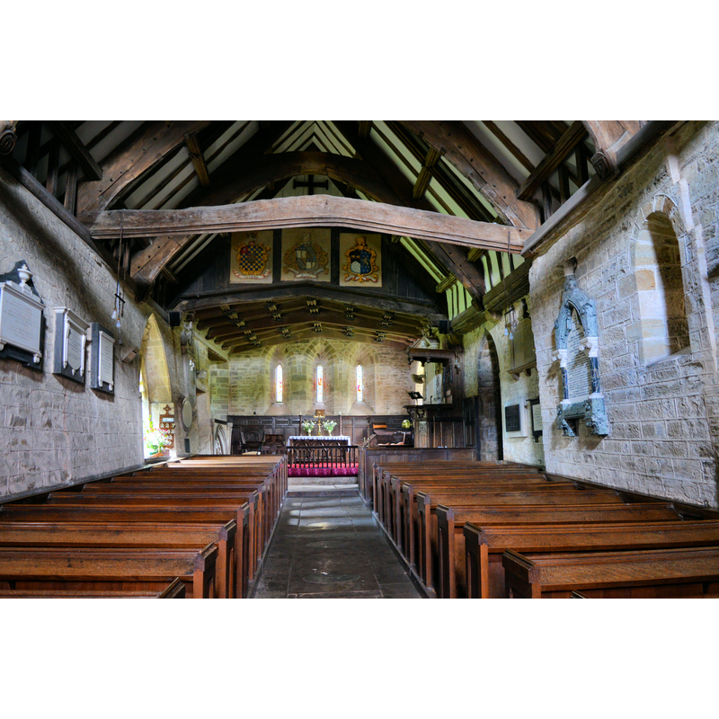
Copyright Statement: Image copyright © Philip Pankhurst, 2014
Image Source: digital photograph taken 23 August 2014 by Philip Pankhurst [www.geograph.org.uk/photo/4158608] [accessed 7 July 2015]
Copyright Instructions: CC-BY-SA-2.0
view of font cover
![described in Newman & Pevsner as "large, coarse cover of 1872" [cf. FontNotes]](/static-50478a99ec6f36a15d6234548c59f63da52304e5/compressed/1150830044_compressed.png)
Scene Description: described in Newman & Pevsner as "large, coarse cover of 1872" [cf. FontNotes]
Copyright Statement: Image copyright © John Salmon, 2000
Image Source: detail of a digital photograph taken 6 September 2000 by John Salmon [www.geograph.org.uk/photo/2246221] [accessed 7 July 2015]
Copyright Instructions: CC-BY-SA-2.0
INFORMATION
Font ID: 16307EAT
Object Type: Baptismal Font1
Font Century and Period/Style: 12th century, Late Norman
Church / Chapel Name: Parish Church of St. Edith
Font Location in Church: Inside the church, at the W end
Church Patron Saint(s): St. Edith
Church Address: Eaton-under-Heywood, Shropshire, SY6 7DH
Site Location: Shropshire, West Midlands, England, United Kingdom
Directions to Site: Located 4 km SE of Church Stretton. This church is part of the Hope Bowdler Benefice.
Ecclesiastic Region: Diocese of Hereford
Additional Comments: altered font? (is the lower half original or a later replacement?)
Font Notes:
Click to view
No entry found for Eaton-under-Heywood in the Domesday survey. The Victoria County History (Shropshire, vol. 10, 1998) notes: "The confirmation of parochial rights over Upper Millichope to Wenlock priory c. 1115 may be related to the earliest evidence of a church at Eaton, its Norman fabric […] A small nave, forming the western part of the present church, was probably built in the 12th century. The present long chancel was built c. 1200 […] fittings include a tub font probably Norman (cover c. 1872)." Much in the same terms in Newman & Pevsner (2006): "Norman tub, with a large, coarse cover of 1872." [NB: is the lower half of the font a later replacement?]
COORDINATES
UTM: 30U 517763 5817318
Latitude & Longitude (Decimal): 52.5057, -2.7383
Latitude & Longitude (DMS): 52° 30′ 20.52″ N, 2° 44′ 17.88″ W
MEDIUM AND MEASUREMENTS
Material: stone
Font Shape: tub-shaped, mounted
Basin Interior Shape: round
Basin Exterior Shape: round
LID INFORMATION
Date: 1872
Material: wood
Notes: [cf. FontNotes]
REFERENCES
- Victoria County History [online], University of London, 1993-. URL: https://www.british-history.ac.uk.
- Newman, John, Shropshire, New Haven: Yale University Press, 2006, p. 257