Slingsby / Eslingesbi / Lengeby / Lenggesby / Lengheby / Sclingasbi / Selingesbi / Selungesbi / Slengesbi / Slingbi / Slingebi / Slyngesbi
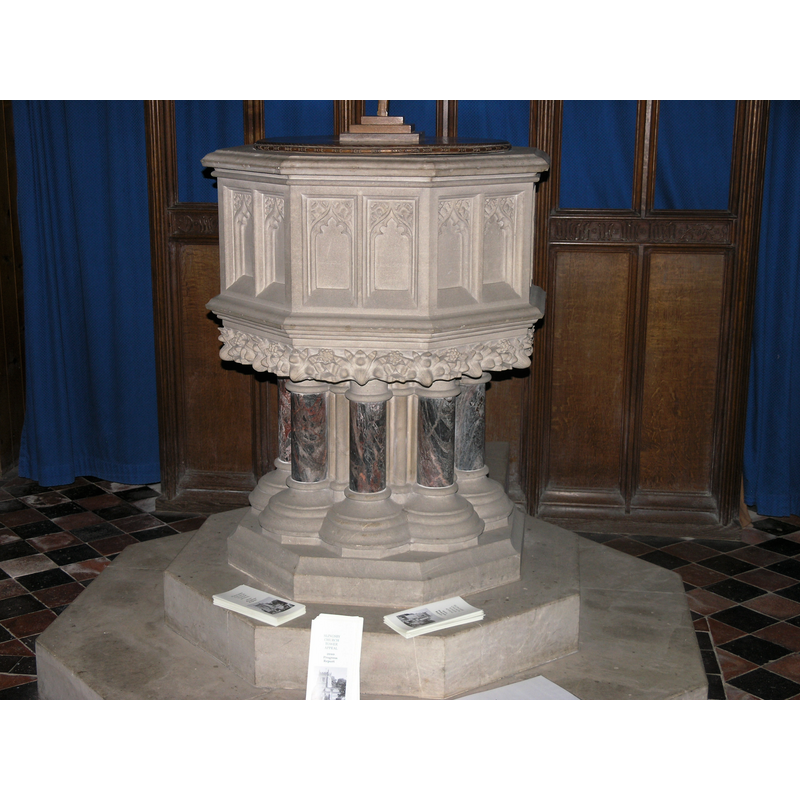
Image copyright © Colin Hinson, 2011
Image and permission received (e-mail of 13 October 2011)
Results: 4 records
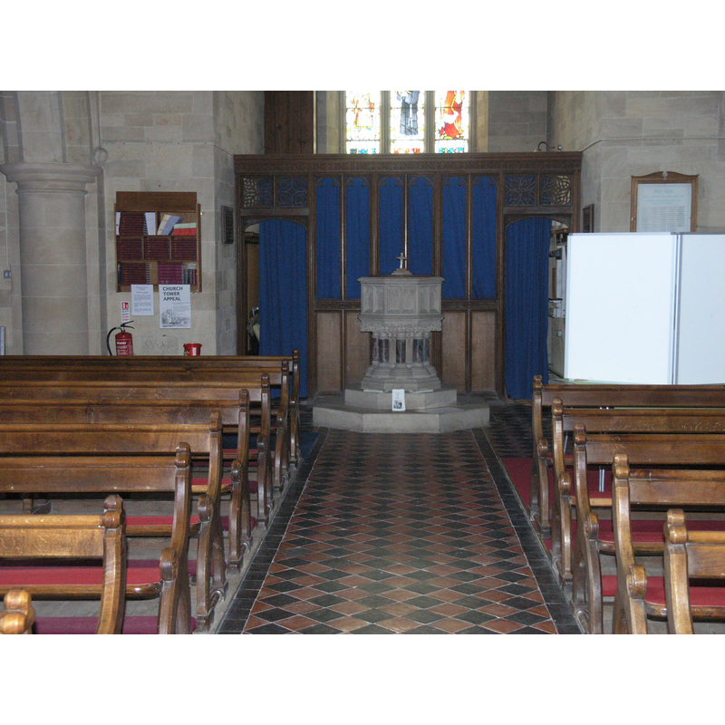
view of font and cover
Scene Description: the modern font
Copyright Statement: Image copyright © Colin Hinson, 2011
Image Source: digital photograph taken October 2011 by Colin Hinson [www.yorkshireCDbooks.com]
Copyright Instructions: Image and permission received (e-mail of 13 October 2011)
view of basin - interior
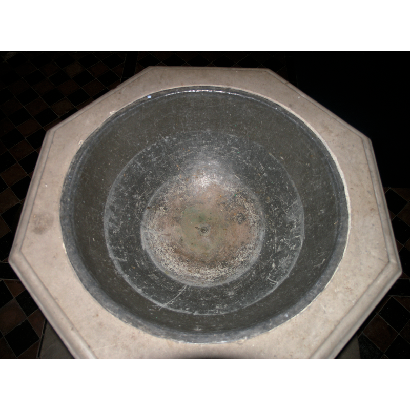
Copyright Statement: Image copyright © Colin Hinson, 2011
Image Source: digital photograph taken October 2011 by Colin Hinson [www.yorkshireCDbooks.com]
Copyright Instructions: Image and permission received (e-mail of 13 October 2011)
view of church exterior - south view
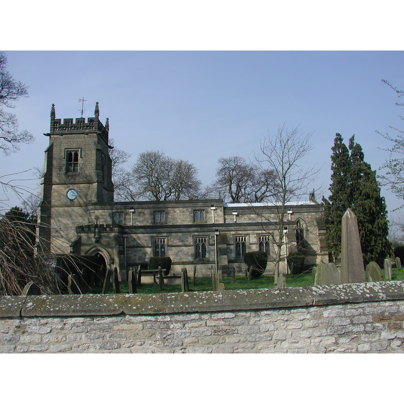
Copyright Statement: Image copyright © Colin Hinson, 2011
Image Source: digital photograph taken October 2011 by Colin Hinson [www.yorkshireCDbooks.com]
Copyright Instructions: Image and permission received (e-mail of 13 October 2011)
view of font and cover in context
Scene Description: the modern font at the west end of the nave
Copyright Statement: Image copyright © Colin Hinson, 2011
Image Source: digital photograph taken October 2011 by Colin Hinson [www.yorkshireCDbooks.com]
Copyright Instructions: Image and permission received (e-mail of 13 October 2011)
INFORMATION
Font ID: 16288SLI
Object Type: Baptismal Font1?
Font Century and Period/Style: 11th century, Pre-Conquest? / Norman
Church / Chapel Name: Parish Church of All Saints
Church Patron Saint(s): All Saints
Church Address: Church Ln, Slingsby, York YO62 4AD, UK
Site Location: North Yorkshire, Yorkshire and the Humber, England, United Kingdom
Directions to Site: Located off the B1257, 3 km N of Castle Howard, 10 km W of Malton
Ecclesiastic Region: Diocese of York
Historical Region: Hundred of Maneshou
Additional Comments: disappeared font? (the medieval one?)
Font Notes:
Click to view
There are two entries [one is multiple-place] for Slingsby [variant spellings] in the Domesday survey [https://opendomesday.org/place/SE6974/slingsby/] [accessed 4 December 2019], one of which reports a priest, but no a church in it, though there must have been one there. Bulmer's Directory of 1890 notices that a priest was reported in 'Selungesbi' in the Domesday survey of 1086, and infers that the church here, though not mentioned explicitly in the survey, must have existed already in Saxon times. The entry for this parish in the Victoria County History (York North Riding, vol. 1, 1914) notes: "The church was given to Whitby Abbey by William Hay and Robert Chambard, [...] confirmed to the abbey by Roger Archbishop of York before 1184 [...] The [present] church of All Saints was built in 1869 [...] nothing remains of the structure of any previous building except, perhaps, some of the voussoirs and a corbel capital of the north arcade, which appear to be 13thcentury work re-used. [...] The font and the other fittings of the church are modern except the communion table, which is of early 17th-century date. In the south chapel is an effigy of a knight in armour of late 13th-century date."
Credit and Acknowledgements: We are grateful to Colin Hinson, of www.yorkshireCDbooks.com, for his photographs of this church and modern font.
COORDINATES
UTM: 30U 634943 6003920
Latitude & Longitude (Decimal): 54.1656, -0.933
Latitude & Longitude (DMS): 54° 9′ 56.16″ N, 0° 55′ 58.8″ W
REFERENCES
- Victoria County History [online], University of London, 1993-. URL: https://www.british-history.ac.uk.
- Bulmer, T., History, Topography, and Directory of North Yorkshire, Comprising its Ancient and Modern History; [...], Preston: T. Bulmer & Co. (T. Snape & Co. Printers), 1890, [transcribed in www.genuki.org.uk/big/eng/YKS/NRY/Slingsby/Slingsby90.html[ [accessed 16 October 2011]