Coreley / Corley / Cornelie

Image copyright © Philip Halling, 2007
CC-BY-SA-2.0
Results: 2 records
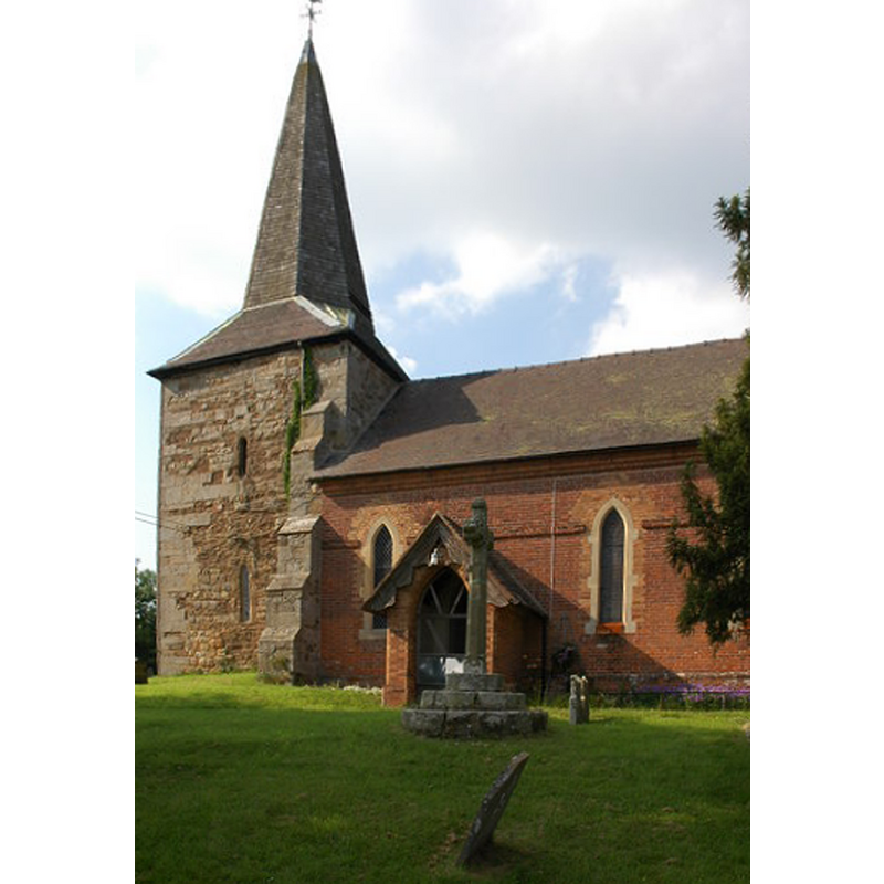
view of church exterior - north view
Scene Description: Source caption: "St Peter's church, Coreley, viewed from the north."
Copyright Statement: Image copyright © Philip Halling, 2007
Image Source: digital photograph taken 9 June 2007 by Philip Halling [www.geograph.org.uk/photo/462066] [accessed 3 December 2014]
Copyright Instructions: CC-BY-SA-2.0
view of church exterior - south view
Scene Description: Source caption: "St Peter's church, Coreley, viewed from the south."
Copyright Statement: Image copyright © Philip Halling, 2007
Image Source: digital photograph taken 9 June 2007 by Philip Halling [www.geograph.org.uk/photo/466514] [accessed 3 December 2014]
Copyright Instructions: CC-BY-SA-2.0
INFORMATION
Font ID: 16283COR
Object Type: Baptismal Font1?
Font Century and Period/Style: 13th century, Medieval
Church / Chapel Name: Parish Church of St. Peter
Font Location in Church: [cf. FontNotes]
Church Patron Saint(s): St. Peter
Church Address: Coreley, Shropshire, SY8 3BD
Site Location: Shropshire, West Midlands, England, United Kingdom
Directions to Site: Located E of Ludlow, 8 km NE of Tenbury Wells, near the county border with Hereford & Worcester, 50 km SW of Birmingham
Ecclesiastic Region: Diocese of Hereford
Historical Region: Hundred of Overs [in Domesday]
Additional Comments: disappeared font? (the one from the mid-13thC (?) church here)
Font Notes:
Click to view
There is an entry for Coreley [variant spelling] in the Domesday survey [http://domesdaymap.co.uk/place/SO6173/coreley/] [accessed 3 December 2014], but it mentions neither cleric nor church in it. Anderson (1864) notes that "a robber took sanctuary" in Coreley church in 1261. Newman & Pevsner (2006) note a church tower of the 13th century, but no font is mentioned in either source. [NB: we have no information on the font from the medieval church here)
COORDINATES
UTM: 30U 529340 5801375
Latitude & Longitude (Decimal): 52.361873, -2.569141
Latitude & Longitude (DMS): 52° 21′ 42.74″ N, 2° 34′ 8.91″ W
REFERENCES
- Anderson, John Corbet, Shropshire, its early history and antiquities, comprising […], London: Willis and Sotheran, 1864, p. 300
- Newman, John, Shropshire, New Haven: Yale University Press, 2006, p. 234