Easthope / Esthop / Stope
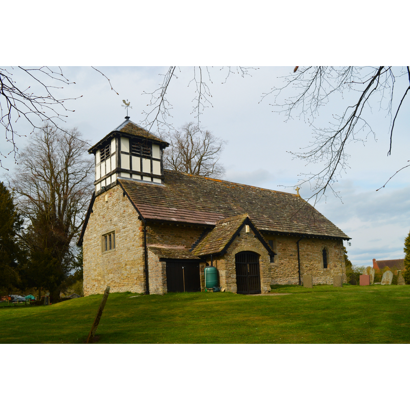
Image copyright © Philip Pankhurst, 2015
CC-BY-SA-2.0
Results: 2 records
view of church exterior - southwest end
Copyright Statement: Image copyright © Philip Pankhurst, 2015
Image Source: digital photograph taken 17 April 2015 by Philip Pankhurst [www.geograph.org.uk/photo/4450259] [accessed 29 June 2015]
Copyright Instructions: CC-BY-SA-2.0
view of church exterior - southeast view
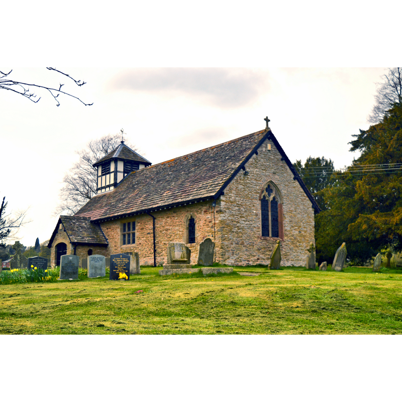
Scene Description: Source caption: "St Peter, Easthope. Extensively restored after a fire in 1928 by Nicholson and Clarke of Hereford."
Copyright Statement: Image copyright © Philip Pankhurst, 2015
Image Source: digital photograph taken 17 April 2015 by Philip Pankhurst [www.geograph.org.uk/photo/4450263] [accessed 29 June 2015]
Copyright Instructions: CC-BY-SA-2.0
INFORMATION
Font ID: 16253EAS
Object Type: Baptismal Font1
Font Century and Period/Style: 11th - 12th century [re-cut in 1928], Norman [altered]
Church / Chapel Name: Parish Church of St. Peter
Font Location in Church: Inside the church
Church Patron Saint(s): St. Peter [earlier dedicated to St. John the Baptist]
Church Address: Easthope, Shropshire TF13 6DN
Site Location: Shropshire, West Midlands, England, United Kingdom
Directions to Site: Located 8 km SW of Much Wenlock
Ecclesiastic Region: Diocese of Hereford
Historical Region: Hundred of Patton [in Domesday] -- Hundred of Munslow
Additional Comments: altered font / re-cut font (re-cut in 1928)
Font Notes:
Click to view
There is an entry for Easthope [variant spelling] in the Domesday survey [http://opendomesday.org/place/SO5695/easthope/] [accessed 29 June 2015], but it mentons neither cleric nor church in it. Anderson (1864) notes a church here since at least 1240. Timmins (1899) reports "a bowl-shaped font" in this church. The National Gazetteer of Great Britain and Ireland (1868) reports "an antique Saxon font" in this church. Timmins (1899) describes it as "a bowl-shaped font". The Victoria County History (Shropshire, vol. 10, 1998) notes: "Parts of the church may be 12th century [...] and the living, mentioned c. 1240, [...] is a rectory. [...] The small parish church of St. Peter, so dedicated by 1741 […] but called St. John the Baptist in 1557 […] Until 1928 the font was circular and tub shaped […] In 1928 fire nearly destroyed the church […] The church was rebuilt to its former appearance […] and dedicated in 1929. The interior, however, was altered; the font was reconstructed […] in plain octagonal form". No font mentioned in Newman & Pevsner (2006).
COORDINATES
UTM: 30U 524307 5822497
Latitude & Longitude (Decimal): 52.552003, -2.641506
Latitude & Longitude (DMS): 52° 33′ 7.21″ N, 2° 38′ 29.42″ W
MEDIUM AND MEASUREMENTS
Material: stone
Font Shape: tub-shaped, re-cut to octagonal
Basin Interior Shape: round
Basin Exterior Shape: round [re-cut to octagonal]
REFERENCES
- The National Gazetteer: a Topographical Dictionary of the British Isles, London: Virtue & Co., 1868, [cited in www.genuki.org.uk/big/eng/SAL/Easthope/index.html] [accessed 6 April 2010]
- Victoria County History [online], University of London, 1993-. URL: https://www.british-history.ac.uk.
- Anderson, John Corbet, Shropshire, its early history and antiquities, comprising […], London: Willis and Sotheran, 1864, p. 262
- Timmins, H. Thornhill, Nooks and corners of Shropshire, London: Elliot Stock, 1899, p. 132