Benthall / Benehale
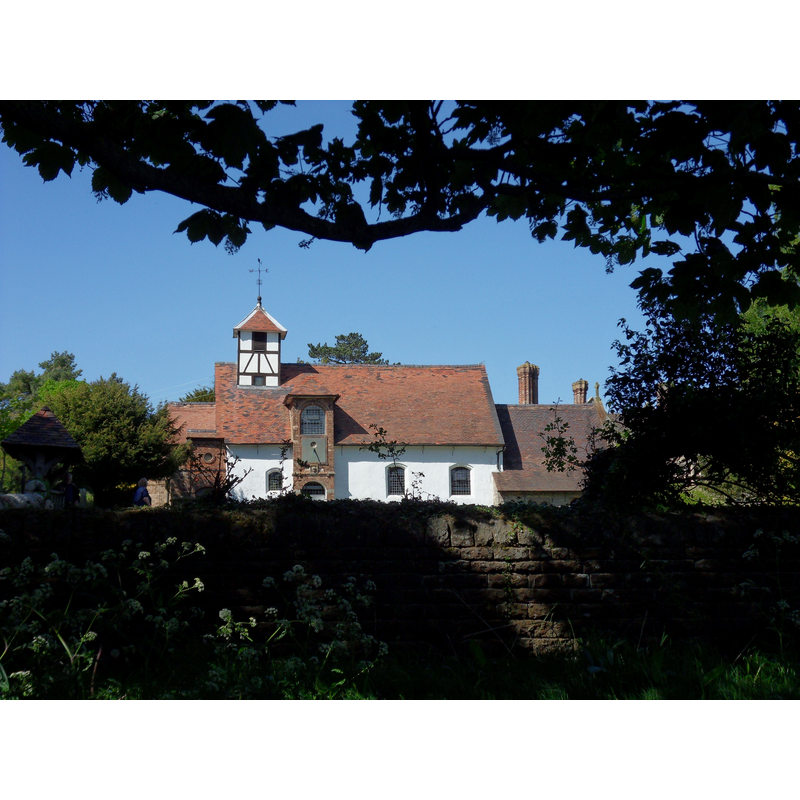
Image copyright © JScott, 2011
CC-BY-SA-3.0
Results: 1 records
view of church exterior - south view
Copyright Statement: Image copyright © JScott, 2011
Image Source: digital photograph taken 3 May 2011 by JScott [www.geograph.org.uk/photo/2396618] [accessed 7 July 2015]
Copyright Instructions: CC-BY-SA-3.0
INFORMATION
Font ID: 16235BEN
Object Type: Baptismal Font1
Font Date: ca. 1668-1670?
Font Century and Period/Style: 17th century, Restoration
Church / Chapel Name: Parish Church of St. Bartholomew [medieval chapel of St. Brice]
Font Location in Church: Inside the church
Church Patron Saint(s): St. Bartholomew [medieval chapel dedicated to St. Brice]
Church Address: Benthall, Shropshire, TF12 5RX
Site Location: Shropshire, West Midlands, England, United Kingdom
Directions to Site: Located off the A4169, just W of Broseley, ESE of Shrewsbury
Ecclesiastic Region: Diocese of Hereford
Historical Region: Hundred of Reweset [in Domesday] -- Hundred of Munslow, Liberty and Borough of Wenlock
Additional Comments: disappeared / destroyed font? (the one from the 13thC church/chapel here)
Font Notes:
Click to view
There is an entry for Benthall [variant spelling] in the Domesday survey [http://opendomesday.org/place/SJ3913/benthall/] [accessed 7 July 2015], but it mentions neither cleric nor church in it. The Victoria County History (Shropshire, vol. 10, 1998) notes: "Benthall had a chapel by 1221[…] The medieval chapel was dedicated to St. Brice, bishop of Tours (d. 444) …] It was 'burnt down to the ground', probably in 1645, and 'wholly demolished'; afterwards no warden was appointed until the building of a new church was undertaken […] A new church of St. Bartholomew, so known by c. 1740, […] was built in or soon after 1667 […] probably on the medieval chapel's foundations […] The font may be of c. 1670". Newman & Pevsner (12006) describe it as "a plain cylinder, presumably of 1668". There may have been a font here since early times, as baptisms appear to have been common in the old chapel, and the VCH points out: "Baptisms and marriages in the chapel became more frequent from the 1570s, [...] perhaps as the mining population increased [...] The earliest register begins in 1640". [NB: we have no information on the earlier font of the old church].
COORDINATES
UTM: 30U 533382 5830060
Latitude & Longitude (Decimal): 52.619514, -2.506909
Latitude & Longitude (DMS): 52° 37′ 10.25″ N, 2° 30′ 24.87″ W
MEDIUM AND MEASUREMENTS
Material: stone
Font Shape: cylindrical
Basin Interior Shape: round
Basin Exterior Shape: round
REFERENCES
- Victoria County History [online], University of London, 1993-. URL: https://www.british-history.ac.uk.
- Newman, John, Shropshire, New Haven: Yale University Press, 2006, p. 141