Beckbury / Becheberie [Domesday] / Beckburye / Bikebir
![Main image for Beckbury / Becheberie [Domesday] / Beckburye / Bikebir](/static-50478a99ec6f36a15d6234548c59f63da52304e5/compressed/1150805021_compressed.png)
Image copyright © Richard Law, 2008
CC-BY-SA-2.0
Results: 5 records
design element - motifs - floral - flower - 4-petal - in a quatrefoil - 8
Copyright Statement: Image copyright © Richard Law, 2008
Image Source: digital photograph taken 14 December 2008 by Richard Law [www.geograph.org.uk/photo/1081292] [accessed 7 July 2015]
Copyright Instructions: CC-BY-SA-2.0
design element - motifs - panel
Copyright Statement: Image copyright © Richard Law, 2008
Image Source: digital photograph taken 14 December 2008 by Richard Law [www.geograph.org.uk/photo/1081292] [accessed 7 July 2015]
Copyright Instructions: CC-BY-SA-2.0
view of church exterior - southeast view
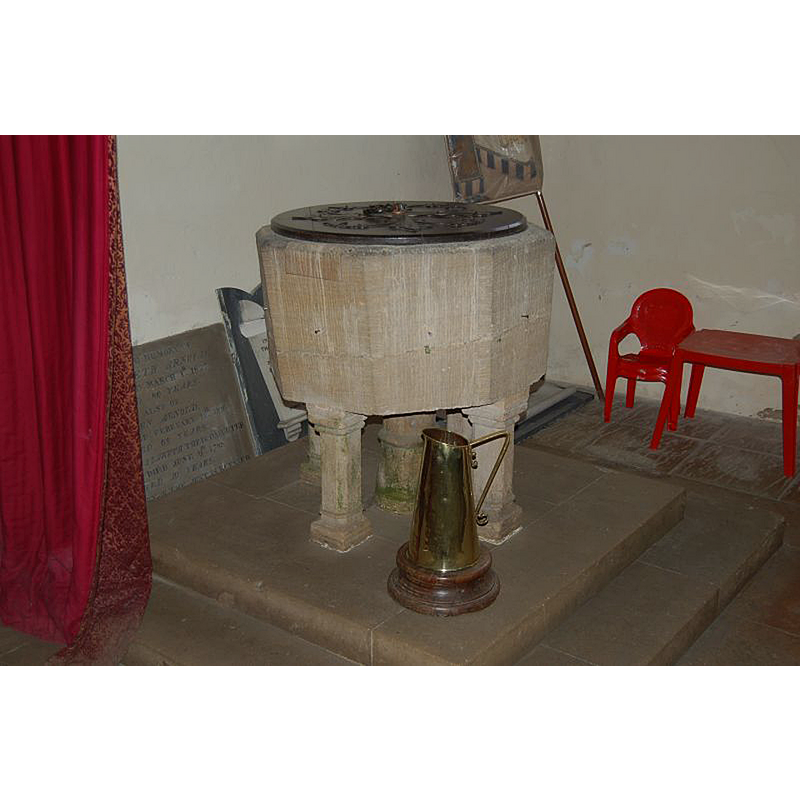
view of font in context
Scene Description: at the west end of the nave, looking east
Copyright Statement: Image copyright © Richard Law, 2008
Image Source: digital photograph taken 14 December 2008 by Richard Law [www.geograph.org.uk/photo/1081292] [accessed 7 July 2015]
Copyright Instructions: CC-BY-SA-2.0
view of church interior - looking west
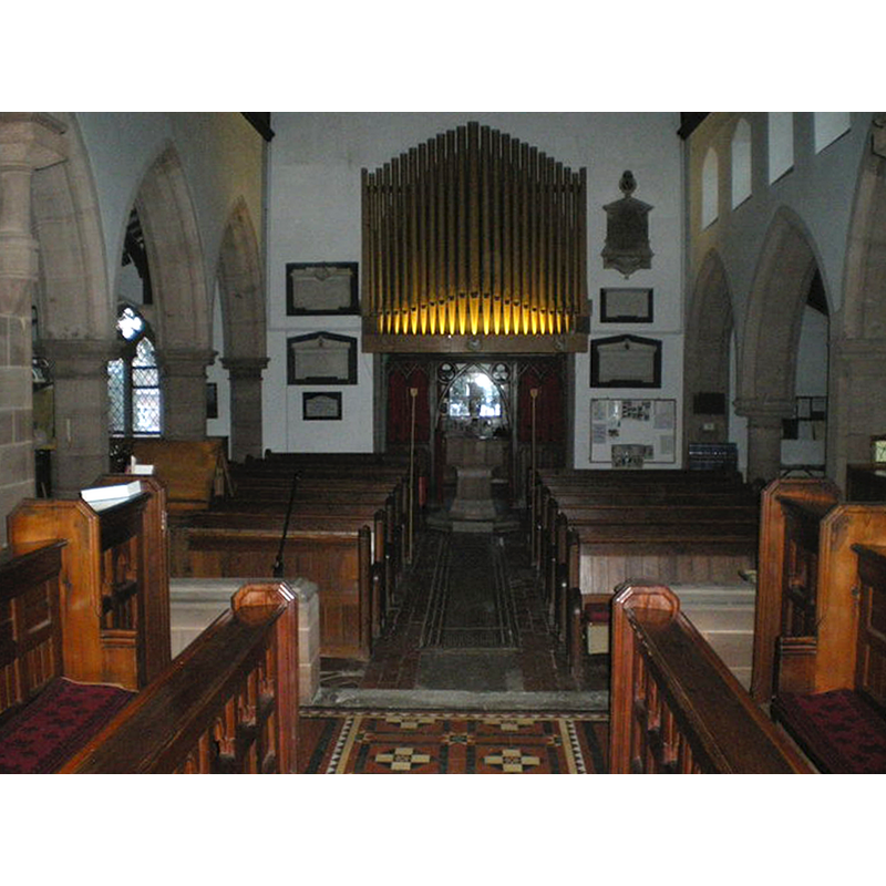
Scene Description: Source caption: "Inside St Milburga's Church. A fine set of organ pipes stands above the font."
Copyright Statement: Image copyright © Richard Law, 2008
Image Source: digital photograph taken 14 December 2008 by Richard Law [www.geograph.org.uk/photo/1081293] [accessed 7 July 2015]
Copyright Instructions: CC-BY-SA-2.0
INFORMATION
Font ID: 16234BEC
Object Type: Baptismal Font1
Font Century and Period/Style: 15th century, Perpendicular
Church / Chapel Name: Parish Church of St. Milburga
Font Location in Church: Inside the church, at the W end of the nave
Church Patron Saint(s): St. Milburga [aka Milburh, Milburgha]
Church Address: Beckbury, Shropshire, TF11 9DG
Site Location: Shropshire, West Midlands, England, United Kingdom
Directions to Site: Located sandwiched between the B4176 to the SW, and the A464 to the NE, 6 km S of Shifnal, WNW of Wolverhampton
Ecclesiastic Region: Diocese of Lichfield
Historical Region: Hundred of Patton [in Domesday] -- Hundred of Munslow, Liberty and Borough of Wenlock
Additional Comments: disappeared font? (the one from the 13thC (?) church here)
Font Notes:
Click to view
There is an entry for Beckbury [variant spelling] in the Domesday survey [http://opendomesday.org/place/SJ7601/beckbury/] [accessed 7 July 2015], but it mentions neither cleric nor church in it. A font here is described in Newman & Pevsner (2006): "Font. Perp[endicular]. Octagonal. Panelled stem. Pointed quatrefoils enclosing four-petal flowers in the faces of the bowl." Anderson (1864) refers to a church belonging "to the great Saxon parish of St. Milburg", and a church in Beckbury is documented as falling under the minimum qualification to be entered in the assessment. The Victoria County History (Shropshire, vol. 10, 1998) notes: "church of ST. MILBURGA, so dedicated by c. 1740 [...] The incumbent was described as rector in 1279, (fn. 137) though the church was often called a chapel in the earlier 14th century and perhaps later. [...] Perpendicular font (restored 1892)". [NB: we have no information on the font of the 13th-century (?) church here].
COORDINATES
UTM: 30U 544116 5829172
Latitude & Longitude (Decimal): 52.610764, -2.34848
Latitude & Longitude (DMS): 52° 36′ 38.75″ N, 2° 20′ 54.53″ W
MEDIUM AND MEASUREMENTS
Material: stone
Font Shape: octagonal, mounted
Basin Interior Shape: round
Basin Exterior Shape: octagonal
Drainage Notes: lead-lined
REFERENCES
- Victoria County History [online], University of London, 1993-. URL: https://www.british-history.ac.uk.
- Anderson, John Corbet, Shropshire, its early history and antiquities, comprising […], London: Willis and Sotheran, 1864, p. 272
- Newman, John, Shropshire, New Haven: Yale University Press, 2006, p. 139