Acton Scott / Actune
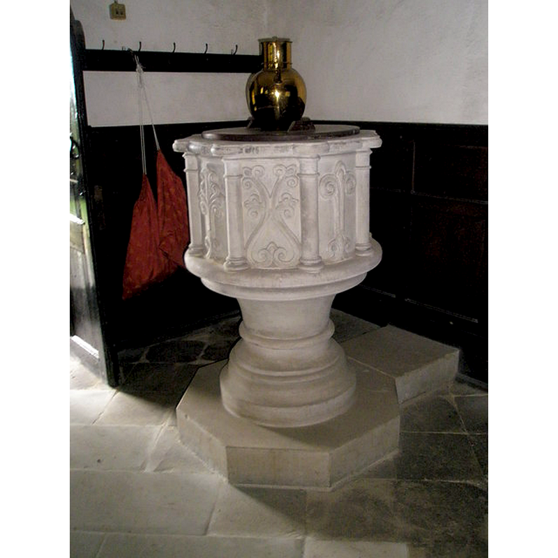
Image copyright © Basher Eyre, 2009
CC-BY-SA-2.0
Results: 4 records
view of font and cover
Copyright Statement: Image copyright © Basher Eyre, 2009
Image Source: digital photograph taken 13 August 2009 by Basher Eyre [www.geograph.org.uk/photo/1441973] [accessed 23 June 2015]
Copyright Instructions: CC-BY-SA-2.0
view of church exterior - north view
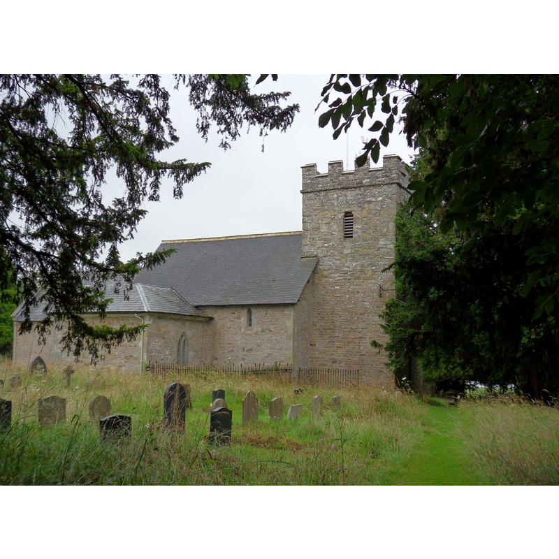
Copyright Statement: Image copyright © J Scott, 2010
Image Source: digital photograph taken 20 July 2010 by J Scott [www.geograph.org.uk/photo/2182684] [accessed 23 June 2015]
Copyright Instructions: CC-BY-SA-2.0
view of church exterior - southeast view
![the modern font [cf. FontNotes]](/static-50478a99ec6f36a15d6234548c59f63da52304e5/compressed/1150626001_compressed.png)
Scene Description: the modern font [cf. FontNotes]
Copyright Statement: Image copyright © J Scott, 2010
Image Source: digital photograph taken 20 July 2010 by J Scott [www.geograph.org.uk/photo/2182680] [accessed 23 June 2015]
Copyright Instructions: CC-BY-SA-2.0
view of church interior - nave - looking east
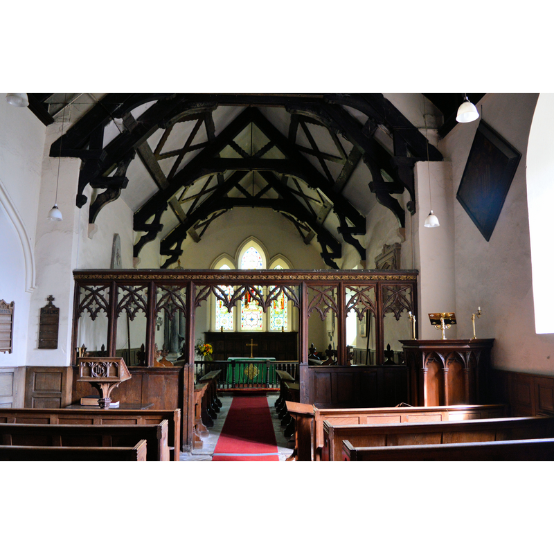
Scene Description: Source caption: "St Margaret, Acton Scott. The chancel, with a notable 17th century roof."
Copyright Statement: Image copyright © Philip Pankhurst, 2014
Image Source: digital photograph taken 23 August 2014 by Philip Pankhurst [www.geograph.org.uk/photo/4155283] [accessed 23 June 2015]
Copyright Instructions: CC-BY-SA-2.0
INFORMATION
Font ID: 16095ACT
Object Type: Baptismal Font1?
Font Century and Period/Style: 13th century (mid?), Early English
Church / Chapel Name: Parish Church of St. Margaret
Church Patron Saint(s): St. Margaret of Antioch [aka Margaret the Virgin, Marina]
Church Address: Henley Lane, Acton Scott, Shropshire SY6 6QQ
Site Location: Shropshire, West Midlands, England, United Kingdom
Directions to Site: Located off (E) the A49, S of Church Stretton
Ecclesiastic Region: Diocese of Hereford
Historical Region: Hundred of Leintwardine [in Domesday] -- Hundred of Munslow
Additional Comments: disappeared font? (the one from the mid-13thC (?) church here)
Font Notes:
Click to view
There is an entry for Acton [Scott] [variant spelling] in the Domesday survey [http://opendomesday.org/place/SO4589/acton-scott/] [accessed 23 June 2015], but it mentions neither cleric nor church in it. The Salopian Shreds and Patches issue for February 2, 1881 (p. 142) notes "a massive font of carved Caen stone" in this church. The Victoria County History (Shropshire, vol. 10, 1998) notes: "The church existed by 1252 […] The church of St. Margaret, so dedicated by the later 18th century […] Font, pulpit, reading desk, and screen may also be early 19th-century". [NB: we have no information on the medieval font of this church].
COORDINATES
UTM: 30U 513207 5816713
Latitude & Longitude (Decimal): 52.500386, -2.805449
Latitude & Longitude (DMS): 52° 30′ 1.39″ N, 2° 48′ 19.61″ W
REFERENCES
- Victoria County History [online], University of London, 1993-. URL: https://www.british-history.ac.uk.