Badger / Beggesoure / Beghesoure
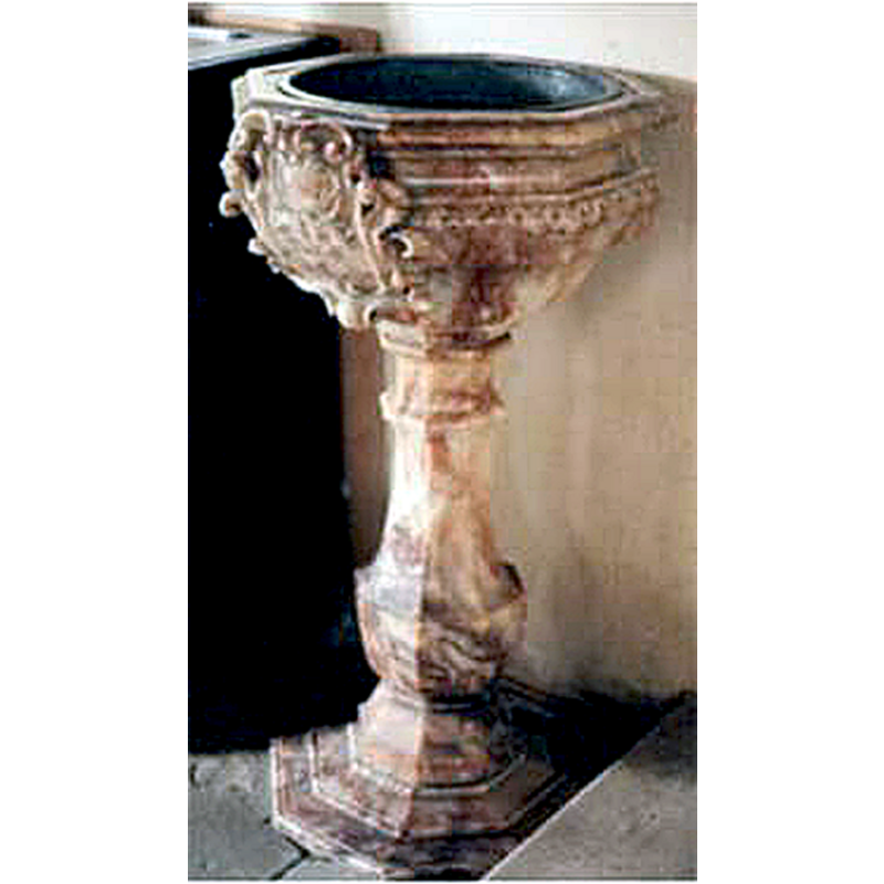
Image copyright © Craig A. Shelley, 2010
Standing permission
Results: 2 records
view of font
Scene Description: the modern font
Copyright Statement: Image copyright © Craig A. Shelley, 2010
Image Source: photograph by Craig A. Shelley [http://myancestry.org/places/shropshire.htm] [accessed 5 March 2010]
Copyright Instructions: Standing permission
view of church exterior - southeast view
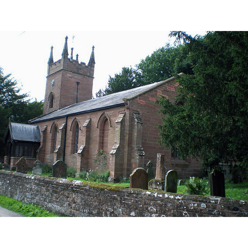
Scene Description: Source caption: "The Parish Church of St Giles, Badger. As with many of the large buildings in the area, this small church is built of the local sandstone."
Copyright Statement: Image copyright © Richard Law, 2008
Image Source: digital photograph taken 17 August 2008 by Richard Law [www.geograph.org.uk/photo/926855] [accessed 30 June 2015]
Copyright Instructions: CC-BY-SA-2.0
INFORMATION
Font ID: 16094BAD
Object Type: Baptismal Font1?
Font Century and Period/Style: 12th century, Late Norman
Church / Chapel Name: Parish Church of St. Giles
Church Patron Saint(s): St. Giles [aka Aegidus, Egidus, Gilles]
Church Address: Badger, Shropshire, WV6 7JR
Site Location: Shropshire, West Midlands, England, United Kingdom
Directions to Site: Located 8 km NE of Bridgnorth
Ecclesiastic Region: Diocese of Lichfield
Historical Region: Hundred of Alnodestreu [in Domesday] -- Liberty and Borough of Wenlock
Additional Comments: disappeared font?
Font Notes:
Click to view
There is an entry for Badger [variant spelling] in the Domesday survey [http://opendomesday.org/place/SO7699/badger/] [accessed 30 June 2015], but it mentions neither cleric nor church in it. Anderson (1864) notes: "This church was founded in the earlier part of the twelfth century" but "did not appear in the assessment of parishes in 1341" [perhaps because its value fell below the assessable minimum?]. The Victoria County History (Shropshire, vol. 10, 1998) notes: "There was a priest, and so presumably a church, at Badger by c. 1174, and the living was called a rectory in 1246. [...] The church of S[t]. G[iles], so known by c. 1740 [...] was rebuilt in 1833-4." The present font is noted in Newman & Pevsner (2006): "Font. 1887. Alabaster copy of the font formerly in Wren's St Bride, Fleet Street" [NB: whereabouts of Wren's fon unknown; London St. Bride's has a font dated 1615 [cf. Index entry]]. [NB: we have no information on the 12th-century font from the old church]
Credit and Acknowledgements: We are grateful to Craig A. Shelley, of www.myancestry.org, for his photograph of the modern font
COORDINATES
UTM: 30U 544451 5827336
Latitude & Longitude (Decimal): 52.594236, -2.343773
Latitude & Longitude (DMS): 52° 35′ 39.25″ N, 2° 20′ 37.58″ W
REFERENCES
- Victoria County History [online], University of London, 1993-. URL: https://www.british-history.ac.uk.
- Newman, John, Shropshire, New Haven: Yale University Press, 2006, p. 131