Stannington nr. Morpeth
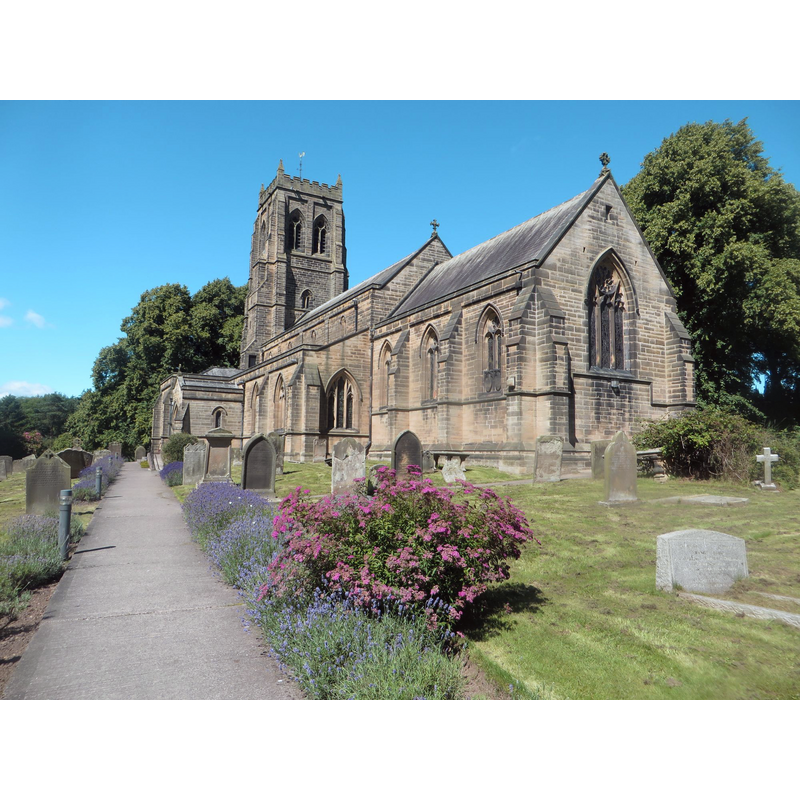
Image copyright © Graham Robson, 2016
CC-BY-SA-2.0
Results: 3 records
view of church exterior - southeast view
Scene Description: Source caption: "Stannington Parish Church. The parish church of St Mary the Virgin in Stannington. The 19th century building sits at the western edge of the village."
Copyright Statement: Image copyright © Graham Robson, 2016
Image Source: digital photograph taken 6 August 2015 by Graham Robson [www.geograph.org.uk/photo/5063976] [accessed 2 January 2019]
Copyright Instructions: CC-BY-SA-2.0
view of church interior - looking east
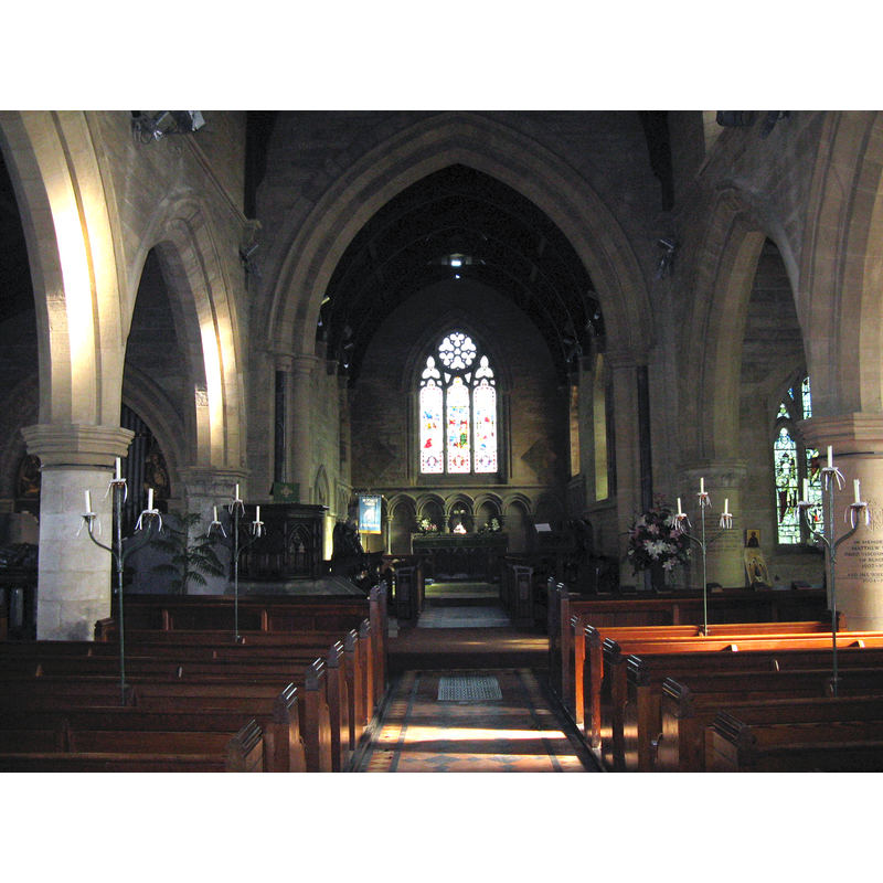
Copyright Statement: Image copyright © M J Richardson, 2011
Image Source: digital photograph taken 2 March 2011 by M J Richardson [www.geograph.org.uk/photo/2302536] [accessed 2 January 2020]
Copyright Instructions: CC-BY-SA-2.0
view of basin - detail

Scene Description: the modern font
Copyright Statement: Image copyright © Morpeth Journal Live, 2010
Image Source: digital photograph in Morpeth Journal Live [http://morpeth.journallive.co.uk/2009/06/st-marys-stannington-in-line-f.html] [accessed 23 February 2010]
Copyright Instructions: PERMISSION NOT AVAILABLE -- IMAGE NOT FOR PUBLIC USE
INFORMATION
Font ID: 16080STA
Object Type: Baptismal Font1?
Font Century and Period/Style: 12th - 13th century, Medieval
Church / Chapel Name: Parish Church of St. Mary the Virgin
Font Location in Church: [cf. FontNotes]
Church Patron Saint(s): St. Mary the Virgin
Church Address: Church Rd, Stannington, Morpeth NE61 6HW, UK -- Tel.: +44 1670 785 606 / 7468 604 339
Site Location: Northumberland, North East, England, United Kingdom
Directions to Site: Located 8 km SE of Morpeth, W of the A1
Ecclesiastic Region: Diocese of Newcastle
Additional Comments: disappeared font? (the one from the 13thC church here)
Font Notes:
Click to view
No individual entry for Stannington found in the Domesday survey. The entry for this church in Historic England [Listing NGR: NZ2098879421] notes: "Church. 1871 by R.J. Johnson of Newcastle, incorporating C13 north arcade of medieval church. [...] Re-set in floor under tower 10 medieval cross-slab grave covers including two with unusual Celtic-style crosses, and late medieval limestone slab with marginal inscription. Also in tower stone with small dancing figure above skull and cable-moulded edges, possibly Pre-Christian"; no font mentioned in it. The present font is a modern one, probably of the 1871 building of the new church, with a rounded basin with eight small protruding round capitals at the upper rim. The wooden cover is round and flat, with metal decoration, probably 19th-century as well. [NB: the original church was built in the 12th century, but was replaced by a new building in 1871 -- we have no information on the original font of the Norman church]
COORDINATES
UTM: 30U 584719 6107626
Latitude & Longitude (Decimal): 55.1081, -1.672
Latitude & Longitude (DMS): 55° 06′ 29″ N, 1° 40′ 19″ W