Halling / Hallinges
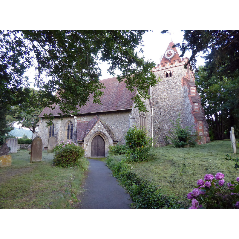
Image copyright © Philip Halling, 2021
CC-BY-SA-2.5
Results: 2 records
view of church exterior - northwest view
Scene Description: Source caption: "Halling Church. St John the Baptist's church in the Medway village of Halling. The church dates from the 12th century with later additions including Victorian restoration in 1889 by H. Bensted. The church is Grade I listed"
Copyright Statement: Image copyright © Philip Halling, 2021
Image Source: digital photograph 10 August 2021 by Philip Halling [https://www.geograph.org.uk/photo/6934813] [accessed 20 November 2023]
Copyright Instructions: CC-BY-SA-2.5
view of church exterior in context
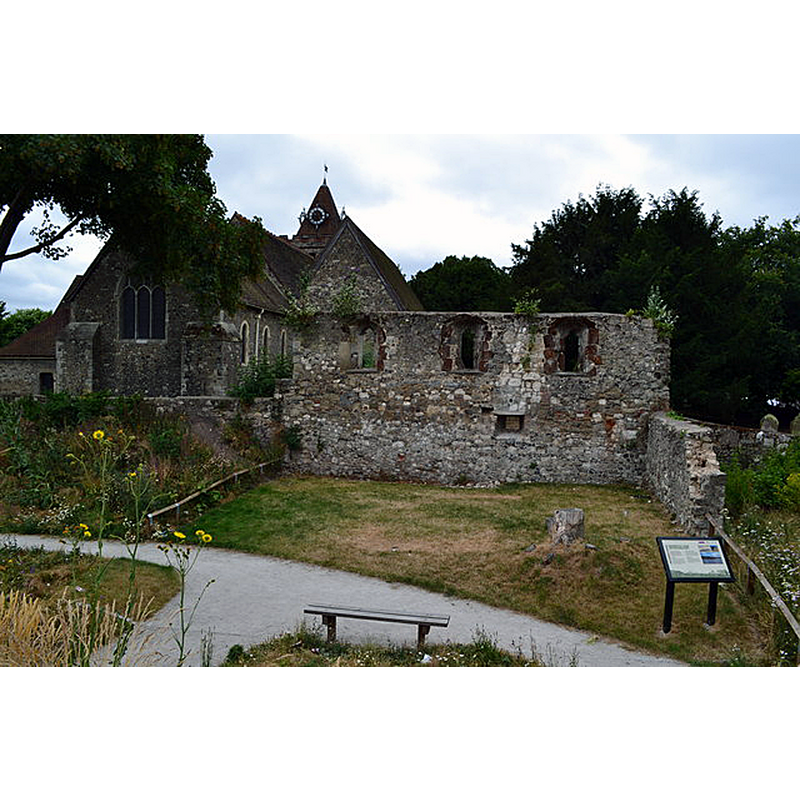
Scene Description: Source caption: "Bishop's Palace ruin and parish church, Halling"
Copyright Statement: Image copyright © David Martin, 2013
Image Source: digital photograph 20 July 2013 by David Martin [https://www.geograph.org.uk/photo/3564270] [accessed 20 November 2023]
Copyright Instructions: CC-BY-SA-2.5
INFORMATION
Font ID: 16059HAL
Object Type: Baptismal Font1
Font Century and Period/Style: 12th century / 13th - 14th century, Norman [altered]
Church / Chapel Name: Parish Church of St. John the Baptist
Font Location in Church: Inside the church
Church Patron Saint(s): St. John the Baptist
Church Address: 107 High St, Halling, Rochester ME2 1BT, United Kingdom -- Tel.: +44 1634 717134
Site Location: Kent, South East, England, United Kingdom
Directions to Site: Located off the A228 [aka Formby Rd], on the W bank of the Medway river, 7 km SSW of Rochester, in the North Downs
Historical Region: Hundred of Shamwell [in Domesday]
Font Notes:
Click to view
There is an entry for Halling and [North and Upper] Halling in te Domesday survey [https://opendomesday.org/place/XX0000/halling-and-north-and-upper-halling/] [accessed 20 November 2023]; it reports a church in it. The font here is described in Glynne (1877): "The font has a plain octagonal bowl on a similar stem, close to one of the south-west piers." The Parish website [http://www.cuxtonandhalling.org.uk/halling.htm] [accessed 18 February 2010] captions its entry in the church plan: "Font – Norman and possibly the earliest work in the Church."
COORDINATES
UTM: 31U 322078 5691679
Latitude & Longitude (Decimal): 51.348499, 0.44503
Latitude & Longitude (DMS): 51° 20′ 54.59″ N, 0° 26′ 42.11″ E
MEDIUM AND MEASUREMENTS
Material: stone
Font Shape: octagonal, mounted
Basin Interior Shape: round
Basin Exterior Shape: octagonal
REFERENCES
- Glynne, Steven Richard, Sir, Notes on the churches of Kent, London: John Murray, 1877, p. 339