Waltham nr. Canterbury
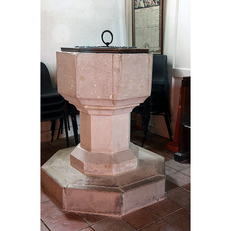
Image copyright © John Salmon, 2010
CC-BY-SA-2.5
Results: 3 records
view of font and cover
Scene Description: Source caption: "St Bartholomew, Waltham, Kent - Font"
Copyright Statement: Image copyright © John Salmon, 2010
Image Source: digital photograph 3 March 2010 by John Salmon [https://www.geograph.org.uk/photo/1736890] [accessed 2 June 2024]
Copyright Instructions: CC-BY-SA-2.5
view of church exterior - northwest view
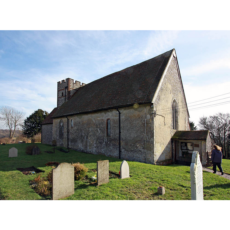
Scene Description: Source caption: "St Bartholomew, Waltham, Kent"
Copyright Statement: Image copyright © John Salmon, 2010
Image Source: digital photograph 3 March 2010 by John Salmon [https://www.geograph.org.uk/photo/1736886] [accessed 2 June 2024]
Copyright Instructions: CC-BY-SA-2.5
view of church interior - looking west
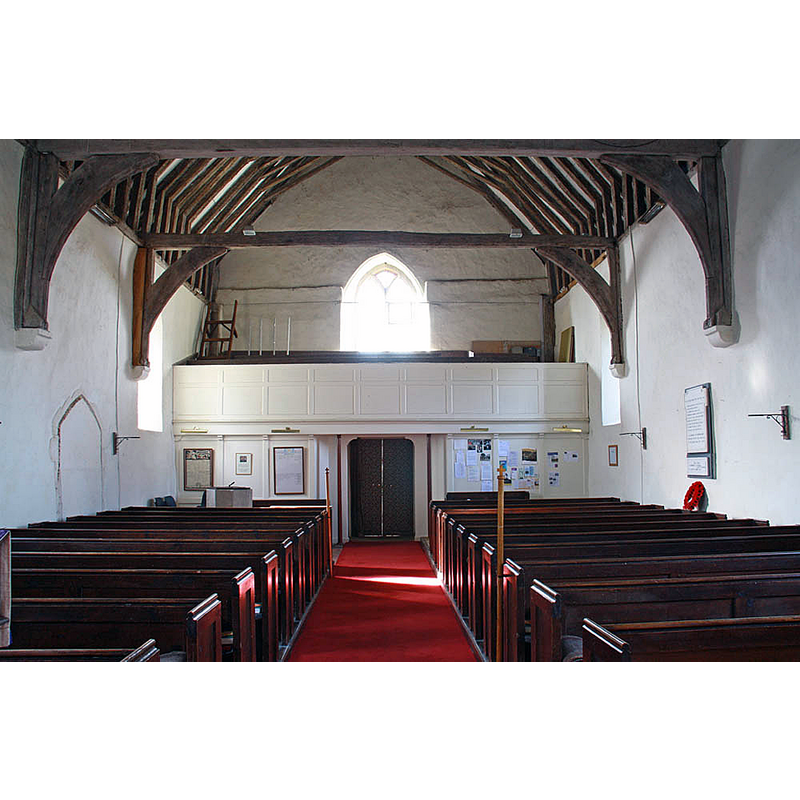
Scene Description: Source caption: "St Bartholomew, Waltham, Kent - West end" -- the font is partially visible at the far back, left side
Copyright Statement: Image copyright © John Salmon, 2010
Image Source: digital photograph 3 March 2010 by John Salmon [https://www.geograph.org.uk/photo/1736901] [accessed 2 June 2024]
Copyright Instructions: CC-BY-SA-2.5
INFORMATION
Font ID: 16043WAL
Object Type: Baptismal Font1
Font Century and Period/Style: 13th - 14th century, Medieval
Church / Chapel Name: Parish Church of St. Bartholomew
Font Location in Church: Inside the church, at the SW end of the nave
Church Patron Saint(s): St. Bartholomew
Church Address: Church Ln, Waltham, Canterbury CT4, UK, United Kingdom -- Tel.: +44 1233 813793
Site Location: Kent, South East, England, United Kingdom
Directions to Site: Located 11 km SW of Canterbury
Ecclesiastic Region: Diocese of Canterbury
Font Notes:
Click to view
Noted in Glynne (1877): "The font has a plain octagonal bowl on a stem". The entry for this church in Historic England [Listing NGR: TR1182748036 ] notes: "The nave is Norman with some C13 and some C14 windows. The chancel tower and porch are Cl3 the tower restored in 1808 but with Cl3 and C14 foundations" but mentions no font in it.
COORDINATES
UTM: 31U 361829 5673502
Latitude & Longitude (Decimal): 51.1962, 1.02247
Latitude & Longitude (DMS): 51° 11′ 46.32″ N, 1° 1′ 20.89″ E
MEDIUM AND MEASUREMENTS
Material: stone
Font Shape: octagonal, mounted
Basin Interior Shape: round
Basin Exterior Shape: octagonal
REFERENCES
- Glynne, Steven Richard, Sir, Notes on the churches of Kent, London: John Murray, 1877, p. 258