Eastwell
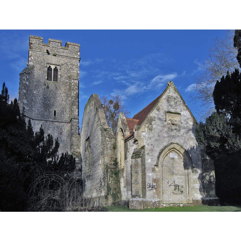
Image copyright © jwfairley, 2008
CC-BY-SA-2.0
Results: 1 records
view of church exterior - ruins
Scene Description: Source caption: " West tower and mortuary chapel of the ruined parish church of St Mary, Eastwell, Kent"
Copyright Statement: Image copyright © jwfairley, 2008
Image Source: digital photograph 6 January 2008 by jwfairley [https://commons.wikimedia.org/wiki/File:Derelict_church,_Eastwell,_near_Ashford,_Kent,_England_UK.jpg] [accessed 1 Kanuary 2022]
Copyright Instructions: CC-BY-SA-2.0
INFORMATION
Font ID: 16034EAS
Object Type: Baptismal Font1?
Font Century and Period/Style: Medieval
Church / Chapel Name: Parish Church of St. Mary [in ruins: in the care of Friends of Friendless Chuches]
Font Location in Church: [cf. FontNotes]
Church Patron Saint(s): St. Mary the Virgin
Church Address: Eastwell, Ashford TN25 4JT, United Kingdom -- Tel.: +44 20 7236 3934
Site Location: Kent, South East, England, United Kingdom
Directions to Site: Located on the N shore of Eastwell lake, about 5 km N of the M20 and Ashford
Additional Comments: disappeared? [cf. FontNotes]
Font Notes:
Click to view
By the time of Glynne's (1877) visit to this church in 1859 the medieval font had been replaced with a new one he reports inside. This church suffered serious damage in the 1940s [not clear whether the damage was caused by a falling bomb, explosives training nearby or tank training activity] [NB: we have no information on either the earlier of the later font]. The entry for this church in Historic England [Listing NGR: TR0107647001] notes: "Parish church, in ruins except C15 tower and C19 south-west chapel [...] All interior fittings and monuments removed." The entry for this church ibn Friends of Friendless Churches [https://friendsoffriendlesschurches.org.uk/church/st-marys-eastwell-kent/] [accessed 1 January 2022] notes: "In the 1940s, Eastwell Park was taken over by the army for tank training exercises. Shocks from nearby explosions didn’t help the vulnerable structure. But in February 1951, after weeks of heavy rain the nave roof collapsed and took the arcade with it. Six years later the church was dismantled. The bells were sold for scrap. The monuments found a new home in the V&A. [...] We took the church into our care in 1980." The entry for the Parish of Eastwell in the V&A [https://collections.vam.ac.uk/search/?offset=0&limit=15&narrow=&extrasearch=&q=Parish+of+Eastwell] [accessed 1 January 2022] lists only six objects in the V&A collections, all of them monuments; no font mentioned.
COORDINATES
UTM: 31U 351472 5673101
Latitude & Longitude (Decimal): 51.19, 0.8745
Latitude & Longitude (DMS): 51° 11′ 24″ N, 0° 52′ 28.2″ E
REFERENCES
- Glynne, Steven Richard, Sir, Notes on the churches of Kent, London: John Murray, 1877, p. 233