Norton nr. Faversham / Norton nr. Teynham / Nortone

Image copyright © pam fray, 2019
CC-BY-SA-2.5
Results: 4 records
view of font and cover
Scene Description: Source caption: "Font in St. Mary's Church, Norton. Simple stone font with a carved wooden cover."
Copyright Statement: Image copyright © pam fray, 2019
Image Source: digital photograph 9 June 2019 by pam fray [https://www.geograph.org.uk/photo/6177776] [accessed 7 October 2023]
Copyright Instructions: CC-BY-SA-2.5
view of church exterior in context - southwest view
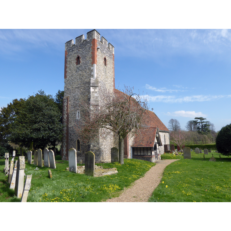
Scene Description: Source caption: "St Mary's Norton is approached up a track through an orchard. The nave and lower chancel are Norman and are unusually long. There is a blocked Norman north doorway. Other parts of the church date from the 13th and 14th centuries. The tower was trimmed with red brick in the 18th century and a timber south porch was added in 1872."
Copyright Statement: Image copyright © Marathon, 2017
Image Source: digital photograph 28 March 2017 by Marathon [https://www.geograph.org.uk/photo/5331181] [accessed 7 October 2023]
Copyright Instructions: CC-BY-SA-2.5
view of church exterior in context - southeast view
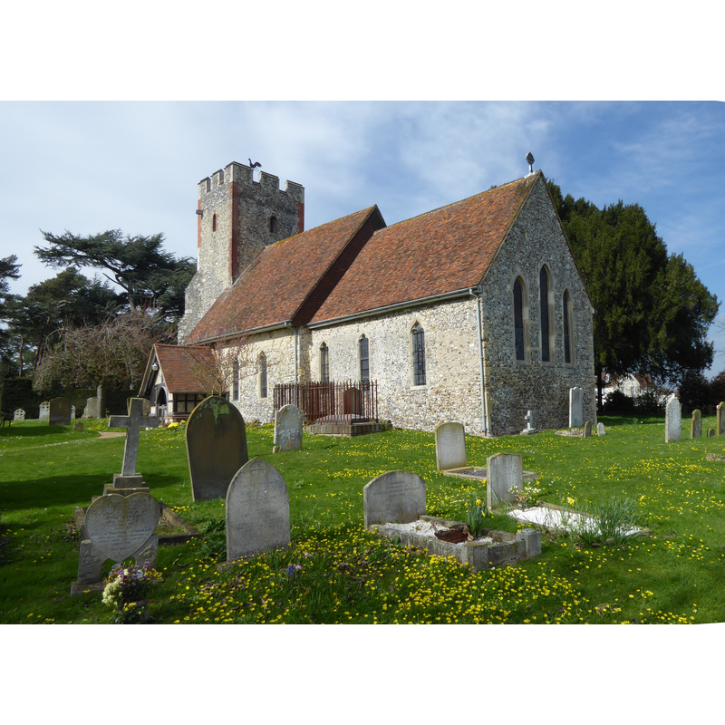
Scene Description: Source caption: "St Mary's Norton is approached up a track through an orchard. The nave and lower chancel are Norman and are unusually long. There is a blocked Norman north doorway. Other parts of the church date from the 13th and 14th centuries. The tower was trimmed with red brick in the 18th century and a timber south porch was added in 1872."
Copyright Statement: Image copyright © Marathon, 2017
Image Source: edited detail of a digital photograph 28 March 2017 by Marathon [https://www.geograph.org.uk/photo/5331205] [accessed 7 October 2023]
Copyright Instructions: CC-BY-SA-2.5
view of church interior - looking east
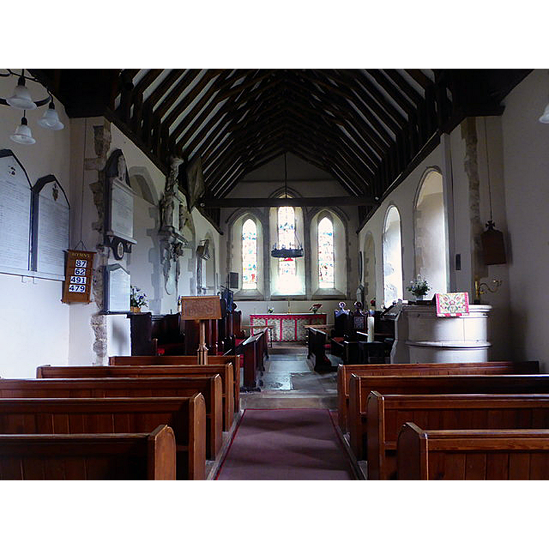
Scene Description: Source caption: "St. Mary's Church, Norton"
Copyright Statement: Image copyright © pam fray, 2019
Image Source: digital photograph 9 June 2019 by pam fray [https://www.geograph.org.uk/photo/6177757] [accessed 7 October 2023]
Copyright Instructions: CC-BY-SA-2.5
INFORMATION
Font ID: 16003NOR
Object Type: Baptismal Font1?
Font Century and Period/Style: 13th century, Early English
Church / Chapel Name: Parish Church of St. Mary
Font Location in Church: [disappeared?]
Church Patron Saint(s): St. Mary the Virgin
Church Notes: 12thC church
Church Address: Provender Ln, Norton, Faversham ME13 0SG, United Kingdom
Site Location: Kent, South East, England, United Kingdom
Directions to Site: Located off the A2 and M2, 4 km SSE of Teynham, 6 km W of Faversham [NB: There used to be no ‘village’ of Norton, just a scattering of houses and farms, but recently the picturesque settlement of Lewson Street [...] now fulfils this role]
Ecclesiastic Region: Diocese of Canterbury
Historical Region: Hundred of Faversham
Additional Comments: disappeared (font?)
Font Notes:
Click to view
There is an entry for this Norton [variant spelling] in the Domesday survey [https://opendomesday.org/place/TQ9661/norton/] [accessed 7 October 2023]; it mentions three churches in it. The entry for this Norton in Edward Hasted, 'Parishes: Norton', in The History and Topographical Survey of the County of Kent: Volume 6 (Canterbury, 1798), pp. 401-413. British History Online http://www.british-history.ac.uk/survey-kent/vol6/pp401-413 [accessed 7 October 2023] notes: "The church, which is dedicated to St. Mary, consists of one isle and a chancel, having a square tower at the west end, in which there is one bell [...] The church of Norton was antiently an appendage to the manor, and as such was the property of the family of Newenham [...] The church of Norton remained, after this, a rectory", but it mentions no font in it. Wilson (1870-1872) notes on the church itself: "The church is early English, in good condition", but does not mention a font; nor does Glynne (1877) in his visit in 1871. There is an object in the church now [2020+] that is used as baptismal font; it is not a crongruent object, and is possibly a composite; the basin has all the characteristics of a medieval grain or liquid measure; the pedestal base and the plinth on which it stands appear to be a modern creation; even the font cover is a challenging object, looking like a four-legged stool with figural finial. We have not been able to gather any reliable information on the object. [NB: we have no information on the medieval font of this church]
COORDINATES
Latitude & Longitude (Decimal): 51.314887, 0.822140
Latitude & Longitude (DMS): 51° 18' 53.6" N, 0° 49' 19.7" E
REFERENCES
- Wilson, John Marius, Imperial Gazetteer of England and Wales: embracing recent changes in counties, dioceses, parishes, and boroughs [...], Edinburgh: A. Fullarton & Co., 1870-1872, [transcribed in http://www.visionofbritain.org.uk/place/place_page.jsp?p_id=6299 [accessed 11 February 2010]]