Upchurch / Cerce / Uppechirche
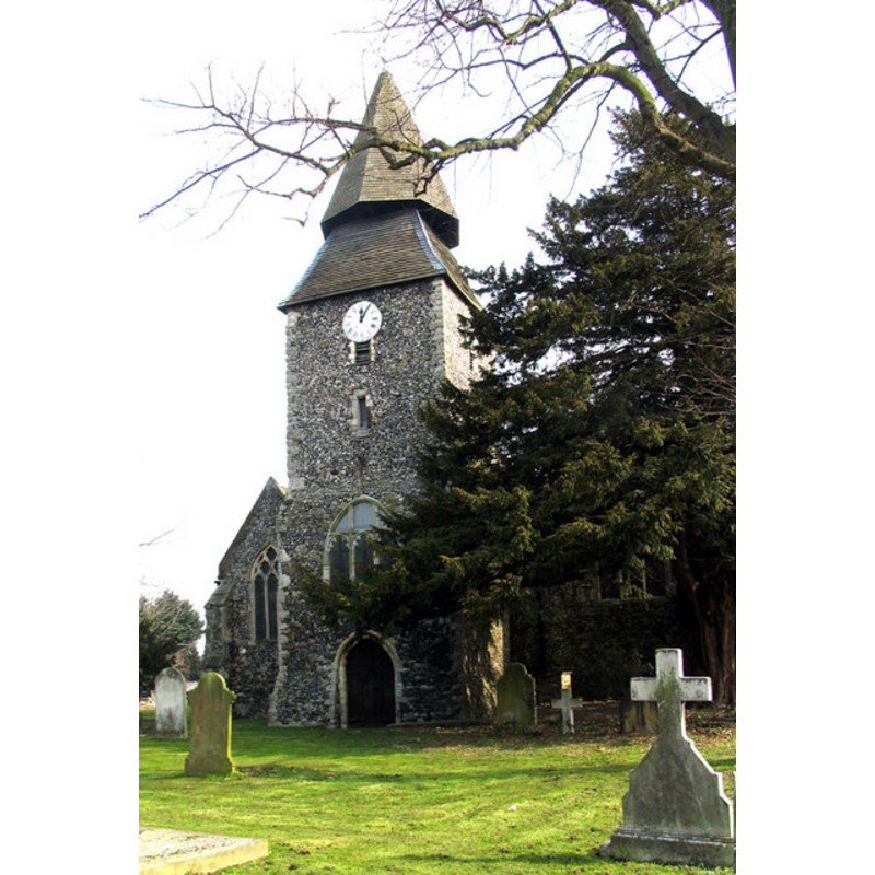
Image copyright © John Salmon, 2006
CC-BY-SA-3.0
Results: 2 records
view of church exterior - west end
Copyright Statement: Image copyright © John Salmon, 2006
Image Source: digital photograph taken 15 March 2006 by John Salmon [www.geograph.org.uk/photo/326732] [accessed 7 September 2013]
Copyright Instructions: CC-BY-SA-3.0
view of church interior - nave - looking east
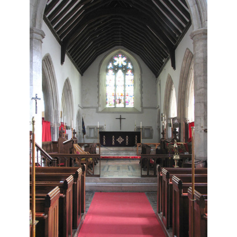
Copyright Statement: Image copyright © John Salmon, 2006
Image Source: digital photograph taken 15 March 2006 by John Salmon [www.geograph.org.uk/photo/326734] [accessed 7 September 2013]
Copyright Instructions: CC-BY-SA-3.0
INFORMATION
Font ID: 15990UPC
Object Type: Baptismal Font1?
Font Century and Period/Style: 11th - 12th century, Norman
Church / Chapel Name: Parish Church of St. Mary the Virgin
Church Patron Saint(s): St. Mary the Virgin
Church Address: Horsham Lane, Upchurch, Kent, ME9 7AL
Site Location: Kent, South East, England, United Kingdom
Directions to Site: Located off (N) the S2, just W of Low Halstow, ESE of Gillingham
Ecclesiastic Region: Diocese of Canterbury
Historical Region: Hundred of Milton [aka Middleton] -- Lath of Sherwinhope [aka Scray, Wiwarlet]
Additional Comments: disappeared font? (the one from the 11thC-12thC church here)
Font Notes:
Click to view
There is an entry for this Upchurch [variant spelling] in the Domesday survey [http://opendomesday.org/place/TQ8467/upchurch/] [accessed 2 May 2015], but it mentions neither cleric nor church in it. Hasted (1798) writes: "The church of Upchurch belonged antiently to the Premonstratensian Abbey de Insula Dei, or Lisle Dieu, in Normandy, founded by Reginald de Paveley, in 1187, who having lands in this county, might probably give this church for the better support of his new foundation. [...] The church, which is dedicated to St. Mary, is a very large, handsome building, consisting of three broad isles and two chancels [...] The steeple at the west end of the church is very remarkable, being a tower on which is placed a square part of a spire for about ten feet, and on that an octagon for the remaining or upper part to the point of the spire at top." Glynne (1877) notes: "a fine new font erected of Decorated character, with ball-flower ornament" in the nave [NB: the church dates back to Norman times but "was completely restored in 1876", according to Glynne (ibid.) -- we have no information on the earlier font(s)]
COORDINATES
UTM: 31U 336241 5694333
Latitude & Longitude (Decimal): 51.3766, 0.647
Latitude & Longitude (DMS): 51° 22′ 35.76″ N, 0° 38′ 49.2″ E
REFERENCES
- Victoria County History [online], University of London, 1993-. URL: https://www.british-history.ac.uk.
- Hasted, Edward, The History and topographical survey of the County of Kent [...], Canterbury: Printed for the author, by Simmons and Kirkby, 1778-, vol. 6: 24-34 / [www.british-history.ac.uk/report.aspx?compid=62944] [accessed 7 September 2013]