Tillington / Tullington / Tullingtun
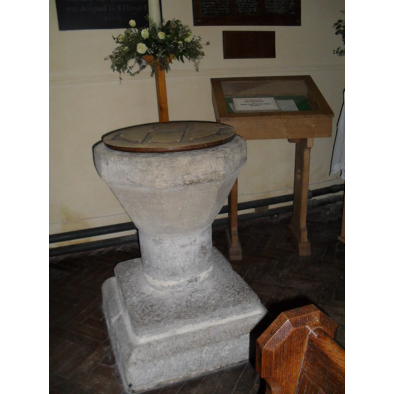
Image copyright © Basher Eyre, 2010
CC-BY-SA-3.0
Results: 3 records
view of font and cover
Copyright Statement: Image copyright © Basher Eyre, 2010
Image Source: digital photograph taken 14 April 2010 by Basher Eyre [www.geograph.org.uk/photo/1807365] [accessed 6 February 2013]
Copyright Instructions: CC-BY-SA-3.0
view of font and cover
Copyright Statement: Image copyright © Pam Brophy, 2005
Image Source: digital photograph taken 17 April 2005 by Pam Brophy [www.geograph.org.uk/photo/4397] [accessed 6 February 2013]
Copyright Instructions: CC-BY-SA-3.0
view of font and cover
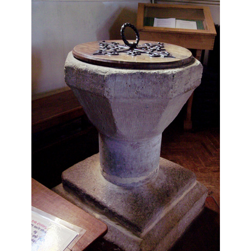
Copyright Statement: Image copyright © Trish Steel, 2007
Image Source: digital photograph taken 21 February 2007 by Trish Steel [http://www.geograph.org.uk/photo/353516] [accessed 29 January 2010]
Copyright Instructions: CC-BY-SA-3.0
INFORMATION
Font ID: 15911TIL
Object Type: Baptismal Font1
Font Century and Period/Style: 12th century [altered?], Norman / Transitional? [altered?]
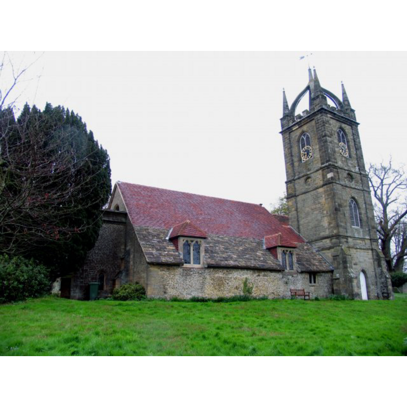
Church / Chapel Name: Parish Church of All Hallows
Font Location in Church: Inside the church, at the W end of the S aisle
Church Patron Saint(s): All Saints
Church Address: Upperton Rd, Tillington, West Sussex, GU28 9AF
Site Location: West Sussex, South East, England, United Kingdom
Directions to Site: Located on the A272, 4 km W of Petworth
Ecclesiastic Region: Diocese of Chichester
Historical Region: Hundred of Rotherbridge -- Rape of Pevensey -- Sussex
Additional Comments: altered?
Font Notes:
Click to view
Harrison (1920) reports a baptismal font of the Transitional period in this church. Described and illustrated in the CRSBI (2008): "The font is located at the W[est] end of the S[outh] aisle. It has an octagonal bowl, which stands on a single column and two superimposed chamfered plinths. The upper plinth appears to be of Sussex marble, but the rest is local limestone. The lower two-thirds of the bowl tapers to fit the size of the supporting column. The interior is circular and lead lined [...] The font is thought to date from the 12th century". Noted in the Tillington Parish Plan (2006) [http://tillington.net/Tillington%20Parish%20Plan2.pdf] [accessed 29 January 2010]. Noted and illustrated by Trish Steel [www.geograph.org.uk/photo/353516] [accessed 29 January 2010]: "A plain 8-sided 12th Century stone font, lead lined on a stone base. The cover was made in c1918 by Willaim Bryder, with ironwork by Paul Thayre, blacksmith."
COORDINATES
UTM: 30U 666389 5651297
Latitude & Longitude (Decimal): 50.989174, -0.629175
Latitude & Longitude (DMS): 50° 59′ 21.02″ N, 0° 37′ 45.03″ W
MEDIUM AND MEASUREMENTS
Material: stone, limestone [cf. FontNotes]
Font Shape: octagonal, mounted
Basin Interior Shape: round
Basin Exterior Shape: octagonal
Drainage Notes: lead-lined
Diameter (inside rim): 45 cm*
Basin Total Height: 39 cm*
Basin Upper Panel Dimensions: * [length of side: vary between 26cm and 29cm, but variation probably due to wear]
Font Height (less Plinth): 97 cm*
Notes on Measurements: * CRSBI (2008)
LID INFORMATION
Date: 1918
Material: wood
Apparatus: no
Notes: round and flat, with metal decoration and ring handle [cf. FontNotes]
REFERENCES
- Corpus of Romanesque Sculpture in Britain and Ireland, The Corpus of Romanesque Sculpture in Britain and Ireland, The Corpus of Romanesque Sculpture in Britain and Ireland. URL: http://www.crsbi.ac.uk.
- Harrison, Frederick, Notes on Sussex churches, Hove: Combridges, 1920, p. 201