Turville / Therfield, Thyrefeld / Tilleberie / Turvile / Turfyld / Tyrefield / Tyrefold / Tyrfeld
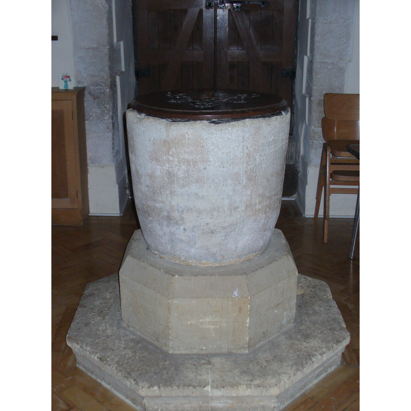
Image copyright © Colin Smith, 2010
Standing permission
Results: 3 records
view of font and cover
Copyright Statement: Image copyright © Colin Smith, 2010
Image Source: digital photograph taken 17 January 2010 by Colin Smith
Copyright Instructions: Standing permission
view of basin
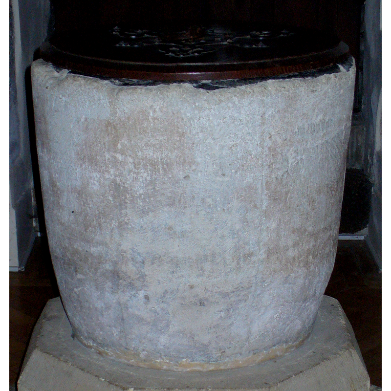
Copyright Statement: Image copyright © Colin Smith, 2010
Image Source: detail of a digital photograph taken 17 January 2010 by Colin Smith
Copyright Instructions: Standing permission
view of church exterior - southwest view
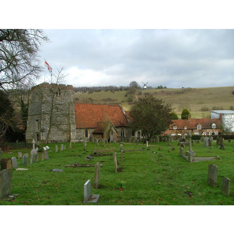
Copyright Statement: Image copyright © Peter Jemmett, 2007
Image Source: digital phtograph taken 28 December 2007 by Peter Jemmett [www.geograph.org.uk/photo/642385]
Copyright Instructions: CC-BY-SA-2.0
INFORMATION
Font ID: 15887TUR
Object Type: Baptismal Font1
Font Century and Period/Style: 12th century [basin only], Medieval [composite]
Church / Chapel Name: Parish Church of St. Mary the Virgin
Font Location in Church: Inside the church
Church Patron Saint(s): St. Mary the Virgin
Church Address: Turville, Henley-on-Thames, Oxfordshire, RG9 6QX
Site Location: Buckinghamshire, South East, England, United Kingdom
Directions to Site: Located 8 km N of Henley-on-Thames, 8 km W of High Wycombe
Ecclesiastic Region: Diocese of Oxford
Historical Region: Hundred of Desborough
Additional Comments: altered font: base and plinth are modern -- the village is a popular one for films; Miss Marple, etc. 'The Vicar of Dibley' series uses the village and church in its episodes
Font Notes:
Click to view
There is an entry for Turville [variant spelling] in the Domesday survey [http://opendomesday.org/place/SU7691/turville/] [accessed 19 October 2015] but it mentions neither cleric nor church in it. Sheahan (1862) notes: "The font is Norman". The Victoria County History (Buckingham, vol. 3, 1925) notes: "The church probably dates from the 12th century, but of the original building the nave alone remains. About the middle of the 14th century the chancel was rebuilt [...] The entire church has been much restored [...] The font has a 12th-century bowl of a deep cupshaped form mounted on a modern base. The lead lining of the bowl has the date 1746 scratched on it." Only the plain tub-shaped basin of this font is original; the added octagonal lower base and plinth are modern. The flat and round wooden cover, with metal decorations and ring handle, is modern as well.
Credit and Acknowledgements: We are grateful to Colin Smith for his photograph of this font
COORDINATES
UTM: 30U 645844 5720225
Latitude & Longitude (Decimal): 51.614142, -0.893515
Latitude & Longitude (DMS): 51° 36′ 50.91″ N, 0° 53′ 36.65″ W
MEDIUM AND MEASUREMENTS
Material: stone
Font Shape: triangular, mounted
Basin Interior Shape: round
Basin Exterior Shape: round
Drainage Notes: lead-lined
LID INFORMATION
Date: modern
Material: wood
Apparatus: no
Notes: [cf. FontNotes]
REFERENCES
- Sheahan, James Joseph, History and topography of Buckinghamshire, comprising a general survey of the county, preceded by an epitome of the early history of Great Britain, London; Pontefract: Longman, Green, Longman, and Roberts; William Edward Bonas [...], 1862, p. 912