Bywell No. 2
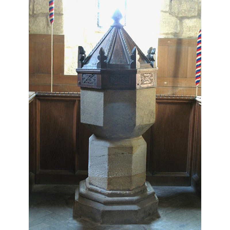
Image copyright © Mike Quinn, 2009
CC-BY-SA-3.0
Results: 4 records
view of font and cover
Copyright Statement: Image copyright © Mike Quinn, 2009
Image Source: digital photograph taken 10 September 2009 by Mike Quinn [www.geograph.org.uk/photo/1573488] [accessed 24 October 2013]
Copyright Instructions: CC-BY-SA-3.0
view of church exterior - south view
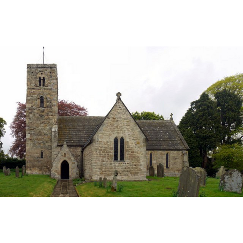
Copyright Statement: Image copyright © Andrew Curtis, 2010
Image Source: digital photograph taken 16 May 2010 by Andrew Curtis [www.geograph.org.uk/photo/1861142] [accessed 24 October 2013]
Copyright Instructions: CC-BY-SA-3.0
view of church interior - nave - looking west
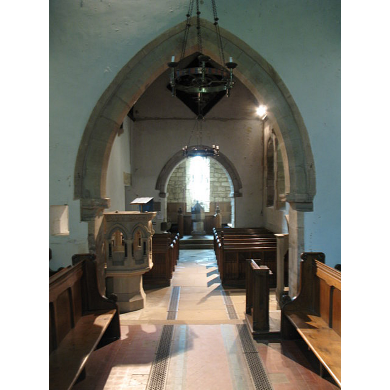
Scene Description: from the chancel; the font and cover are visible at the west end
Copyright Statement: Image copyright © Mike Quinn, 2009
Image Source: digital photograph taken 10 September 2009 by Mike Quinn [www.geograph.org.uk/photo/1573442] [accessed 24 October 2013]
Copyright Instructions: CC-BY-SA-3.0
view of church interior - nave - looking east
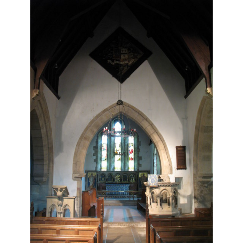
Scene Description: through the chancel arch
Copyright Statement: Image copyright © Mike Quinn, 2009
Image Source: digital photograph taken 10 September 2009 by Mike Quinn [www.geograph.org.uk/photo/1573478] [accessed 24 October 2013]
Copyright Instructions: CC-BY-SA-3.0
INFORMATION
Font ID: 15872BYW
Object Type: Baptismal Font1
Font Century and Period/Style: 17th century, Restoration
Church / Chapel Name: Parish Church of St. Andrew [redundant]
Font Location in Church: Inside the church
Church Patron Saint(s): St. Andrew
Church Notes: church said to have belonged to the Premonstratensian Blanchland Abbey -- redundant since 1973; in the care of The Churches conservation Trust since 1975 -- church retains substantial Saxon parts (tower, west end of the nave, shaft of a cross, etc.) according to Byrne (2013)
Church Address: Bywell, Stocksfield, Northumberland, NE43 7AD
Site Location: Northumberland, North East, England, United Kingdom
Directions to Site: There is no village here; the church is located W of Hexham, 8 km E of Corbridge, 16 km from Newcastley-upon-Tyne
Ecclesiastic Region: Diocese of Newcastle
Additional Comments: altered font? (the present one: re-tooled) -- disappeared font? (the one from the Saxon church here)
Font Notes:
Click to view
Pevsner (1957) notes a font and cover, both of the 17th-century, in this church. The basin and base have been drastically re-tooled; not so the lower base, which could Victorian. [NB: the tower of the church dates back to the Anglo-Saxon period, but we have no information on the original font of the earlier church]
COORDINATES
UTM: 30U 568789 6089544
Latitude & Longitude (Decimal): 54.9481, -1.926
Latitude & Longitude (DMS): 54° 56′ 53.16″ N, 1° 55′ 33.6″ W
MEDIUM AND MEASUREMENTS
Material: stone
LID INFORMATION
Date: 17th-century?
Material: wood
Notes: [cf. FontNotes]
REFERENCES
- Byrne, Matthew, Beautiful churches saved by The Churches Conservation Trust, London: Frances Lincoln, 2013, p. 26-28
- Pevsner, Nikolaus, Northumberland, Harmondsworth: Penguin Books, 1957, p. 108