Swinton / Sinitun / Suintone
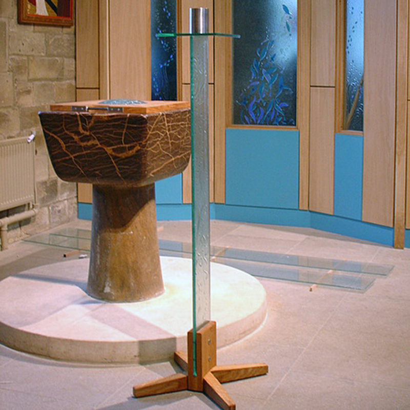
Image copyright © Martin Johnson & Co (York) Ltd, 2007
No known copyright restriction / Fair Dealing
Results: 3 records
view of font and cover
Scene Description: the modern font in the modern church
Copyright Statement: Image copyright © Martin Johnson & Co (York) Ltd, 2007
Image Source: digital photograph 22 March 2007 by Steve Collins Photographs in [www.martinjohnsonglass.co.uk/wp-content/uploads/2014/06/small-pixels-059.jpg] [accessed 27 November 2018]
Copyright Instructions: No known copyright restriction / Fair Dealing
view of church exterior - south view
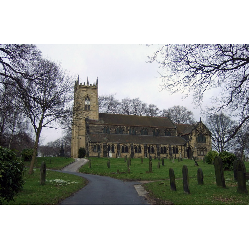
Scene Description: the modern church
Copyright Statement: Image copyright © JThomas, 2013
Image Source: digital photograph taken 9 February 2013 by JThomas [www.geograph.org.uk/photo/3326785] [accessed 27 November 2018]
Copyright Instructions: CC-BY-SA-2.0
view of church exterior - south view
![a rendering of the disappeared Norman church here
EXT MOD CHURCH S digital photograph taken 9 February 2013 by JThomas [www.geograph.org.uk/photo/3326785] [accessed 27 November 2018]
EXT NORMAN CHURCH S digital image of a B&W photograph [ [www.stmargaretswinton.uk/history.html] [accessed 27 November 2018] No known..
MOD FONT in MOD CHURCH digital image [www.stmargaretswinton.uk/history.html] [accessed 27 November 2018] NO KNOWN.
MOD FONT2 in [www.martinjohnsonglass.co.uk/wp-content/uploads/2014/06/small-pixels-059.jpg] [accessed 27 November 2018] Copyright © 2016 Martin Johnson & Co (York) Ltd](/static-50478a99ec6f36a15d6234548c59f63da52304e5/compressed/0181128009_compressed.png)
Scene Description: a rendering of the disappeared Norman church here
EXT MOD CHURCH S digital photograph taken 9 February 2013 by JThomas [www.geograph.org.uk/photo/3326785] [accessed 27 November 2018]
EXT NORMAN CHURCH S digital image of a B&W photograph [ [www.stmargaretswinton.uk/history.html] [accessed 27 November 2018] No known..
MOD FONT in MOD CHURCH digital image [www.stmargaretswinton.uk/history.html] [accessed 27 November 2018] NO KNOWN.
MOD FONT2 in [www.martinjohnsonglass.co.uk/wp-content/uploads/2014/06/small-pixels-059.jpg] [accessed 27 November 2018] Copyright © 2016 Martin Johnson & Co (York) Ltd
Copyright Statement: Image copyright © [in the public domain]
Image Source: digital image of a B&W photograph [www.stmargaretswinton.uk/history.html] [accessed 27 November 2018]
Copyright Instructions: assumed PD
INFORMATION
Font ID: 15762SWI
Object Type: Baptismal Font1?
Font Century and Period/Style: 12th century, Late Norman
Church / Chapel Name: Chapel of St. Margaret [later Parish Church of St. Margaret]
Font Location in Church: [cf. FontNotes]
Church Patron Saint(s): St. Margaret of Antioch [aka Margaret the Virgin, Marina]
Church Address: 50 Golden Smithies Ln, Swinton, Mexborough S64 8DL, UK -- Tel.: +44 1709 582259
Site Location: South Yorkshire, Yorkshire and the Humber, England, United Kingdom
Directions to Site: Located off (N) the A6022, WSW of Mexborough, 8 km NNE of Rotherham, in Wath-upon-Dearne
Ecclesiastic Region: Diocese of Sheffield
Historical Region: Hundred of Strafforth -- formerly WRYrks
Additional Comments: disappeared font?
Font Notes:
Click to view
There are two entries for this Swinton [variant spellings] in the Domesday survey [http://opendomesday.org/place/SK4599/swinton/] [accessed 17 November 2018] neither of which mentions cleric or church in it. Hunter (1828-1831) notes that the old chapel of Swinton "was founded not later than the twelfth century", and that "it was endowed with the privilege of a font". The same source informs that the old chapel "was taken down in 1817". 'A brief history of St Margaret's Church' [www.stmargaretswinton.uk/history.html] [accessed 27 November 2018] notes: "The first place of worship in Swinton was a Norman chapel of ease to Wath church, built in about 1200 AD on the site of the present church hall. The small chapel was dedicated to St Mary Magdalene and was finally pulled down in 1815 before the construction of the new church. The two Norman arches were preserved and moved to the new churchyard when the Victorian church was consecrated in 1817. This church of St Margaret was destroyed by a fire in 1897, although the tower survived. The body of the new church was built around the tower, using stone from local quarries at Mexborough, Darfield and Hooton Roberts. The church was consecrated by the Archbishop of York in October 1899." There is an entry for the remains of the medieval chapel in Historic England [Listing NGR: SK4522099388]: "Remains of chapel. c1200, demolished 1815 and now incorporated in church-yard wall"; no fontr mentioned in it. The font in the Church of St Margaret is modern.
[NB: we have no information on the whereabouts of the original font of the old chapel]
[NB: we have no information on the whereabouts of the original font of the old chapel]
COORDINATES
UTM: 30U 611483 5927981
Latitude & Longitude (Decimal): 53.48897, -1.3197
Latitude & Longitude (DMS): 53° 29′ 20.29″ N, 1° 19′ 10.92″ W
REFERENCES
- Hunter, Joseph, South Yorkshire, Wakefield: EP Publishing for Sheffield City Libraries, 1974 c1828-1931, vol. 2: 77