Boxted / Boxted nr. Hartest
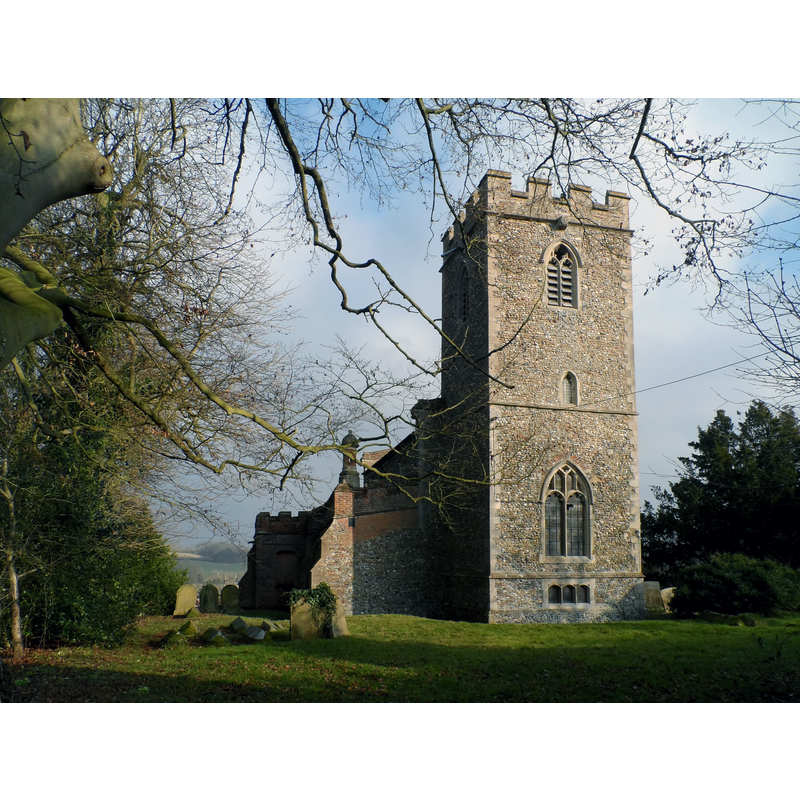
Image copyright © Bikeboy, 2015
CC-BY-SA-2.0
Results: 2 records
view of church exterior - north view
Scene Description: Source caption: "All Saints' church Boxted. Mostly C15. Inside there are some C16 pews and memorials to the Poley family from Boxted Hall".
Copyright Statement: Image copyright © Bikeboy, 2015
Image Source: digital photograph taken 15 February 2015 by Bikeboy [www.geograph.org.uk/photo/4365149] [accessed 13 June 2018]
Copyright Instructions: CC-BY-SA-2.0
view of church exterior - southwest view
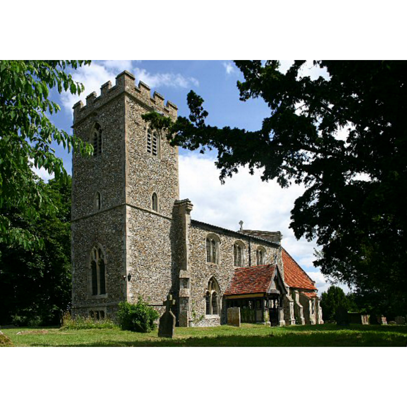
Copyright Statement: Image copyright © Bob Jones, 2006
Image Source: digital photograph taken 8 July 2006 by Bob Jones [www.geograph.org.uk/photo/198156] [accessed 13 June 2018]
Copyright Instructions: CC-BY-SA-2.0
INFORMATION
Font ID: 15681BOX
Object Type: Baptismal Font1
Font Century and Period/Style: 15th century, Perpendicular
Church / Chapel Name: Parish Church of All Saints
Font Location in Church: [cf. FontNotes]
Church Patron Saint(s): All Saints
Church Address: Lane to Braggon's Hill, Boxted, Bury Saint Edmunds IP29 4LN, UK
Site Location: Suffolk, East Anglia, England, United Kingdom
Directions to Site: Located off the B1066, S of Hartest, 13 km N of Sudbury -- Hartest is located up the B1066, 2 km NNE of Boxted, both of them SSW of Bury St Edmunds
Ecclesiastic Region: Diocese of St.Edmundsbury & Ipswich
Historical Region: Hundred of Babergh
Font Notes:
Click to view
[NB: there seems to be some confusion in listing Hartest All Saints and Boxted Holy Trinity churches -- the Church of England site
notes: "All Saints Hartest is unusual in that it sits in the lowest part of the village. If you have problems finding it just look for the Crown public house and we are to its left. Holy Trinity Boxted has been linked with All Saints for over a thousand years, but retains its own character and unique features."] There is an entry for this Boxted in the Domesday survey [http://opendomesday.org/place/TL8250/boxted/], but it mentions neither priest nor church in it. Parker (1855) notes a plain font of the Perpendicular period in this church. Knott (2009) [www.suffolkchurches.co.uk/boxted.html] [accessed 13 June 2018] mentions no font in this church.
notes: "All Saints Hartest is unusual in that it sits in the lowest part of the village. If you have problems finding it just look for the Crown public house and we are to its left. Holy Trinity Boxted has been linked with All Saints for over a thousand years, but retains its own character and unique features."] There is an entry for this Boxted in the Domesday survey [http://opendomesday.org/place/TL8250/boxted/], but it mentions neither priest nor church in it. Parker (1855) notes a plain font of the Perpendicular period in this church. Knott (2009) [www.suffolkchurches.co.uk/boxted.html] [accessed 13 June 2018] mentions no font in this church.
COORDINATES
UTM: 31U 340104 5777156
Latitude & Longitude (Decimal): 52.121783, 0.664373
Latitude & Longitude (DMS): 52° 7′ 18.42″ N, 0° 39′ 51.74″ E
MEDIUM AND MEASUREMENTS
Material: stone
Font Shape: octagonal, mounted
Basin Interior Shape: round
Basin Exterior Shape: octagonal
REFERENCES
- Parker, John Henry, The Ecclesiastical and architectural topography of England [...] Suffolk, 1855, [unpaged]