Tannington nr. Framlingham / Tantintuna
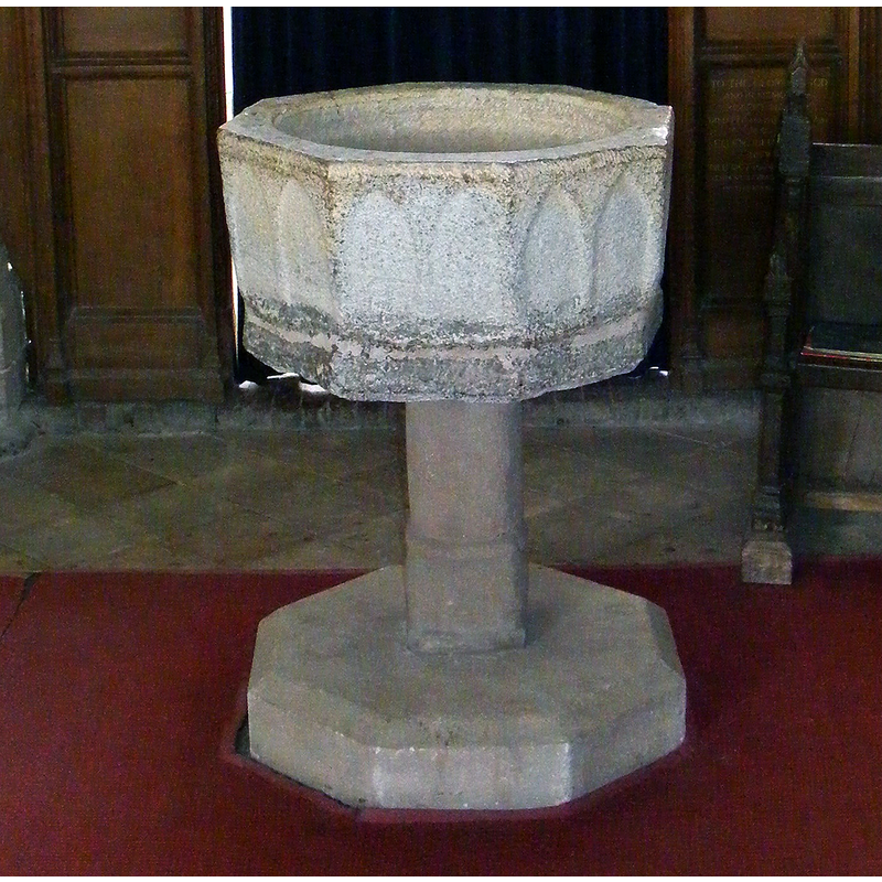
Image copyright © Geographer, 2010
CC-BY-SA-2.5
Results: 5 records
view of font
Scene Description: Source caption: "St Ethelbert Church Font. Off Church Road"
Copyright Statement: Image copyright © Geographer, 2010
Image Source: edited detail of a digital photograph 11 May 2010 by Geographer [https://www.geograph.org.uk/photo/1900684] [accessed 2 June 2024]
Copyright Instructions: CC-BY-SA-2.5
view of font
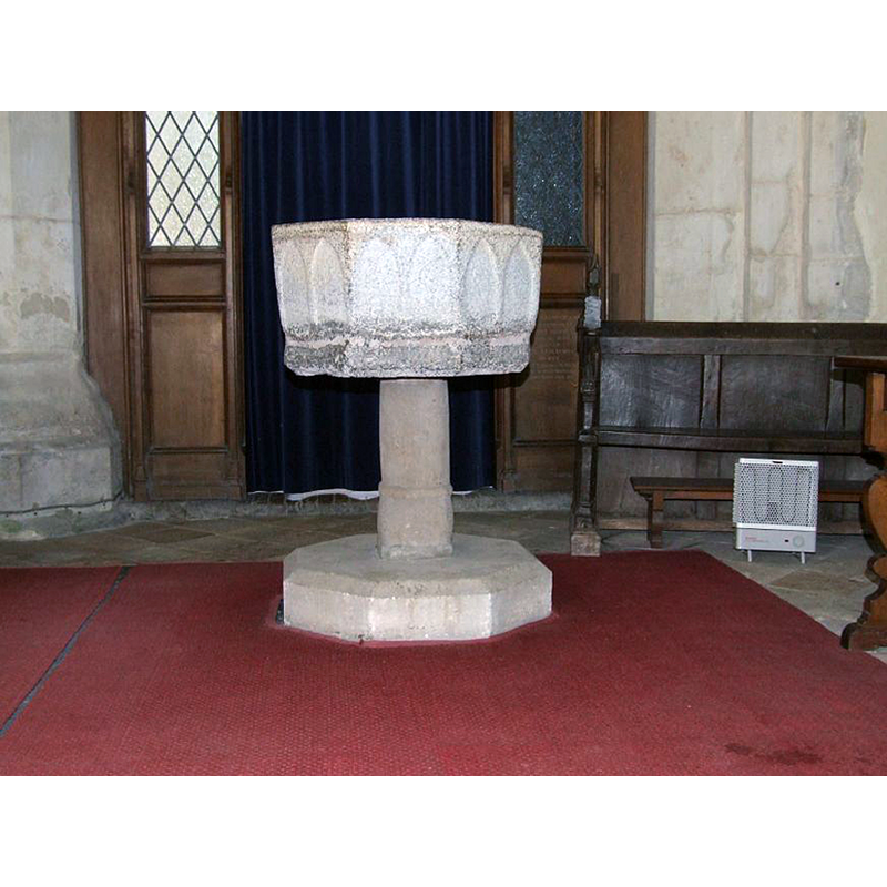
Copyright Statement: Image copyright © Simon Knott, 2009
Image Source: digital photograph taken by Simon Knott [http://www.suffolkchurches.co.uk/tannington.html] [accessed 23 October 2009]
Copyright Instructions: Standing permission
design element - architectural - arcade - blind - pointed arches - 16
Copyright Statement: Image copyright © Simon Knott, 2009
Image Source: digital photograph taken by Simon Knott [http://www.suffolkchurches.co.uk/tannington.html] [accessed 23 October 2009]
Copyright Instructions: Standing permission
view of church exterior - southeast view
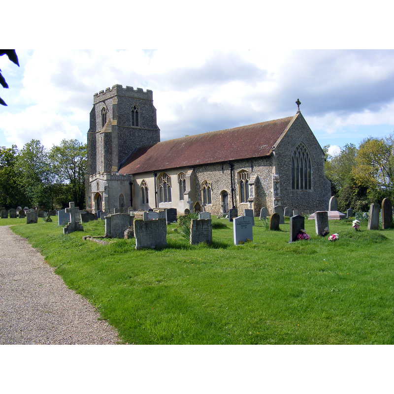
Scene Description: Source caption: "St Ethelbert Church, Tannington"
Copyright Statement: Image copyright © Geographer, 2010
Image Source: digital photograph 11 May 2010 by Geographer [https://www.geograph.org.uk/photo/1900679] [accessed 2 June 2024]
Copyright Instructions: CC-BY-SA-2.5
view of church interior - looking east
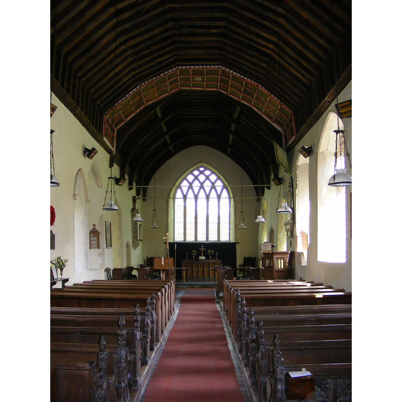
Scene Description: Source caption: "The interior of St Ethelbert Church. Off Church Road. Tannington, Suffolk"
Copyright Statement: Image copyright © Geographer, 2010
Image Source: digital photograph 11 May 2010 by Geographer [https://www.geograph.org.uk/photo/1900691] [accessed 2 June 2024]
Copyright Instructions: CC-BY-SA-2.5
INFORMATION
Font ID: 15577TAN
Object Type: Baptismal Font1
Font Century and Period/Style: 13th century [basin only] [composite font], Medieval [composite]
Church / Chapel Name: Parish Church of St. Mary and St. Ethelred
Font Location in Church: Inside the church, at the W end of the nave
Church Patron Saint(s): St. Mary the Virgin & St. Ethelred
Church Address: 1 Church Corner, Tannington, Woodbridge IP13 7LU, United Kingdom -- Tel.: +44 1986 798136
Site Location: Suffolk, East Anglia, England, United Kingdom
Directions to Site: Located 7 km NW of Framlingham, 10 km NE of Debenham, 16 km SE of Diss
Historical Region: Hundred of Bishp's [in Domesday]
Additional Comments: altered composite font / made up font
Font Notes:
Click to view
There is an entry for this Tannington [variant spelling] in the Domesday survey [https://opendomesday.org/place/TM2467/tannington/] [accessed 2 June 2024]; it reports " in it. Noted in Parker (1855) as a plain octagonal font; no date suggested, though the church itself is Norman to Decorated. Listed in Leach (1975) as a font made of Purbeck marble. Illustrated in Knott (2001, 2007). The font, located at the west end of the nave, is probably a composite object made up of a 13th-century octagonal basin with pairs of blind pointed arches on its sides, precariously raised on an unlikely slender pedestal stem and a modern octagonal plinth. The type of basin here is meant to be supported on a central shaft and angle colonnettes; the stem now supporting it must have belonged to a different object in its former function.
Credit and Acknowledgements: We are grateful to Simon Knott, of www.suffolkchurches.co.uk, for his photograph of this font
COORDINATES
UTM: 31U 382891 5791382
Latitude & Longitude (Decimal): 52.26034, 1.2841
Latitude & Longitude (DMS): 52° 15′ 37.22″ N, 1° 17′ 2.76″ E
MEDIUM AND MEASUREMENTS
Material: stone
Font Shape: octagonal, mounted
Basin Interior Shape: round
Basin Exterior Shape: octagonal
REFERENCES
- Knott, Simon, The Suffolk Churches Site, Simon Knott, 1999-. [standing permission to reproduce images received from Simon [February 2005]. URL: www.suffolkchurches.co.uk.
- Parker, John Henry, The Ecclesiastical and architectural topography of England [...] Suffolk, 1855, [unpaged]