Flowton / Flochetuna / Floughton
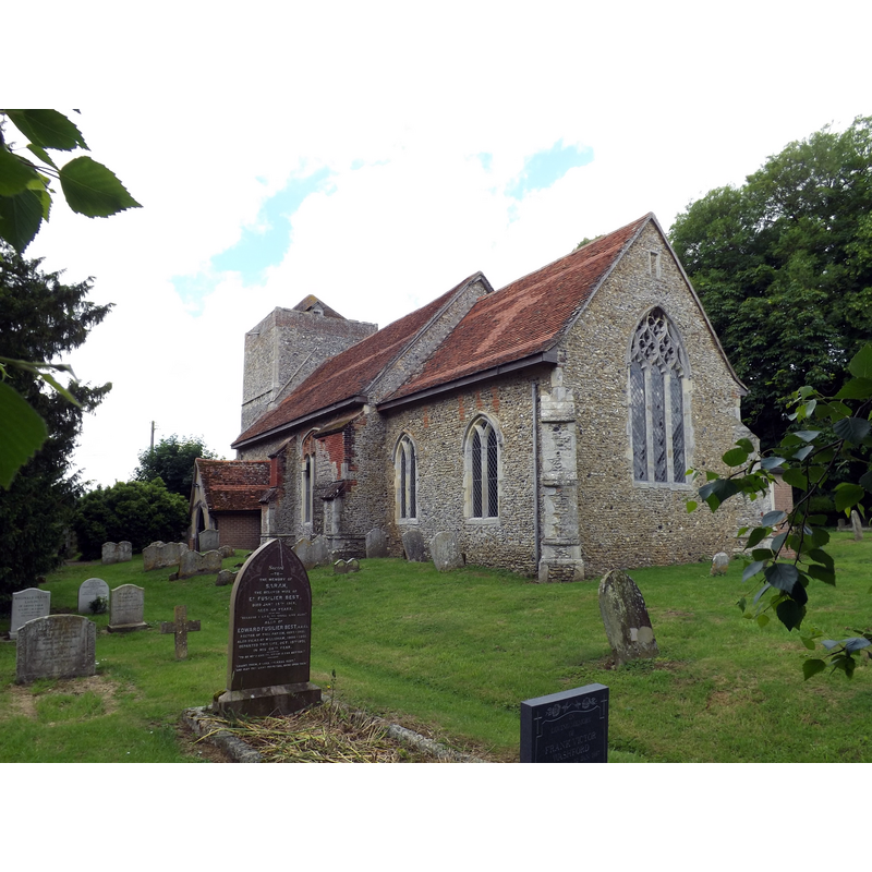
Image copyright © Geographer, 2016
CC-BY-SA-2.5
Results: 3 records
view of church exterior - southeast view
Scene Description: Source caption: "St.Mary's Church, Flowton"
Copyright Statement: Image copyright © Geographer, 2016
Image Source: digital photograph 16 June 2016 by Geographer [https://www.geograph.org.uk/photo/5000975] [accessed 30 May 2024]
Copyright Instructions: CC-BY-SA-2.5
view of church exterior - northeast view
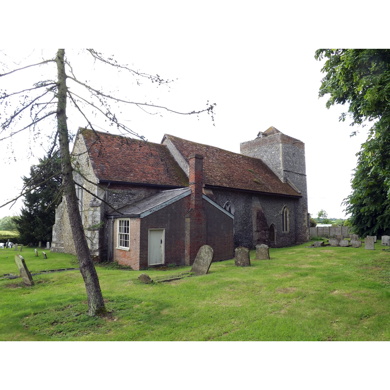
Scene Description: Source caption: "St.Mary's Church, Flowton"
Copyright Statement: Image copyright © Geographer, 2016
Image Source: digital photograph 16 June 2016 by Geographer [https://www.geograph.org.uk/photo/5000969] [accessed 30 May 2024]
Copyright Instructions: CC-BY-SA-2.5
view of font and cover in context - east side
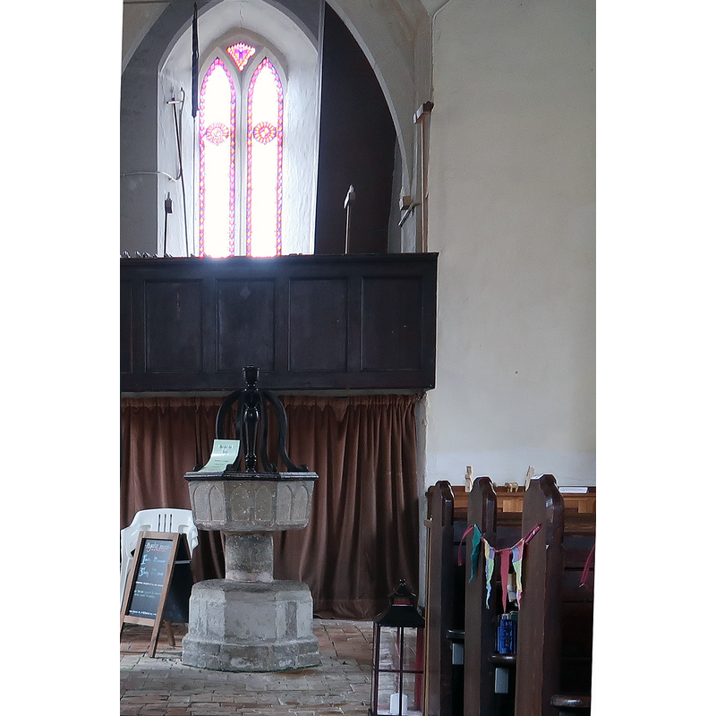
Copyright Statement: Image copyright © Tights4men, 2020
Image Source: edited detail of a digital photograph 21 December 2020 [https://commons.wikimedia.org/wiki/File:White_opaque_tights.jpg] [accessed 30 May 2024]
Copyright Instructions: CC-BY-SA-4.0
INFORMATION
Font ID: 15534FLO
Object Type: Baptismal Font1
Font Century and Period/Style: 13th century, Medieval
Church / Chapel Name: Parish Church of St. Mary
Font Location in Church: Inside the church, at the W end
Church Patron Saint(s): St. Mary the Virgin
Church Address: Flowton Rd, Flowton, Ipswich IP8 4LL, United Kingdom -- Tel.: +44 1473 658522
Site Location: Suffolk, East Anglia, England, United Kingdom
Directions to Site: Located 5 km W of Ipswich
Historical Region: Hundred of Bosmere
Additional Comments: destroyed stoup?
Font Notes:
Click to view
There are four entries for Flowton [variant spelling] in the Domesday survey [https://opendomesday.org/place/TM0846/flowton/] [accessed 30 May 2024], none of which mentions priest or church in it. Parker (1855) notes: "The font is early; an octagon, with slightly sunk panels on the bowl, and a massive circular pedestal, on an octagonal base." Dowsing (1885) reports on his visit to this church in 1643/1644 "a Holy Water Font in the Chancel", but does not say whether they destroyed or defaced it or not. Listed in Leach (1975) as a font made of Purbeck marble. The entry for this church in English Heritage [Listing NGR: TM0819546856] notes: "Church, mediaeval [...] Octagonal C13 font with splayed bowl, each face with shallow arcading; C17 Oak cover with ramped scrolls."
COORDINATES
UTM: 31U 365482 5771853
Latitude & Longitude (Decimal): 52.08089, 1.0369
Latitude & Longitude (DMS): 52° 4′ 51.2″ N, 1° 2′ 12.84″ E
MEDIUM AND MEASUREMENTS
Material: stone, limestone (Purbeck marble)
Font Shape: octagonal, mounted
Basin Interior Shape: round
Basin Exterior Shape: octagonal
LID INFORMATION
Date: 17th century?
Material: wood, oak
Notes: [cf. FontNotes]
REFERENCES
- Dowsing, William, of Stratford, The Journal of William Dowsing, of Stratford, Parliamentary visitor, appointed under a warrant from the Earl of Manchester, for demolishing the superstitious pictures and ornaments of churches &c., within the County of Suffolk, in the years 1643-1644, Ipswich: Pawsey and Hayes, 1885, p. 30
- Leach, Rosemary, A Investigation into the use of Purbeck Marble in Medieval England, Hartlepool: E.W. Harrisons & Sons, 1975, p. 76
- Parker, John Henry, The Ecclesiastical and architectural topography of England [...] Suffolk, 1855, [unpaged]