Shelton nr. Newark-on-Trent / Sceltun / Sceltune
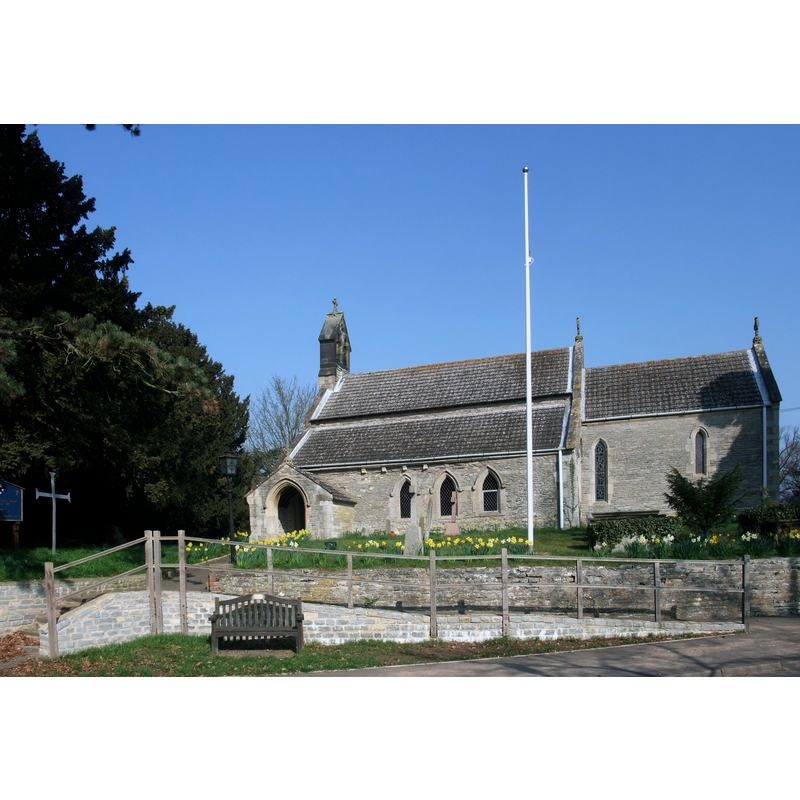
Image copyright © Tim Heaton, 2011
CC-BY-SA-2.0
Results: 3 records
view of church exterior - southeast view
Copyright Statement: Image copyright © Tim Heaton, 2011
Image Source: edited detail of a digital photograph taken 24 March 2011 by Tim Heaton [www.geograph.org.uk/photo/2324399] [accessed 15 September 2015]
Copyright Instructions: CC-BY-SA-2.0
view of church interior - nave - looking west
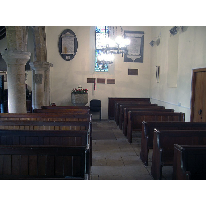
Scene Description: the font is partially visible at the far end
Copyright Statement: Image copyright © The Southwell & Nottigham The Church History Project, 2015
Image Source: digital photograph in The Southwell & Nottigham The Church History Project [http://southwellchurches.history.nottingham.ac.uk/shelton/pintw.jpg] [accessed 15 September 2015]
Copyright Instructions: No known copyright restriction / Fair Dealing
view of church interior - nave - looking east
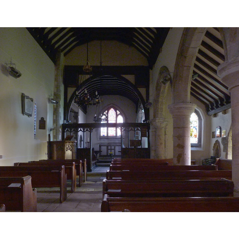
Scene Description: Source caption: "The nave, St Mary's Church, Shelton. The arcade to the south aisle is 13th century. The rood screen is heavily restored but retains some 15th century material."
Copyright Statement: Image copyright © Alan Murray-Rust, 2014
Image Source: digital photograph taken 13 April 2014 by Alan Murray-Rust [www.geograph.org.uk/photo/3936133] [accessed 15 September 2015]
Copyright Instructions: CC-BY-SA-2.0
INFORMATION
Font ID: 15527SHE
Object Type: Baptismal Font1
Font Century and Period/Style: 14th century / 17th century, Decorated? / Restoration?
Church / Chapel Name: Parish Church of St. Mary and All Saints [aka St. Mary and All Hallows']
Font Location in Church: Inside the church
Church Wikidata: https://www.wikidata.org/wiki/Q26268199
Church Patron Saint(s): St. Mary the Virgin & All Saints
Church Notes: original church probably 11thC
Church Address: Main Street, Shelton, Nottinghamshire NG23 5JQ
Site Location: Nottinghamshire, East Midlands, England, United Kingdom
Directions to Site: Located 13 km S of Newark-on-Trent
Ecclesiastic Region: Diocese of Southwell & Nottingham
Historical Region: Hundred of Newark [in Domesday]
Additional Comments: disappeared font? (the one from the Domesday-time church here)
Font Notes:
Click to view
There are three entries for this Shelton [variant spelling] in the Domesday survey [http://opendomesday.org/place/SK7844/shelton/] [accessed 15 September 2015], one of which mentions a church in it. Cox (1912) writes: "Hexagonal chalice-shaped font Dec[orated]". Not mentioned in Pevsner & Williamson (1979). The Southwell & Nottigham The Church History Project [http://southwellchurches.history.nottingham.ac.uk/shelton/pintw.jpg] [accessed 15 September 2015], however, reports a "mid C17 font with tapered octagonal stem with ring, and plain octagonal bowl".
COORDINATES
Latitude & Longitude (Decimal): 52.99315, -0.83923
Latitude & Longitude (DMS): 52° 59′ 35.34″ N, 0° 50′ 21.24″ W
MEDIUM AND MEASUREMENTS
Material: stone
Font Shape: polygonal, mounted
Basin Interior Shape: round
Basin Exterior Shape: polygonal
REFERENCES
- Cox, John Charles, Nottinghamshire, London: Allen, 1912, p. 184 / [http://ia301109.us.archive.org/3/items/nottinghamsh00coxuoft/nottinghamsh00coxuoft.pdf] [accessed 13 Oct 2009]