Merrow / Merewe / Merroe / Merwe
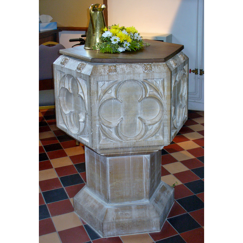
Image copyright © Colin Smith, 2016
Image and permission received (e-mail of 3 July 2016)
Results: 6 records
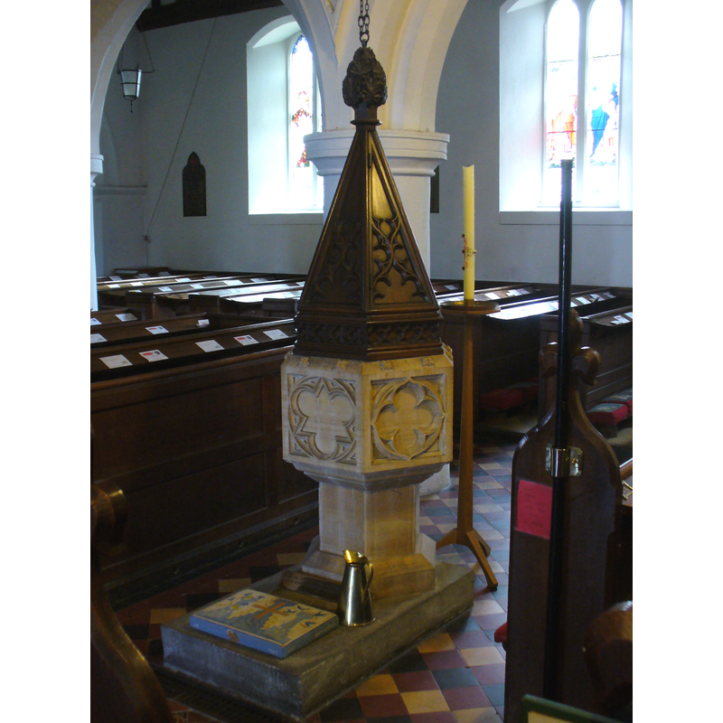
view of font and cover
Scene Description: the flat and plain modern cover; there is a fancier one hanging above the font
Copyright Statement: Image copyright © Colin Smith, 2016
Image Source: digital photograph taken 2 April 2016 by Colin Smith
Copyright Instructions: Image and permission received (e-mail of 3 July 2016)
view of font and cover
Scene Description: the modern font
Copyright Statement: Image copyright © Colin Smith, 2009
Image Source: digital photograph taken 12 September 2009 by Colin Smith
Copyright Instructions: Image and permission received (e-mail of 16 October 2009)
view of basin
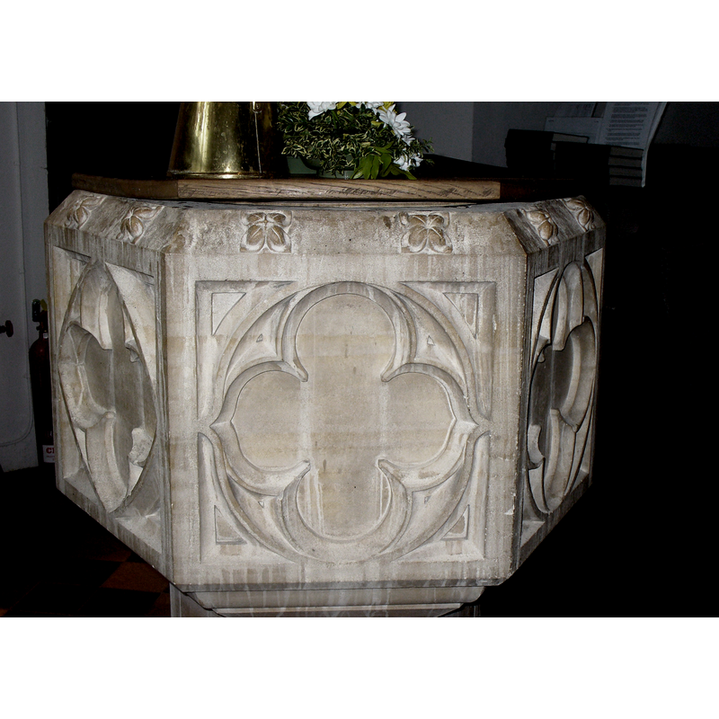
Copyright Statement: Image copyright © Colin Smith, 2016
Image Source: digital photograph taken 2 April 2016 by Colin Smith
Copyright Instructions: Image and permission received (e-mail of 3 July 2016)
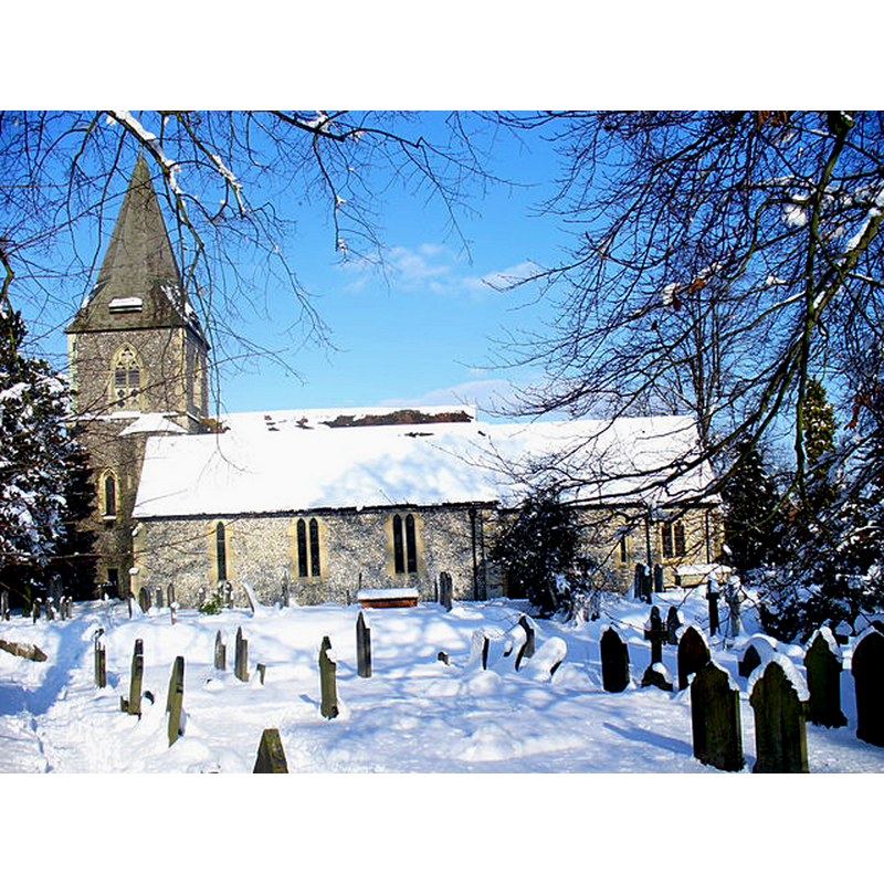
view of church exterior - north view
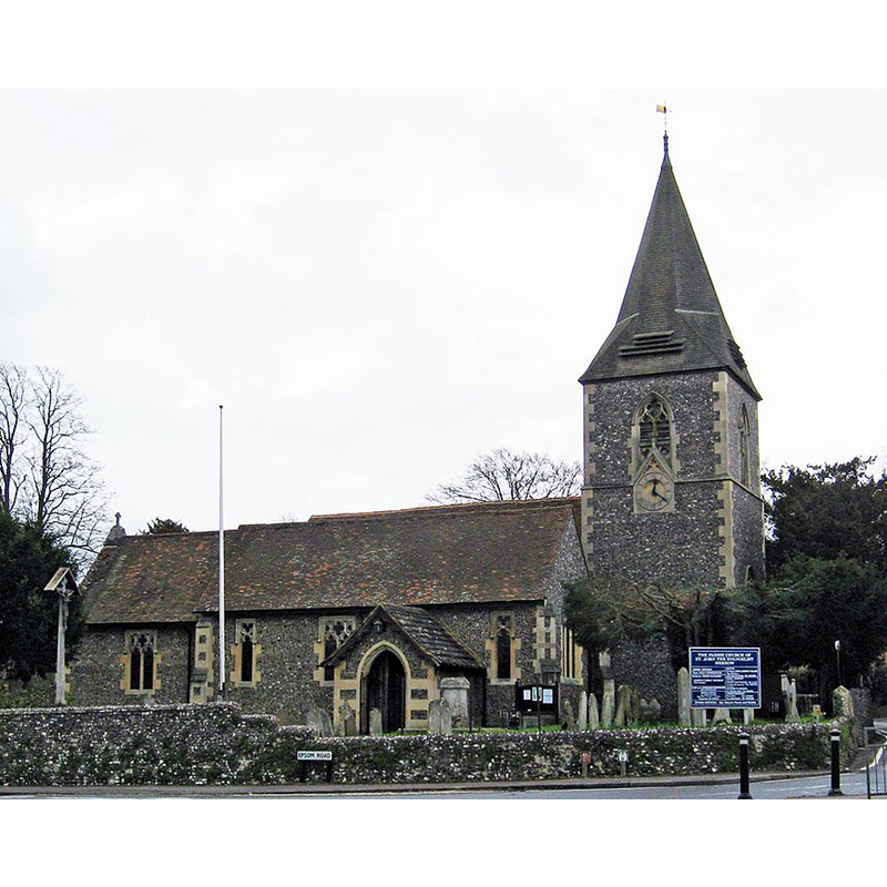
Scene Description: Source caption: "The Parish Church of St. John the Evangelist (1), Epsom Road, Merrow, Guildford. Merrow was originally a village, although it is now in effect a suburb of Guildford. The Parish Church is believed to be 12th century, although later parts were built in the 13th century. By the 1830's the church was in a ruinous state. A donation was made for the restoration of the church to the original plan. This work was completed by 1843."
Copyright Statement: Image copyright © P L Chadwick, 2012
Image Source: edited detail of a digital photograph taken 10 March 2011 by P L Chadwick [www.geograph.org.uk/photo/2785169] [accessed 17 December 2015]
Copyright Instructions: CC-BY-SA-2.0
view of church exterior - south view
Scene Description: Source caption: "St John's, Merrow. A church stood on this site in the 12th century but this one was rebuilt in the 1840s. The south wall re-used the old stones and the remaining walls were built with flint. Its full name is St John the Evangelist."
Copyright Statement: Image copyright © Colin Smith, 2009
Image Source: digital photograph taken 3 February 2009 by Colin Smith [www.geograph.org.uk/photo/1146153] [accessed 17 December 2015]
Copyright Instructions: CC-BY-SA-2.0
view of font cover
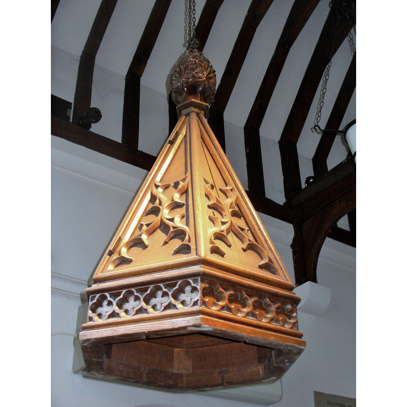
Scene Description: the fancier cover, hanging above the font
Copyright Statement: Image copyright © Colin Smith, 2016
Image Source: digital photograph taken 2 April 2016 by Colin Smith
Copyright Instructions: Image and permission received (e-mail of 3 July 2016)
INFORMATION
Font ID: 15490MER
Object Type: Baptismal Font1?
Font Century and Period/Style: 12th century, Late Norman
Church / Chapel Name: Parish Church of St. John the Evangelist
Church Patron Saint(s): St. John the Evangelist
Church Address: Epsom Road, Merrow, Guildford, Surrey, GU4 7DA
Site Location: Surrey, South East, England, United Kingdom
Directions to Site: Located 3 km NE of Guildford, 45 km SW of London
Ecclesiastic Region: Diocese of Guildford
Historical Region: Hundred of Woking
Additional Comments: disappeared font? (the one from the 12thC church here)
Font Notes:
Click to view
No entry found for Merrow in the Domesday survey. The Victoria County History (Surrey, vol. 3, 1911) notes: "The first mention of Merrow Church seems to be in 1208, when it was said to be in the gift of the king. [...] The church is almost entirely modern, having been rebuilt in 1842 with the exception of the south arcade and the south chapel. There are, however, a few remains of a 12th-century building, which have been re-used"; no font mentioned. Baptismal font consisting of a hexagonal basin with a crenellated upper rim, the sides decorated with traceried panels, the underbowl with a graded chamfer; raised on a plain hexagonal pedestal base and splaying lower base of the same shape; on a rectangular plinth, also modern. Hexagonal wooden cover of pyramidal shape, the sides carved with tracery patterns, a floral finial; it is raised with a counterweight system; it appears contemporary with the font, 19th-century. [NB: we have no information on the medieval font here]
Credit and Acknowledgements: We are grateful to Colin Smith for his photographs of this church and modern font
COORDINATES
UTM: 30U 672550 5680039
Latitude & Longitude (Decimal): 51.24558, -0.527721
Latitude & Longitude (DMS): 51° 14′ 44.09″ N, 0° 31′ 39.8″ W