Wambrook
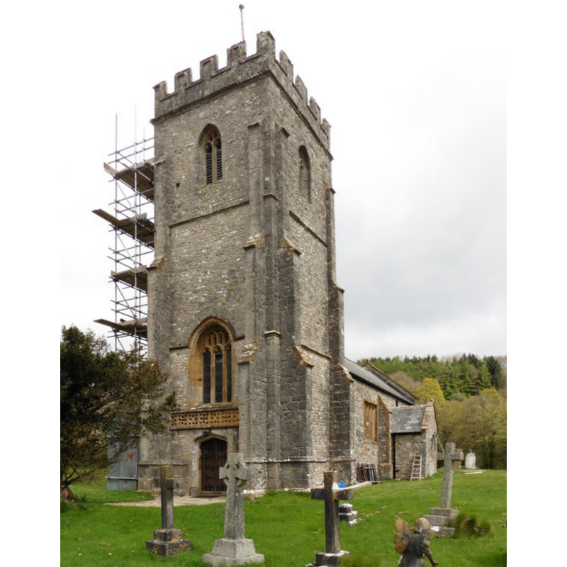
Image copyright © Roger Cornfoot, 2017
CC-BY-SA-2.0
Results: 2 records
view of church exterior - southwest view
Copyright Statement: Image copyright © Roger Cornfoot, 2017
Image Source: digital photograph taken 12 April 2017 by Roger Cornfoot [www.geograph.org.uk/photo/5347771] [accessed 27 February 2018]
Copyright Instructions: CC-BY-SA-2.0
view of church interior - nave - looking east
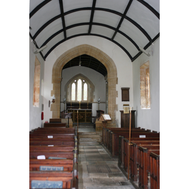
Copyright Statement: Image copyright © Nick Chipchase, 2012
Image Source: digital photograph taken 28 September 2012 by Nick Chipchase [www.geograph.org.uk/photo/3154969] [accessed 27 February 2018]
Copyright Instructions: CC-BY-SA-2.0
INFORMATION
Font ID: 15409WAM
Object Type: Baptismal Font1
Font Century and Period/Style: 13th century, Early English
Church / Chapel Name: Parish Church of the Blessed St. Mary the Virgin
Font Location in Church: Inside the church
Church Patron Saint(s): St. Mary the Virgin
Church Address: Wambrook, Chard TA203EH , UK -- Tel.: (+44) 01460 66159
Site Location: Somerset, South West, England, United Kingdom
Directions to Site: Located off (W) the A358, 3 km WSW of Chard
Ecclesiastic Region: Diocese of Bath & Wells
Historical Region: formerly Dorset?
Font Notes:
Click to view
No entry for Warmbrook found in the Domesday survey. The entry for this parish in the Victoria County History (Somerset, vol. 4, 1978) notes: "The chapel, later church, of Wambrook was first mentioned in a deed of 1215–20 by which Philip of Yarcombe, chaplain, probably the parish priest, acknowledged that the chapel was a member of the prebendal church of Chardstock [...] The chancel is of 13th-century origin but has been much rebuilt in the 19th century. The nave, porches, and tower were all built or rebuilt in the 15th century but are also much restored. There was a bell tower by 1405"; there is no mention of a font in the VCH entry. The National Monuments Record [http://www.imagesofengland.org.uk/details/default.aspx?id=431569] [accessed 30 September 2009] reports an "Octagonal C13 font with C17 flat ribbed cover" in this church. Not mentioned in Pevsner (1958).
COORDINATES
UTM: 30U 499669 5634757
Latitude & Longitude (Decimal): 50.8645, -3.0047
Latitude & Longitude (DMS): 50° 51′ 52.2″ N, 3° 0′ 16.92″ W
MEDIUM AND MEASUREMENTS
Material: stone
Font Shape: octagonal, mounted
Basin Exterior Shape: octagonal
LID INFORMATION
Date: 17th-century?
Material: wood
Apparatus: no
Notes: [cf. FontNotes]
REFERENCES
- Victoria County History [online], University of London, 1993-. URL: https://www.british-history.ac.uk.