Holford / Holeford / Holford St. Mary
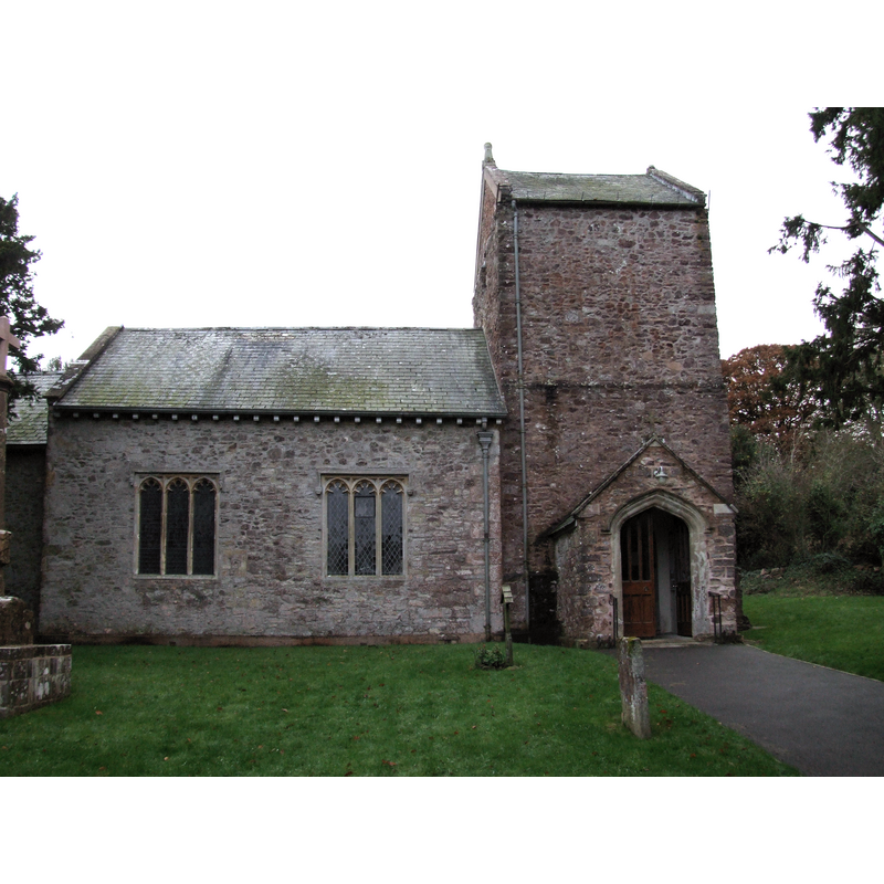
Image copyright © Robert Cutts, 2008
CC-BY-SA-2.0
Results: 2 records
view of church exterior - north view
Copyright Statement: Image copyright © Robert Cutts, 2008
Image Source: digital photograph taken 17 November 2008 by Robert Cutts [www.flickr.com/photos/21678559@N06/4448742348] [accessed 28 February 2018]
Copyright Instructions: CC-BY-SA-2.0
view of church exterior - southeast view
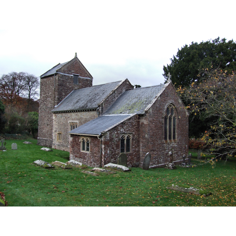
Copyright Statement: Image copyright © Robert Cutts, 2008
Image Source: digital photograph taken 17 November 2008 by Robert Cutts [www.flickr.com/photos/21678559@N06/4447968795] [accessed 28 February 2018]
Copyright Instructions: CC-BY-SA-2.0
INFORMATION
Font ID: 15402HOL
Object Type: Baptismal Font1?
Font Date: ca. 1175?
Font Century and Period/Style: 12th century, Late Norman
Church / Chapel Name: Parish Church of the Blessed Virgin Mary
Font Location in Church: [cf. FontNotes]
Church Patron Saint(s): St. Mary the Virgin [originally dedicated to St. John]
Church Address: Holford, Bridgwater TA5 1RY , UK -- Tel.: 01278 732873
Site Location: Somerset, South West, England, United Kingdom
Directions to Site: Located off (W) the A39, 10 km E of Williton, 17 km W of Bridgwater
Ecclesiastic Region: Diocese of Bath & Wells
Historical Region: Hundred of Whitley -- Hundred of Williton [in Domesday
Additional Comments: disappeared font? (the one from the church documented 1175)
Font Notes:
Click to view
There is an entry for Holford [St Mary] in the Domesday survey [http://opendomesday.org/place/ST1541/holford-st-mary/] [accessed 28 February 2018], but it mentions neither cleric nor church in it. The entry for this parish in the Victoria County History (Somerset, vol. 5, 1985) notes: "In 1175 the church of Holford was given by Robert son of Alfred to Stogursey Priory [...] he church of ST. MARY THE VIRGIN, dedicated to St. John by 1175 [...] and to St. Mary by 1791"; there is no mention of a font in the VCH entry. The National Monuments Record [Listing NGR: ST1565641091] notes the present font: "late C19 fittings including a many coloured marble font of arresting vulgarity." [NB: the original building is believed to date back to the 12th century, but we have no information on its font]
COORDINATES
Latitude & Longitude (Decimal): 51.1628, -3.2076
Latitude & Longitude (DMS): 51° 9' 46" N, 3° 12' 27" W
REFERENCES
- Victoria County History [online], University of London, 1993-. URL: https://www.british-history.ac.uk.