Enmore / Animere
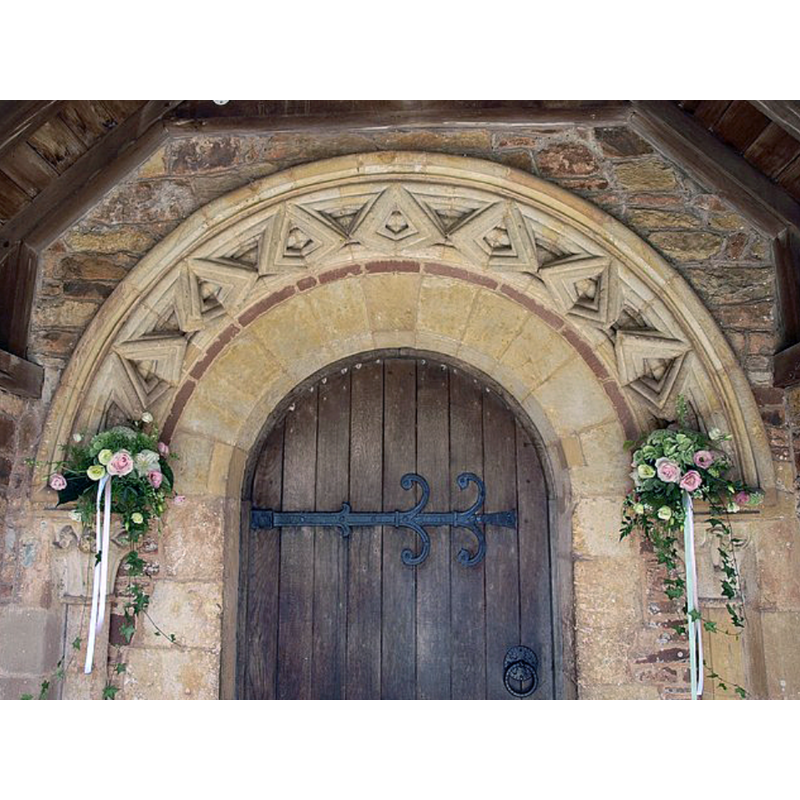
Image copyright © Derek Harper, 2010
CC-BY-SA-2.0
Results: 3 records
view of church exterior - south portal - detail
Scene Description: Source caption: "Doorway, St Michael's Church, Enmore.The Norman doorway at St Michael's Church, Enmore, dated 1185, with its zig-zag decoration. Pevsner (South & West Somerset, 1958) describes this as "two zigzags ... one parallel with the wall, the other at right angles." At either side are the trumpet type capital".
Copyright Statement: Image copyright © Derek Harper, 2010
Image Source: digital photograph taken 26 July 2010 by Derek Harper [www.geograph.org.uk/photo/1986954] [accessed 3 April 2017]
Copyright Instructions: CC-BY-SA-2.0
view of church exterior - northeast view
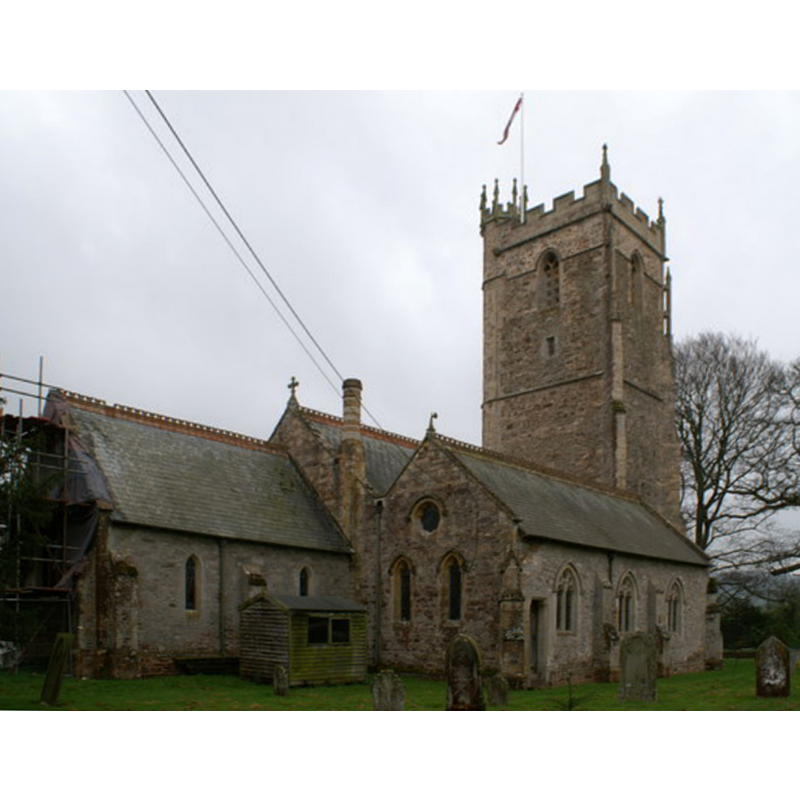
Copyright Statement: Image copyright © Adrian and Janet Quantock, 2006
Image Source: digital photograph taken 23 April 2006 by Adrian and Janet Quantock [https://commons.wikimedia.org/wiki/File:St_Michael's_Church,_Enmore_-_geograph.org.uk_-_157306.jpg]
Copyright Instructions: CC-BY-SA-2.0
view of church exterior - southeast view
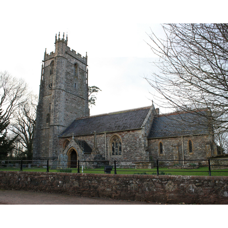
Copyright Statement: Image copyright © Robert Cutts, 2011
Image Source: digital photograph taken 9 March 2011 by Robert Cutts [https://flickr.com/photos/21678559@N06/5526131396] [accessed 3 April 2018]
Copyright Instructions: CC-BY-SA-2.0
INFORMATION
Font ID: 15347ENM
Object Type: Baptismal Font1
Font Century and Period/Style: 12th century (late?), Late Norman? / Transitional?
Church / Chapel Name: Parish Church of St. Michael
Font Location in Church: Inside the church
Church Patron Saint(s): St. Michael
Site Location: Somerset, South West, England, United Kingdom
Directions to Site: Located NW of Broomfield, WSW of Durleigh, 6 km W of Bridgwater
Ecclesiastic Region: Diocese of Bath & Wells
Historical Region: Hundred of Andersfield
Additional Comments: disused font / restored font / disappeared font?
Font Notes:
Click to view
There is an entry for Enmore [variant spelling] in the Domesday survey [http://opendomesday.org/place/ST2335/enmore/] [accessed 3 April 2018], but it mentions neither cleric nor church in it. The Victoria County History (Somerset, vol. 6, 1992) note: "The earliest evidence for a church at Enmore is the late Norman south doorway […] The church of St. Michael, so dedicated by 1348 […] The font, possibly of the 13th century, replaced a Victorian font in 1937." The National Monuments Record, English Heritage [http://www.imagesofengland.org.uk/details/default.aspx?id=269275] [accessed 18 September 2009] notes: "Plain octagonal C13 font". [NB: Pevsner (1958) dates the south doorway to ca. 1185, but does not mention any font in this church; we have no information on the original font of the late-Norman church]
COORDINATES
UTM: 30U 493894 5662185
Latitude & Longitude (Decimal): 51.111111, 3.087222
Latitude & Longitude (DMS): 51° 6′ 40″ N, 3° 5′ 14″ W
MEDIUM AND MEASUREMENTS
Material: stone
Font Shape: octagonal
Basin Exterior Shape: octagonal
REFERENCES
- Victoria County History [online], University of London, 1993-. URL: https://www.british-history.ac.uk.
- Pevsner, Nikolaus, South and West Somerset, Harmondsworth: Penguin Books, 1958, p. 166