East Quantoxhead / Cantocheheue / East Quantoxhed / Great Quantoxhead
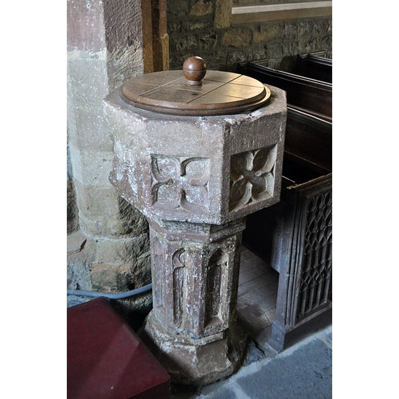
Image copyright © Ashley Dace, 2011
CC-BY-SA-2.0
Results: 3 records
view of font and cover
Scene Description: the present font in this church; though much battered and looking older than its age, it is probably 19thC
Copyright Statement: Image copyright © Ashley Dace, 2011
Image Source: digital photograph taken 11 June 2011 by Ashley Dace [www.geograph.org.uk/photo/2504859] [accessed 28 March 2018]
Copyright Instructions: CC-BY-SA-2.0
view of church exterior - south view
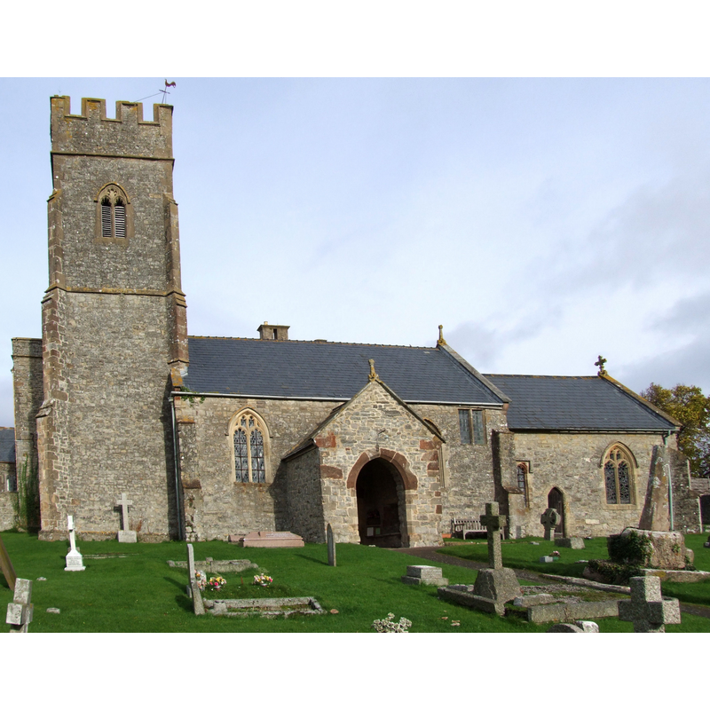
Copyright Statement: Image copyright © Robert Cutts, 2008
Image Source: digital photograph taken 17 November 2008 by Robert Cutts [www.flickr.com/photos/21678559@N06/4450574630] [accessed 28 March 2019]
Copyright Instructions: CC-BY-2.0
view of church interior - nave - looking east
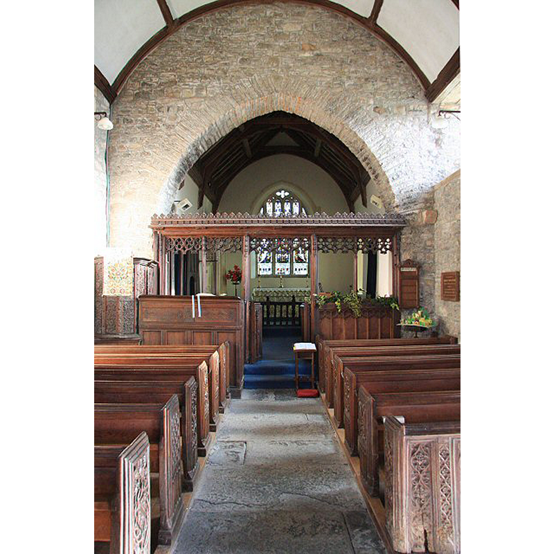
Scene Description: Source caption: "East Quantoxhead church interior. The nave of the church dedicated to St Mary the Virgin, with its splendid rood screen."
Copyright Statement: Image copyright © Bob Jones, 2007
Image Source: digital photograph taken 29 December 2007 by Bob Jones [www.geograph.org.uk/photo/648350] [accessed 29 March 2018]
Copyright Instructions: CC-BY-SA-2.0
INFORMATION
Font ID: 15345QUA
Object Type: Baptismal Font1?
Font Date: ca. 1259?
Font Century and Period/Style: 13th century (mid?), Medieval
Church / Chapel Name: Parish Church of the Blessed Virgin Mary
Church Patron Saint(s): St. Mary the Virgin
Church Address: East Quantoxhead, Somerset TA5 1EJ, UK -- Tel.: 01278 732873
Site Location: Somerset, South West, England, United Kingdom
Directions to Site: Located off (N) the A39, 20 km W of Bridgwater
Ecclesiastic Region: Diocese of Bath & Wells
Historical Region: Hundred of Williton
Additional Comments: disappeared font? (the one from the mid-13thC (?) church here)
Font Notes:
Click to view
There is an entry for [East] Quantoxhead [variant spelling] in the Domesday survey [http://opendomesday.org/place/ST1343/east-quantoxhead/] [accessed 28 March 2018], but it mentions neither cleric nor church in it. The entry for this parish in the Victoria County History (Somerset, vol. 5, 1985) notes: "There was a church at East Quantoxhead by 1259 [...] The rectory was valued at £10 13s. 4d. in 1291 [...] An altar recently dedicated in 1329 [...] and the surviving tower arch suggest an early 14th-century date for the origin of the present building"; there is no mention of a font in the VCH entry. There is no font mentioned in the English Heritage [Listing NGR: ST1364143656] entry for this church. The modern -19th-century?- font is illustrated in Flickr [http://www.flickr.com/photos/mike-watson/3516613278/] [accessed 18 September 2009]; it is an octagonal basin with quatrefoils raised on an octagonal pedestal with panelled sides, and a moulded lower base. The wooden cover is round, with a ball handle; appears contemporary with the font. [NB: we have no information on the earlier font of this church].
COORDINATES
UTM: 30U 483395 5670433
Latitude & Longitude (Decimal): 51.18507, -3.23759
Latitude & Longitude (DMS): 51° 11′ 6.25″ N, 3° 14′ 15.32″ W
LID INFORMATION
Date: 19th-century?
Material: wood
Apparatus: no
Notes: [cf. FontNotes]
REFERENCES
- Victoria County History [online], University of London, 1993-. URL: https://www.british-history.ac.uk.